 |
|
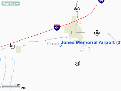
Location & QuickFacts
| FAA Information Effective: | 2008-09-25 |
| Airport Identifier: | 3F7 |
| Airport Status: | Operational |
| Longitude/Latitude: | 096-25-18.6800W/35-48-24.6700N
-96.421856/35.806853 (Estimated) |
| Elevation: | 851 ft / 259.38 m (Surveyed) |
| Land: | 60 acres |
| From nearest city: | 3 nautical miles SW of Bristow, OK |
| Location: | Creek County, OK |
| Magnetic Variation: | 05E (2000) |
Owner & Manager
| Ownership: | Publicly owned |
| Owner: | City Of Bristow |
| Address: | 110 W 7th St
Bristow, OK 74010 |
| Phone number: | 918-367-6244 |
| Manager: | Al Johns
AIRPORT BOARD CHAIRMAN. |
| Address: | 136 E. 7th Ave.
Bristow, OK 74010 |
| Phone number: | 918-367-5952 |
Airport Operations and Facilities
| Airport Use: | Open to public |
| Wind indicator: | Yes |
| Segmented Circle: | No |
| Control Tower: | No |
| Lighting Schedule: | DUSK-DAWN
ACTVT MIRL RY 17/35 - CTAF. |
| Beacon Color: | Clear-Green (lighted land airport) |
| Landing fee charge: | No |
| Sectional chart: | Dallas-ft Worth |
| Region: | ASW - Southwest |
| Boundary ARTCC: | ZKC - Kansas City |
| Tie-in FSS: | MLC - Mc Alester |
| FSS on Airport: | No |
| FSS Toll Free: | 1-800-WX-BRIEF |
| NOTAMs Facility: | MLC (NOTAM-d service avaliable) |
| Federal Agreements: | N |
Airport Communications
Airport Services
| Fuel available: | 100LL
24 HR. AUTOMATED FUEL SERVICE SYSTEM. |
| Bottled Oxygen: | NONE |
| Bulk Oxygen: | NONE |
Runway Information
Runway 17/35
| Dimension: | 3400 x 45 ft / 1036.3 x 13.7 m |
| Surface: | ASPH, Fair Condition |
| Weight Limit: | Single wheel: 4000 lbs. |
| Edge Lights: | Medium |
| |
Runway 17 |
Runway 35 |
| Longitude: | 096-25-18.3300W | 096-25-19.0300W |
| Latitude: | 35-48-41.4700N | 35-48-07.8700N |
| Elevation: | 803.00 ft | 851.00 ft |
| Alignment: | 127 | 1 |
| Traffic Pattern: | Left | Left |
| Markings: | Basic, Fair Condition | Basic, Fair Condition |
| Obstruction: | 35 ft trees, 654.0 ft from runway, 12:1 slope to clear
4 FT FENCE 150 FT FM END OF RY 10 FT BLO END OF RY SFC. | 60 ft pline, 1170.0 ft from runway, 16:1 slope to clear |
|
Radio Navigation Aids
| ID |
Type |
Name |
Ch |
Freq |
Var |
Dist |
| TZO | NDB | Bristow | | 251.00 | 05E | 2.2 nm |
| CUH | NDB | Cushing | | 242.00 | 05E | 17.9 nm |
| CQB | NDB | Tilghman | | 396.00 | 06E | 20.0 nm |
| GGU | NDB | Prague | | 314.00 | 06E | 22.7 nm |
| OWP | NDB | William Pogue | | 362.00 | 06E | 25.6 nm |
| HET | NDB | Henryetta | | 267.00 | 04E | 31.3 nm |
| SRE | NDB | Seminole | | 278.00 | 06E | 34.5 nm |
| DW | NDB | Owaso | | 375.00 | 06E | 40.1 nm |
| HDL | NDB | Holdenville | | 411.00 | 06E | 43.4 nm |
| LCY | NDB | Logan County | | 326.00 | 07E | 48.5 nm |
| GNP | VOR/DME | Glenpool | 043X | 110.60 | 06E | 23.1 nm |
| OKM | VOR/DME | Okmulgee | 096X | 114.90 | 08E | 28.0 nm |
| SWO | VOR/DME | Stillwater | 021X | 108.40 | 07E | 40.7 nm |
| TUL | VORTAC | Tulsa | 091X | 114.40 | 08E | 38.7 nm |
| TUL | VOT | Tulsa Intl | | 109.00 | | 38.7 nm |
Remarks
- CARETAKER MARK HARMON - 918-367-9253.
Images and information placed above are from
http://www.airport-data.com/airport/3F7/
We thank them for the data!
| General Info
|
| Country |
United States
|
| State |
OKLAHOMA
|
| FAA ID |
3F7
|
| Latitude |
35-48-24.670N
|
| Longitude |
096-25-18.680W
|
| Elevation |
851 feet
|
| Near City |
BRISTOW
|
We don't guarantee the information is fresh and accurate. The data may
be wrong or outdated.
For more up-to-date information please refer to other sources.
|
|


