 |
|
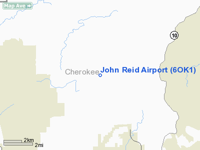
Location & QuickFacts
| FAA Information Effective: | 2008-09-25 |
| Airport Identifier: | 6OK1 |
| Airport Status: | Operational |
| Longitude/Latitude: | 095-00-10.8490W/36-00-05.3320N
-95.003014/36.001481 (Estimated) |
| Elevation: | 831 ft / 253.29 m (Estimated) |
| Land: | 40 acres |
| From nearest city: | 6 nautical miles NW of Tahlequah, OK |
| Location: | Cherokee County, OK |
| Magnetic Variation: | 05E (1985) |
Owner & Manager
| Ownership: | Privately owned |
| Owner: | John L. Reid |
| Address: | Rt 4 Box 222
Tahlequah, OK 74464 |
| Manager: | John L. Reid |
| Address: | Rt 4 Box 222
Tahlequah, OK 74464 |
Airport Operations and Facilities
| Airport Use: | Private |
| Wind indicator: | Yes |
| Segmented Circle: | No |
| Control Tower: | No |
| Lighting Schedule: | PHONE REQ
FOR LIRL RY 07/25 CALL 918-456-5455. |
| Landing fee charge: | No |
| Sectional chart: | Memphis |
| Region: | ASW - Southwest |
| Boundary ARTCC: | ZME - Memphis |
| Tie-in FSS: | MLC - Mc Alester |
| FSS on Airport: | No |
| FSS Toll Free: | 1-800-WX-BRIEF |
Airport Services
Runway Information
Runway 07/25
| Dimension: | 1970 x 40 ft / 600.5 x 12.2 m |
| Surface: | TURF, Fair Condition |
| Edge Lights: | Non-standard lighting system
NSTD LIRL. |
| |
Runway 07 |
Runway 25 |
| Traffic Pattern: | Left | Left |
| Obstruction: | 4 ft fence, 30.0 ft from runway, 7:1 slope to clear | 60 ft trees, 350.0 ft from runway, 50 ft right of centerline, 5:1 slope to clear |
|
Radio Navigation Aids
| ID |
Type |
Name |
Ch |
Freq |
Var |
Dist |
| TQH | NDB | Tahlequah | | 215.00 | 05E | 4.5 nm |
| SLG | NDB | Siloam Springs | | 284.00 | 04E | 27.4 nm |
| MKO | NDB | Muskogee | | 306.00 | 06E | 28.1 nm |
| IQS | NDB | Sallisaw | | 520.00 | 05E | 37.6 nm |
| DW | NDB | Owaso | | 375.00 | 06E | 46.2 nm |
| MEE | VOR | Davis | | 108.60 | 06E | 27.0 nm |
| DAK | VOR/DME | Drake | 025X | 108.80 | 07E | 39.2 nm |
| OKM | VOR/DME | Okmulgee | 096X | 114.90 | 08E | 46.0 nm |
| GNP | VOR/DME | Glenpool | 043X | 110.60 | 06E | 47.2 nm |
| TUL | VORTAC | Tulsa | 091X | 114.40 | 08E | 39.9 nm |
| RZC | VORTAC | Razorback | 111X | 116.40 | 04E | 45.3 nm |
| TUL | VOT | Tulsa Intl | | 109.00 | | 39.9 nm |
Images and information placed above are from
http://www.airport-data.com/airport/6OK1/
We thank them for the data!
| General Info
|
| Country |
United States
|
| State |
OKLAHOMA
|
| FAA ID |
6OK1
|
| Latitude |
36-00-05.332N
|
| Longitude |
095-00-10.849W
|
| Elevation |
831 feet
|
| Near City |
TAHLEQUAH
|
We don't guarantee the information is fresh and accurate. The data may
be wrong or outdated.
For more up-to-date information please refer to other sources.
|
|


