 |
|
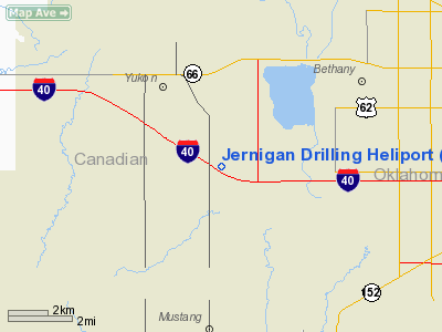
Jernigan Drilling Heliport |
Location & QuickFacts
| FAA Information Effective: | 2008-09-25 |
| Airport Identifier: | 5OK7 |
| Airport Status: | Operational |
| Longitude/Latitude: | 097-43-01.1540W/35-28-00.2040N
-97.716987/35.466723 (Estimated) |
| Elevation: | 1323 ft / 403.25 m (Estimated) |
| Land: | 0 acres |
| From nearest city: | 0 nautical miles of Oklahoma City, OK |
| Location: | Canadian County, OK |
| Magnetic Variation: | 07E (1985) |
Owner & Manager
| Ownership: | Privately owned |
| Owner: | Mr Steve Jernigan |
| Address: | 6422 N Santa Fe Ave B
Oklahoma City, OK 73116-9116 |
| Phone number: | 405-324-5000 |
| Manager: | Jamie Harris |
| Address: | 6422 N Santa Fe B
Oklahoma City, OK 73116-9116 |
| Phone number: | 405-840-1585 |
Airport Operations and Facilities
| Airport Use: | Private |
| Wind indicator: | No |
| Segmented Circle: | No |
| Control Tower: | No |
| Landing fee charge: | No |
| Sectional chart: | Dallas-ft Worth |
| Region: | ASW - Southwest |
| Boundary ARTCC: | ZFW - Fort Worth |
| Tie-in FSS: | MLC - Mc Alester |
| FSS on Airport: | No |
| FSS Toll Free: | 1-800-WX-BRIEF |
Runway Information
Helipad H1
| Dimension: | 25 x 25 ft / 7.6 x 7.6 m |
| Surface: | GRAVEL, |
| |
Runway H1 |
Runway |
| Traffic Pattern: | Left | Left |
|
Radio Navigation Aids
| ID |
Type |
Name |
Ch |
Freq |
Var |
Dist |
| OK | NDB | Tuloo | | 406.00 | 07E | 5.5 nm |
| RQO | NDB | El Reno | | 335.00 | 07E | 14.3 nm |
| OUN | NDB | Norman | | 260.00 | 07E | 17.9 nm |
| OLR | NDB | Chickasha | | 290.00 | 07E | 25.1 nm |
| LCY | NDB | Logan County | | 326.00 | 07E | 27.1 nm |
| JWG | NDB | Watonga | | 359.00 | 07E | 42.0 nm |
| CQB | NDB | Tilghman | | 396.00 | 06E | 46.5 nm |
| OJA | NDB | Weatherford | | 272.00 | 07E | 46.8 nm |
| GGU | NDB | Prague | | 314.00 | 06E | 49.0 nm |
| TIK | TACAN | Tinker | 105X | | 07E | 16.6 nm |
| PWA | VOR/DME | Wiley Post | 081X | 113.40 | 08E | 5.2 nm |
| IRW | VORTAC | Will Rogers | 088X | 114.10 | 07E | 8.4 nm |
| IFI | VORTAC | Kingfisher | 094X | 114.70 | 09E | 24.7 nm |
| OKC | VOT | Oklahoma Will Rgs W | | 108.80 | | 7.2 nm |
Remarks
Images and information placed above are from
http://www.airport-data.com/airport/5OK7/
We thank them for the data!
| General Info
|
| Country |
United States
|
| State |
OKLAHOMA
|
| FAA ID |
5OK7
|
| Latitude |
35-28-00.204N
|
| Longitude |
097-43-01.154W
|
| Elevation |
1323 feet
|
| Near City |
OKLAHOMA CITY
|
We don't guarantee the information is fresh and accurate. The data may
be wrong or outdated.
For more up-to-date information please refer to other sources.
|
|


