 |
|
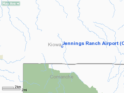
Location & QuickFacts
| FAA Information Effective: | 2008-09-25 |
| Airport Identifier: | OL09 |
| Airport Status: | Operational |
| Longitude/Latitude: | 098-45-01.2410W/34-53-00.2230N
-98.750345/34.883395 (Estimated) |
| Elevation: | 1620 ft / 493.78 m (Estimated) |
| Land: | 0 acres |
| From nearest city: | 4 nautical miles E of Cooperton, OK |
| Location: | Kiowa County, OK |
| Magnetic Variation: | 08E (1985) |
Owner & Manager
| Ownership: | Privately owned |
| Owner: | James L. Jennings |
| Address: | Route 2
Mountain View, OK 73062 |
| Phone number: | 405-347-2398 |
| Manager: | James L. Jennings |
| Address: | Route 2
Mountain View, OK 73062 |
| Phone number: | 405-347-2398 |
Airport Operations and Facilities
| Airport Use: | Private |
| Wind indicator: | Yes |
| Segmented Circle: | No |
| Control Tower: | No |
| Sectional chart: | Dallas-ft Worth |
| Region: | ASW - Southwest |
| Boundary ARTCC: | ZFW - Fort Worth |
| Tie-in FSS: | MLC - Mc Alester |
| FSS Toll Free: | 1-800-WX-BRIEF |
Runway Information
Runway 01/19
| Dimension: | 2300 x 30 ft / 701.0 x 9.1 m |
| Surface: | GRVL, |
| |
Runway 01 |
Runway 19 |
| Traffic Pattern: | Left | Left |
| Obstruction: | 30 ft trees, 400.0 ft from runway | 30 ft trees, 30.0 ft from runway |
|
Radio Navigation Aids
| ID |
Type |
Name |
Ch |
Freq |
Var |
Dist |
| FSI | FAN MARKER | Trail | | | 09E | 18.2 nm |
| OFZ | NDB | Trail | | 388.00 | 09E | 18.2 nm |
| PFL | NDB | Post | | 308.00 | 08E | 23.8 nm |
| OJA | NDB | Weatherford | | 272.00 | 07E | 39.1 nm |
| CLK | NDB | Clinton | | 320.00 | 07E | 40.5 nm |
| OLR | NDB | Chickasha | | 290.00 | 07E | 40.6 nm |
| BZ | NDB | Fossi | | 393.00 | 08E | 40.7 nm |
| EZY | NDB | Elk City | | 241.00 | 08E | 45.6 nm |
| VRT | NDB | Wilbarger | | 230.00 | 08E | 47.4 nm |
| LAW | VOR/DME | Lawton | 031X | 109.40 | 09E | 28.6 nm |
| HBR | VORTAC | Hobart | 055X | 111.80 | 10E | 15.5 nm |
| LTS | VORTAC | Altus | 035X | 109.80 | 08E | 28.9 nm |
| BFV | VORTAC | Burns Flat | 037X | 110.00 | 08E | 30.9 nm |
Remarks
- TREES ARE SCATTERED ALONG BOTH SIDES OF RY 25 FT FM CNTRLN.
Images and information placed above are from
http://www.airport-data.com/airport/OL09/
We thank them for the data!
| General Info
|
| Country |
United States
|
| State |
OKLAHOMA
|
| FAA ID |
OL09
|
| Latitude |
34-53-00.223N
|
| Longitude |
098-45-01.241W
|
| Elevation |
1620 feet
|
| Near City |
COOPERTON
|
We don't guarantee the information is fresh and accurate. The data may
be wrong or outdated.
For more up-to-date information please refer to other sources.
|
|


