 |
|
Location & QuickFacts
| FAA Information Effective: | 2008-09-25 |
| Airport Identifier: | 58OK |
| Airport Status: | Operational |
| Longitude/Latitude: | 095-55-00.9410W/36-44-00.3200N
-95.916928/36.733422 (Estimated) |
| Elevation: | 715 ft / 217.93 m (Estimated) |
| Land: | 0 acres |
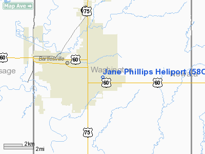
| From nearest city: | 0 nautical miles N of Bartlesville, OK |
| Location: | Washington County, OK |
| Magnetic Variation: | 05E (2000) |
Owner & Manager
| Ownership: | Privately owned |
| Owner: | Jane Phillips Meml Med Ctr |
| Address: | 3500/410 E Frank Philips Blvd
Bartlesville, OK 74003 |
| Phone number: | 918-333-7200 |
| Manager: | Mike Moore |
| Address: | 3500 E. Frank Philips Blvd
Bartlesville, OK 74006 |
| Phone number: | 918-333-7200
EXT 370. |
Airport Operations and Facilities
| Airport Use: | Private
MEDICAL. |
| Wind indicator: | Yes |
| Segmented Circle: | No |
| Control Tower: | No |
| Lighting Schedule: | PHONE REQ
FOR ROTG BCN & PERIMETER LGTS CALL 918-333-7200. |
| Beacon Color: | Clear-Green-Yellow (heliport) |
| Sectional chart: | Dallas-ft Worth |
| Region: | ASW - Southwest |
| Boundary ARTCC: | ZKC - Kansas City |
| Tie-in FSS: | MLC - Mc Alester |
| FSS Toll Free: | 1-800-WX-BRIEF |
Runway Information
Helipad H1
| Dimension: | 20 x 20 ft / 6.1 x 6.1 m |
| Surface: | ASPH, |
| |
Runway H1 |
Runway |
| Traffic Pattern: | Left | Left |
|
Radio Navigation Aids
| ID |
Type |
Name |
Ch |
Freq |
Var |
Dist |
| DW | NDB | Owaso | | 375.00 | 06E | 25.7 nm |
| CFV | NDB | Coffeyville | | 212.00 | 05E | 27.3 nm |
| OWP | NDB | William Pogue | | 362.00 | 06E | 35.6 nm |
| PPF | NDB | Parsons | | 258.00 | 06E | 41.3 nm |
| BVO | VOR/DME | Bartlesville | 126X | 117.90 | 08E | 7.8 nm |
| GNP | VOR/DME | Glenpool | 043X | 110.60 | 06E | 48.9 nm |
| TUL | VORTAC | Tulsa | 091X | 114.40 | 08E | 32.9 nm |
| OSW | VORTAC | Oswego | 123X | 117.60 | 08E | 42.7 nm |
| TUL | VOT | Tulsa Intl | | 109.00 | | 32.9 nm |
Remarks
- PROVIDED PERIMETER LGTS ARE USED FOR NIGHT OPERATIONS.
Images and information placed above are from
http://www.airport-data.com/airport/58OK/
We thank them for the data!
| General Info
|
| Country |
United States
|
| State |
OKLAHOMA
|
| FAA ID |
58OK
|
| Latitude |
36-44-00.320N
|
| Longitude |
095-55-00.941W
|
| Elevation |
715 feet
|
| Near City |
BARTLESVILLE
|
We don't guarantee the information is fresh and accurate. The data may
be wrong or outdated.
For more up-to-date information please refer to other sources.
|
|


