 |
|
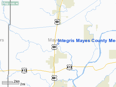
Integris Mayes County Medical Center Heliport |
Location & QuickFacts
| FAA Information Effective: | 2008-09-25 |
| Airport Identifier: | 7OK3 |
| Airport Status: | Operational |
| Longitude/Latitude: | 095-20-00.8860W/36-13-00.3460N
-95.333579/36.216763 (Estimated) |
| Elevation: | 621 ft / 189.28 m (Estimated) |
| Land: | 0 acres |
| From nearest city: | 0 nautical miles N of Pryor, OK |
| Location: | Mayes County, OK |
| Magnetic Variation: | 06E (1985) |
Owner & Manager
| Ownership: | Privately owned |
| Owner: | Integris Mayes County Medical Ctr |
| Address: | 111 North Bailey
Pryor, OK 74361 |
| Phone number: | 918-825-1600 |
| Manager: | W. Charles Jordan
ADMINISTRATOR. |
| Address: | 111 North Bailey
Pryor, OK 74361 |
| Phone number: | 918-825-1600 |
Airport Operations and Facilities
| Airport Use: | Private
MEDICAL. |
| Wind indicator: | Yes |
| Segmented Circle: | No |
| Control Tower: | No |
| Landing fee charge: | No |
| Sectional chart: | Kansas City |
| Region: | ASW - Southwest |
| Boundary ARTCC: | ZME - Memphis |
| Responsible ARTCC: | ZKC - Kansas City |
| Tie-in FSS: | MLC - Mc Alester |
| FSS on Airport: | No |
| FSS Toll Free: | 1-800-WX-BRIEF |
Runway Information
Helipad H1
| Dimension: | 30 x 30 ft / 9.1 x 9.1 m |
| Surface: | ASPH, |
| |
Runway H1 |
Runway |
| Traffic Pattern: | Left | Left |
|
Radio Navigation Aids
| ID |
Type |
Name |
Ch |
Freq |
Var |
Dist |
| TQH | NDB | Tahlequah | | 215.00 | 05E | 23.6 nm |
| DW | NDB | Owaso | | 375.00 | 06E | 26.8 nm |
| MKO | NDB | Muskogee | | 306.00 | 06E | 37.5 nm |
| OWP | NDB | William Pogue | | 362.00 | 06E | 39.9 nm |
| SLG | NDB | Siloam Springs | | 284.00 | 04E | 41.0 nm |
| MEE | VOR | Davis | | 108.60 | 06E | 33.3 nm |
| GNP | VOR/DME | Glenpool | 043X | 110.60 | 06E | 35.6 nm |
| OKM | VOR/DME | Okmulgee | 096X | 114.90 | 08E | 40.8 nm |
| BVO | VOR/DME | Bartlesville | 126X | 117.90 | 08E | 49.7 nm |
| TUL | VORTAC | Tulsa | 091X | 114.40 | 08E | 22.1 nm |
| TUL | VOT | Tulsa Intl | | 109.00 | | 22.1 nm |
Remarks
- APCH LNDG AREA FROM NORTH OR SOUTH.
- PRVDD LNDG TKOF NOT ATTEMPTED WITH TLWD IN EXCESS OF 8 KNOTS; LNDG SITE MUST BE SECURED TO PRECLUDE ANY TFC ENTERING AREA DURG GND OPNS WITH ROTORS TURNING; NO OPNS TO BE CONDUCTED CONTRARY TO FARS OR AIR AMB/AIR TAXI CERT HOLDERS CO MANUAL.
Images and information placed above are from
http://www.airport-data.com/airport/7OK3/
We thank them for the data!
| General Info
|
| Country |
United States
|
| State |
OKLAHOMA
|
| FAA ID |
7OK3
|
| Latitude |
36-13-00.346N
|
| Longitude |
095-20-00.886W
|
| Elevation |
621 feet
|
| Near City |
PRYOR
|
We don't guarantee the information is fresh and accurate. The data may
be wrong or outdated.
For more up-to-date information please refer to other sources.
|
|


