 |
|
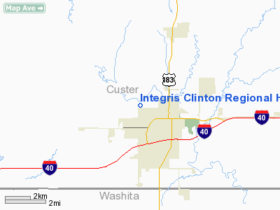
Integris Clinton Rgnl Hospital Heliport |
Location & QuickFacts
| FAA Information Effective: | 2008-09-25 |
| Airport Identifier: | 5OK5 |
| Airport Status: | Operational |
| Longitude/Latitude: | 098-59-31.3090W/35-31-30.1780N
-98.992030/35.525049 (Estimated) |
| Elevation: | 1615 ft / 492.25 m (Estimated) |
| Land: | 0 acres |
| From nearest city: | 1 nautical miles W of Clinton, OK |
| Location: | Custer County, OK |
| Magnetic Variation: | 08E (1985) |
Owner & Manager
| Ownership: | Publicly owned |
| Owner: | City Of Clinton
LISA ANDRES, CITY CLERK. |
| Address: | Grayson Bottom, P O Box 1177
Clinton, OK 73601
CITY MANAGER |
| Phone number: | 580-323-0261 |
| Manager: | Lisa Anders
CITY CLERK |
| Address: | P O Box 1177
Clinton, OK 73601 |
| Phone number: | 580-323-0265 |
Airport Operations and Facilities
| Airport Use: | Private
MEDICAL. |
| Wind indicator: | No |
| Segmented Circle: | Yes |
| Control Tower: | No |
| Landing fee charge: | No |
| Sectional chart: | Dallas-ft Worth |
| Region: | ASW - Southwest |
| Boundary ARTCC: | ZFW - Fort Worth |
| Tie-in FSS: | MLC - Mc Alester |
| FSS on Airport: | No |
| FSS Toll Free: | 1-800-WX-BRIEF |
Runway Information
Helipad H1
| Dimension: | 42 x 42 ft / 12.8 x 12.8 m |
| Surface: | CONC, |
| |
Runway H1 |
Runway |
| Traffic Pattern: | Left | Left |
|
Radio Navigation Aids
| ID |
Type |
Name |
Ch |
Freq |
Var |
Dist |
| CLK | NDB | Clinton | | 320.00 | 07E | 2.9 nm |
| BZ | NDB | Fossi | | 393.00 | 08E | 11.2 nm |
| OJA | NDB | Weatherford | | 272.00 | 07E | 15.7 nm |
| EZY | NDB | Elk City | | 241.00 | 08E | 20.8 nm |
| JWG | NDB | Watonga | | 359.00 | 07E | 34.3 nm |
| RQO | NDB | El Reno | | 335.00 | 07E | 48.2 nm |
| BFV | VORTAC | Burns Flat | 037X | 110.00 | 08E | 20.2 nm |
| SYO | VORTAC | Sayre | 099X | 115.20 | 10E | 33.3 nm |
| HBR | VORTAC | Hobart | 055X | 111.80 | 10E | 39.7 nm |
Remarks
Images and information placed above are from
http://www.airport-data.com/airport/5OK5/
We thank them for the data!
| General Info
|
| Country |
United States
|
| State |
OKLAHOMA
|
| FAA ID |
5OK5
|
| Latitude |
35-31-30.178N
|
| Longitude |
098-59-31.309W
|
| Elevation |
1615 feet
|
| Near City |
CLINTON
|
We don't guarantee the information is fresh and accurate. The data may
be wrong or outdated.
For more up-to-date information please refer to other sources.
|
|


