 |
|
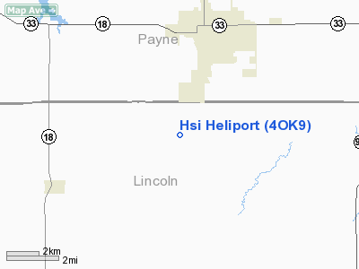
Location & QuickFacts
| FAA Information Effective: | 2008-09-25 |
| Airport Identifier: | 4OK9 |
| Airport Status: | Operational |
| Longitude/Latitude: | 096-47-03.0890W/35-55-26.2300N
-96.784191/35.923953 (Estimated) |
| Elevation: | 950 ft / 289.56 m (Estimated) |
| Land: | 0 acres |
| From nearest city: | 4 nautical miles S of Cushing, OK |
| Location: | Lincoln County, OK |
| Magnetic Variation: | 06E (1990) |
Owner & Manager
| Ownership: | Privately owned |
| Owner: | Helicopter Structures, Inc. |
| Address: | Po Box 1469, Rt 1 Box 460
Cushing, OK 74023 |
| Phone number: | 918-225-4224 |
| Manager: | Robert Remington |
| Address: | Rt 1 Box 460
Cushing, OK 74023 |
| Phone number: | 918-225-2928 |
Airport Operations and Facilities
| Airport Use: | Private |
| Segmented Circle: | No |
| Control Tower: | No |
| Sectional chart: | Dallas-ft Worth |
| Region: | ASW - Southwest |
| Boundary ARTCC: | ZKC - Kansas City |
| Tie-in FSS: | MLC - Mc Alester |
| FSS on Airport: | No |
| FSS Toll Free: | 1-800-WX-BRIEF |
Runway Information
Helipad H1
| Dimension: | 17 x 17 ft / 5.2 x 5.2 m |
| Surface: | CONC, |
| |
Runway H1 |
Runway |
| Traffic Pattern: | Left | Left |
|
Radio Navigation Aids
| ID |
Type |
Name |
Ch |
Freq |
Var |
Dist |
| CUH | NDB | Cushing | | 242.00 | 05E | 2.1 nm |
| CQB | NDB | Tilghman | | 396.00 | 06E | 12.2 nm |
| TZO | NDB | Bristow | | 251.00 | 05E | 19.8 nm |
| GGU | NDB | Prague | | 314.00 | 06E | 24.7 nm |
| LCY | NDB | Logan County | | 326.00 | 07E | 31.1 nm |
| OWP | NDB | William Pogue | | 362.00 | 06E | 34.1 nm |
| SRE | NDB | Seminole | | 278.00 | 06E | 39.6 nm |
| OK | NDB | Tuloo | | 406.00 | 07E | 48.4 nm |
| HET | NDB | Henryetta | | 267.00 | 04E | 48.9 nm |
| DW | NDB | Owaso | | 375.00 | 06E | 49.8 nm |
| TIK | TACAN | Tinker | 105X | | 07E | 41.3 nm |
| SWO | VOR/DME | Stillwater | 021X | 108.40 | 07E | 23.1 nm |
| GNP | VOR/DME | Glenpool | 043X | 110.60 | 06E | 39.7 nm |
| OKM | VOR/DME | Okmulgee | 096X | 114.90 | 08E | 46.9 nm |
| PWA | VOR/DME | Wiley Post | 081X | 113.40 | 08E | 48.2 nm |
Images and information placed above are from
http://www.airport-data.com/airport/4OK9/
We thank them for the data!
| General Info
|
| Country |
United States
|
| State |
OKLAHOMA
|
| FAA ID |
4OK9
|
| Latitude |
35-55-26.230N
|
| Longitude |
096-47-03.089W
|
| Elevation |
950 feet
|
| Near City |
CUSHING
|
We don't guarantee the information is fresh and accurate. The data may
be wrong or outdated.
For more up-to-date information please refer to other sources.
|
|


