 |
|
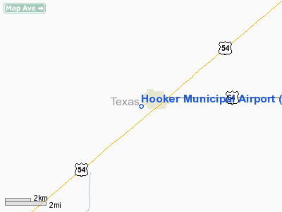
Location & QuickFacts
| FAA Information Effective: | 2008-09-25 |
| Airport Identifier: | O45 |
| Airport Status: | Operational |
| Longitude/Latitude: | 101-13-37.5250W/36-51-25.4990N
-101.227090/36.857083 (Estimated) |
| Elevation: | 2998 ft / 913.79 m (Surveyed) |
| Land: | 60 acres |
| From nearest city: | 0 nautical miles W of Hooker, OK |
| Location: | Texas County, OK |
| Magnetic Variation: | 09E (1985) |
Owner & Manager
| Ownership: | Publicly owned |
| Owner: | City Of Hooker |
| Address: | Box 67
Hooker, OK 73945 |
| Phone number: | 580-652-2885 |
| Manager: | Bill Longest
MAYOR. |
| Address: | Po Box 626
Hooker, OK 73945 |
| Phone number: | 580-652-2047 |
Airport Operations and Facilities
| Airport Use: | Open to public |
| Wind indicator: | Yes |
| Segmented Circle: | Yes |
| Control Tower: | No |
| Lighting Schedule: | RDO-CTL
ACTVT MIRL RY 17/35 - CTAF. |
| Landing fee charge: | No |
| Sectional chart: | Wichita |
| Region: | ASW - Southwest |
| Traffic Pattern Alt: | 1002 ft |
| Boundary ARTCC: | ZKC - Kansas City |
| Tie-in FSS: | MLC - Mc Alester |
| FSS on Airport: | No |
| FSS Toll Free: | 1-800-WX-BRIEF |
| NOTAMs Facility: | MLC (NOTAM-d service avaliable) |
| Federal Agreements: | N |
Airport Communications
Airport Services
| Fuel available: | 100LL
FOR FUEL CALL 580-652-2111. |
Runway Information
Runway 17/35
| Dimension: | 3312 x 60 ft / 1009.5 x 18.3 m |
| Surface: | ASPH, Good Condition |
| Edge Lights: | Medium |
| |
Runway 17 |
Runway 35 |
| Longitude: | 101-13-37.5480W | 101-13-37.5020W |
| Latitude: | 36-51-41.8700N | 36-51-09.1270N |
| Elevation: | 2998.00 ft | 2992.00 ft |
| Alignment: | 127 | 127 |
| Traffic Pattern: | Right | Left |
| Markings: | Basic, Good Condition | Basic, Good Condition |
| Obstruction: | 15 ft road, 568.0 ft from runway, 24:1 slope to clear | 57 ft pole, 1371.0 ft from runway, 20:1 slope to clear |
|
Radio Navigation Aids
| ID |
Type |
Name |
Ch |
Freq |
Var |
Dist |
| GUY | NDB | Guymon | | 275.00 | 09E | 16.2 nm |
| HQG | NDB | Hugoton | | 365.00 | 09E | 19.7 nm |
| EHA | NDB | Elkhart | | 377.00 | 10E | 32.8 nm |
| PYX | NDB | Perryton | | 266.00 | 09E | 35.3 nm |
| ULS | NDB | Ulysses | | 395.00 | 09E | 45.0 nm |
| MEJ | NDB | Meade | | 389.00 | 09E | 48.9 nm |
| LBL | VORTAC | Liberal | 070X | 112.30 | 11E | 16.7 nm |
Remarks
- TOWER 336 FT AGL 2160 FT NE.
- PROVIDED ALL TRAFFIC PATTERNS ARE WEST OF PROPOSED ARPT; I.E. LEFT TFC RWY 35 AND RIGHT TFC RWY 17.
Images and information placed above are from
http://www.airport-data.com/airport/O45/
We thank them for the data!
| General Info
|
| Country |
United States
|
| State |
OKLAHOMA
|
| FAA ID |
O45
|
| Latitude |
36-51-25.499N
|
| Longitude |
101-13-37.525W
|
| Elevation |
2998 feet
|
| Near City |
HOOKER
|
We don't guarantee the information is fresh and accurate. The data may
be wrong or outdated.
For more up-to-date information please refer to other sources.
|
|


