 |
|
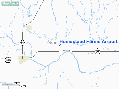
Location & QuickFacts
| FAA Information Effective: | 2008-09-25 |
| Airport Identifier: | O66 |
| Airport Status: | Operational |
| Longitude/Latitude: | 097-43-36.1890W/36-41-30.1090N
-97.726719/36.691697 (Estimated) |
| Elevation: | 1030 ft / 313.94 m (Estimated) |
| Land: | 320 acres |
| From nearest city: | 4 nautical miles E of Pond Creek, OK |
| Location: | Grant County, OK |
| Magnetic Variation: | 07E (1985) |
Owner & Manager
| Ownership: | Privately owned |
| Owner: | David T Kirk |
| Address: | Homestead Farms, Rt 2 Box 10
Pond Creek, OK 73766 |
| Phone number: | 580-532-4970 |
| Manager: | David T Kirk |
| Address: | Rt 2 Box 10
Pond Creek, OK 73766 |
| Phone number: | 580-532-4970 |
Airport Operations and Facilities
| Airport Use: | Open to public |
| Wind indicator: | Yes |
| Segmented Circle: | No |
| Control Tower: | No |
| Landing fee charge: | No |
| Sectional chart: | Wichita |
| Region: | ASW - Southwest |
| Boundary ARTCC: | ZKC - Kansas City |
| Tie-in FSS: | MLC - Mc Alester |
| FSS on Airport: | No |
| FSS Toll Free: | 1-800-WX-BRIEF |
| NOTAMs Facility: | MLC (NOTAM-d service avaliable) |
Airport Communications
Airport Services
| Airframe Repair: | NONE |
| Power Plant Repair: | NONE |
Runway Information
Runway 17/35
| Dimension: | 2870 x 21 ft / 874.8 x 6.4 m |
| Surface: | ASPH-TURF, Poor Condition
BOTH TURF RY ENDS MUDDY WHEN WET. PARTS OF ASPHALT PORTION BROKEN AND DETERIORATED.
ASPH STRIP 1659 FT BY 21 FT MIDDLE OF RY. 546 FT ON NORTH END AND 665 FT ON SOUTH END TURF. |
| |
Runway 17 |
Runway 35 |
| Traffic Pattern: | Left | Left |
| Obstruction: | 4 ft fence | 60 ft trees, 80.0 ft from runway, 1:1 slope to clear |
|
Radio Navigation Aids
| ID |
Type |
Name |
Ch |
Freq |
Var |
Dist |
| PN | NDB | Ponca | | 515.00 | 05E | 31.2 nm |
| EGT | NDB | Wellington | | 414.00 | 07E | 41.3 nm |
| FAU | NDB | Fairview | | 246.00 | 07E | 43.8 nm |
| AVK | NDB | Alva | | 203.00 | 08E | 45.8 nm |
| ODG | VOR/DME | Woodring | 027X | 109.00 | 08E | 19.3 nm |
| SWO | VOR/DME | Stillwater | 021X | 108.40 | 07E | 42.0 nm |
| END | VORTAC | Vance | 101X | 115.40 | 09E | 22.8 nm |
| PER | VORTAC | Pioneer | 079X | 113.20 | 06E | 27.5 nm |
| ANY | VORTAC | Anthony | 076X | 112.90 | 07E | 35.3 nm |
Images and information placed above are from
http://www.airport-data.com/airport/O66/
We thank them for the data!
| General Info
|
| Country |
United States
|
| State |
OKLAHOMA
|
| FAA ID |
O66
|
| Latitude |
36-41-30.109N
|
| Longitude |
097-43-36.189W
|
| Elevation |
1030 feet
|
| Near City |
POND CREEK
|
We don't guarantee the information is fresh and accurate. The data may
be wrong or outdated.
For more up-to-date information please refer to other sources.
|
|


