 |
|
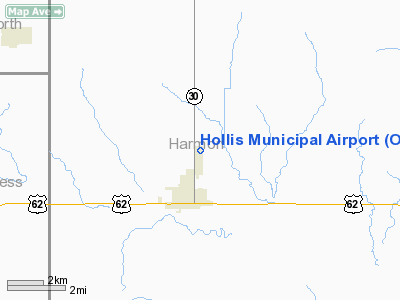
Location & QuickFacts
| FAA Information Effective: | 2008-09-25 |
| Airport Identifier: | O35 |
| Airport Status: | Operational |
| Longitude/Latitude: | 099-54-31.3630W/34-42-30.2190N
-99.908712/34.708394 (Estimated) |
| Elevation: | 1658 ft / 505.36 m (Estimated) |
| Land: | 160 acres |
| From nearest city: | 2 nautical miles N of Hollis, OK |
| Location: | Harmon County, OK |
| Magnetic Variation: | 08E (1985) |
Owner & Manager
| Ownership: | Publicly owned |
| Owner: | City Of Hollis |
| Address: | Po Box 188
Hollis, OK 73550 |
| Phone number: | 580-688-9245 |
| Manager: | Karen Testerman
CITY MANAGER. |
| Address: | Po Box 188
Hollis, OK 73550 |
| Phone number: | 580-688-9245 |
Airport Operations and Facilities
| Airport Use: | Open to public |
| Wind indicator: | Yes |
| Segmented Circle: | Yes |
| Control Tower: | No |
| Lighting Schedule: | DUSK-DAWN
ACTVT MIRL RY 17/35 - 122.8. |
| Beacon Color: | Clear-Green (lighted land airport) |
| Landing fee charge: | No |
| Sectional chart: | Dallas-ft Worth |
| Region: | ASW - Southwest |
| Boundary ARTCC: | ZFW - Fort Worth |
| Tie-in FSS: | MLC - Mc Alester |
| FSS on Airport: | No |
| FSS Toll Free: | 1-800-WX-BRIEF |
| NOTAMs Facility: | MLC (NOTAM-d service avaliable) |
| Federal Agreements: | NGY |
Airport Communications
Airport Services
| Fuel available: | 100LL
FOR FUEL CALL POLICE 580-688-9216. |
| Airframe Repair: | NONE |
| Power Plant Repair: | NONE |
| Bottled Oxygen: | NONE |
| Bulk Oxygen: | NONE |
Runway Information
Runway 17/35
| Dimension: | 3000 x 60 ft / 914.4 x 18.3 m |
| Surface: | ASPH, Good Condition |
| Weight Limit: | Single wheel: 4000 lbs. |
| Edge Lights: | Medium |
| |
Runway 17 |
Runway 35 |
| Longitude: | 099-54-30.5600W | 099-54-30.7168W |
| Latitude: | 34-42-33.7200N | 34-42-04.0464N |
| Elevation: | 1658.00 ft | 1658.00 ft |
| Alignment: | 127 | 0 |
| Traffic Pattern: | Left | Left |
| Markings: | Basic, Good Condition | Basic, Good Condition |
| Obstruction: | 6 ft road, 477.0 ft from runway, 46:1 slope to clear | , 50:1 slope to clear |
|
Radio Navigation Aids
| ID |
Type |
Name |
Ch |
Freq |
Var |
Dist |
| VRT | NDB | Wilbarger | | 230.00 | 08E | 42.6 nm |
| EZY | NDB | Elk City | | 241.00 | 08E | 49.9 nm |
| CDS | VORTAC | Childress | 123X | 117.60 | 10E | 27.8 nm |
| LTS | VORTAC | Altus | 035X | 109.80 | 08E | 31.6 nm |
| SYO | VORTAC | Sayre | 099X | 115.20 | 10E | 40.6 nm |
| HBR | VORTAC | Hobart | 055X | 111.80 | 10E | 42.8 nm |
| BFV | VORTAC | Burns Flat | 037X | 110.00 | 08E | 47.0 nm |
Images and information placed above are from
http://www.airport-data.com/airport/O35/
We thank them for the data!
| General Info
|
| Country |
United States
|
| State |
OKLAHOMA
|
| FAA ID |
O35
|
| Latitude |
34-42-30.219N
|
| Longitude |
099-54-31.363W
|
| Elevation |
1658 feet
|
| Near City |
HOLLIS
|
We don't guarantee the information is fresh and accurate. The data may
be wrong or outdated.
For more up-to-date information please refer to other sources.
|
|


