 |
|
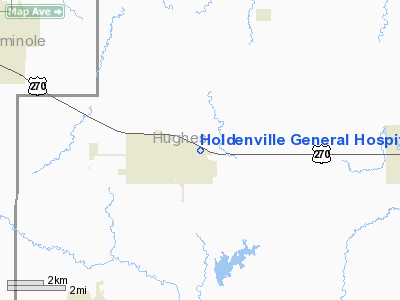
Holdenville General Hospital Heliport |
Location & QuickFacts
| FAA Information Effective: | 2008-09-25 |
| Airport Identifier: | 49OK |
| Airport Status: | Operational |
| Longitude/Latitude: | 096-22-42.0340W/35-05-20.3040N
-96.378343/35.088973 (Estimated) |
| Elevation: | 864 ft / 263.35 m (Estimated) |
| Land: | 0 acres |
| From nearest city: | 0 nautical miles N of Holdenville, OK |
| Location: | Hughes County, OK |
| Magnetic Variation: | 07E (1980) |
Owner & Manager
| Ownership: | Publicly owned |
| Owner: | Holdenville General Hospital |
| Address: | 100 Crestview Dr
Holdenville, OK 74848 |
| Phone number: | 405-379-6631 |
| Manager: | Administrator
OTHER CONTACT RANDY DENNIE 405-379-4289 RDENNIE@HGHOSPITAL.COM |
| Address: | 100 Crestview Dr
Holdenville, OK 74848 |
| Phone number: | 405-379-6631 |
Airport Operations and Facilities
| Airport Use: | Private
MEDICAL. |
| Wind indicator: | Yes |
| Segmented Circle: | No |
| Control Tower: | No |
| Sectional chart: | Dallas-ft Worth |
| Region: | ASW - Southwest |
| Boundary ARTCC: | ZFW - Fort Worth |
| Tie-in FSS: | MLC - Mc Alester |
| FSS Toll Free: | 1-800-WX-BRIEF |
Runway Information
Helipad H1
| Dimension: | 30 x 30 ft / 9.1 x 9.1 m |
| Surface: | CONC, |
| |
Runway H1 |
Runway |
| Traffic Pattern: | Left | Left |
|
Radio Navigation Aids
| ID |
Type |
Name |
Ch |
Freq |
Var |
Dist |
| HDL | NDB | Holdenville | | 411.00 | 06E | 1.7 nm |
| SRE | NDB | Seminole | | 278.00 | 06E | 18.2 nm |
| HET | NDB | Henryetta | | 267.00 | 04E | 26.1 nm |
| GGU | NDB | Prague | | 314.00 | 06E | 30.7 nm |
| TZO | NDB | Bristow | | 251.00 | 05E | 41.0 nm |
| CQB | NDB | Tilghman | | 396.00 | 06E | 43.8 nm |
| PVJ | NDB | Pauls Valley | | 384.00 | 06E | 47.6 nm |
| ADH | VOR/DME | Ada | 125X | 117.80 | 06E | 22.4 nm |
| OKM | VOR/DME | Okmulgee | 096X | 114.90 | 08E | 44.1 nm |
| MLC | VORTAC | Mc Alester | 057X | 112.00 | 08E | 32.7 nm |
Remarks
- PVDD INGRESS/EGRESS ROUTES ARE TO/FM 120-300 DEG TO AVOID FLYING ON HOSP OR PARKING LOT.
Images and information placed above are from
http://www.airport-data.com/airport/49OK/
We thank them for the data!
| General Info
|
| Country |
United States
|
| State |
OKLAHOMA
|
| FAA ID |
49OK
|
| Latitude |
35-05-20.304N
|
| Longitude |
096-22-42.034W
|
| Elevation |
864 feet
|
| Near City |
HOLDENVILLE
|
We don't guarantee the information is fresh and accurate. The data may
be wrong or outdated.
For more up-to-date information please refer to other sources.
|
|


