 |
|
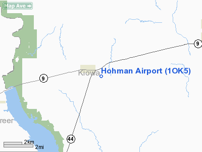
Location & QuickFacts
| FAA Information Effective: | 2008-09-25 |
| Airport Identifier: | 1OK5 |
| Airport Status: | Operational |
| Longitude/Latitude: | 099-13-46.2860W/34-59-00.2050N
-99.229524/34.983390 (Estimated) |
| Elevation: | 1563 ft / 476.40 m (Estimated) |
| Land: | 15 acres |
| From nearest city: | 1 nautical miles SE of Lone Wolf, OK |
| Location: | Kiowa County, OK |
| Magnetic Variation: | 08E (1985) |
Owner & Manager
| Ownership: | Privately owned |
| Owner: | Carl Hohman |
| Address: | Po Box 194
Lone Wolf, OK 73655 |
| Address: |
|
| Phone number: | 405-846-5751 |
Airport Operations and Facilities
| Airport Use: | Private |
| Wind indicator: | No |
| Segmented Circle: | No |
| Control Tower: | No |
| Landing fee charge: | No |
| Sectional chart: | Dallas-ft Worth |
| Region: | ASW - Southwest |
| Boundary ARTCC: | ZFW - Fort Worth |
| Tie-in FSS: | MLC - Mc Alester |
| FSS on Airport: | No |
| FSS Toll Free: | 1-800-WX-BRIEF |
Airport Services
| Airframe Repair: | NONE |
| Power Plant Repair: | NONE |
Runway Information
Runway N/S
| Dimension: | 2600 x 20 ft / 792.5 x 6.1 m
TRTD DIRT STRIP ON 100' WIDE RWY-25' TURF TO E & 55' TURF TO W OF CNTR. |
| Surface: | TRTD-DIRT, |
| |
Runway N |
Runway S |
| Traffic Pattern: | Left | Left |
|
Radio Navigation Aids
| ID |
Type |
Name |
Ch |
Freq |
Var |
Dist |
| FSI | FAN MARKER | Trail | | | 09E | 42.6 nm |
| EZY | NDB | Elk City | | 241.00 | 08E | 27.9 nm |
| BZ | NDB | Fossi | | 393.00 | 08E | 28.1 nm |
| CLK | NDB | Clinton | | 320.00 | 07E | 36.4 nm |
| OFZ | NDB | Trail | | 388.00 | 09E | 42.6 nm |
| OJA | NDB | Weatherford | | 272.00 | 07E | 42.8 nm |
| VRT | NDB | Wilbarger | | 230.00 | 08E | 45.6 nm |
| PFL | NDB | Post | | 308.00 | 08E | 46.6 nm |
| LAW | VOR/DME | Lawton | 031X | 109.40 | 09E | 49.8 nm |
| HBR | VORTAC | Hobart | 055X | 111.80 | 10E | 10.8 nm |
| BFV | VORTAC | Burns Flat | 037X | 110.00 | 08E | 15.3 nm |
| LTS | VORTAC | Altus | 035X | 109.80 | 08E | 19.4 nm |
| SYO | VORTAC | Sayre | 099X | 115.20 | 10E | 29.5 nm |
Remarks
- DO NOT LND IN WET WEATHER.
- EXISTED PRIOR TO OCT 1959.
Images and information placed above are from
http://www.airport-data.com/airport/1OK5/
We thank them for the data!
| General Info
|
| Country |
United States
|
| State |
OKLAHOMA
|
| FAA ID |
1OK5
|
| Latitude |
34-59-00.205N
|
| Longitude |
099-13-46.286W
|
| Elevation |
1563 feet
|
| Near City |
LONE WOLF
|
We don't guarantee the information is fresh and accurate. The data may
be wrong or outdated.
For more up-to-date information please refer to other sources.
|
|


