 |
|
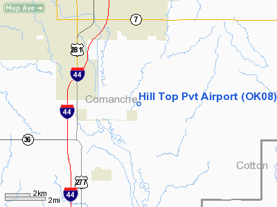
Location & QuickFacts
| FAA Information Effective: | 2008-09-25 |
| Airport Identifier: | OK08 |
| Airport Status: | Operational |
| Longitude/Latitude: | 098-21-01.1800W/34-32-00.2780N
-98.350328/34.533411 (Estimated) |
| Elevation: | 1100 ft / 335.28 m (Estimated) |
| Land: | 320 acres |
| From nearest city: | 4 nautical miles SE of Lawton, OK |
| Location: | Comanche County, OK |
| Magnetic Variation: | 07E (1985) |
Owner & Manager
| Ownership: | Privately owned |
| Owner: | Nick Calluchee |
| Address: | 8220 Se Flower Mound Rd
Lawton, OK 73501 |
| Phone number: | 580-353-0748
CELL: 580-585-4927 FAX: 580-355-2493 |
| Manager: | Clifford C Dossey |
| Address: | 8220 Se Flower Mound Rd
Lawton, OK 73501 |
| Phone number: | 405-355-3834
405-355-4046 |
Airport Operations and Facilities
| Airport Use: | Private |
| Wind indicator: | Yes |
| Segmented Circle: | No |
| Control Tower: | No |
| Landing fee charge: | No |
| Sectional chart: | Dallas-ft Worth |
| Region: | ASW - Southwest |
| Boundary ARTCC: | ZFW - Fort Worth |
| Tie-in FSS: | MLC - Mc Alester |
| FSS on Airport: | No |
| FSS Toll Free: | 1-800-WX-BRIEF |
Airport Communications
Airport Services
| Bottled Oxygen: | NONE |
| Bulk Oxygen: | NONE |
Runway Information
Runway 01/19
| Dimension: | 4000 x 200 ft / 1219.2 x 61.0 m |
| Surface: | TURF, Good Condition |
| |
Runway 01 |
Runway 19 |
| Traffic Pattern: | Left | Left |
| Obstruction: | 4 ft fence | 4 ft fence, 0.0 ft from runway |
|
Radio Navigation Aids
| ID |
Type |
Name |
Ch |
Freq |
Var |
Dist |
| FSI | FAN MARKER | Trail | | | 09E | 15.1 nm |
| PFL | NDB | Post | | 308.00 | 08E | 5.2 nm |
| OFZ | NDB | Trail | | 388.00 | 09E | 15.1 nm |
| OLR | NDB | Chickasha | | 290.00 | 07E | 39.1 nm |
| SKB | NDB | Scotland | | 344.00 | 08E | 45.2 nm |
| VRT | NDB | Wilbarger | | 230.00 | 08E | 49.7 nm |
| SHP | TACAN | Sheppard | 045X | | 10E | 33.8 nm |
| LAW | VOR/DME | Lawton | 031X | 109.40 | 09E | 3.8 nm |
| DUC | VOR/DME | Duncan | 047X | 111.00 | 09E | 23.3 nm |
| SPS | VORTAC | Wichita Falls | 074X | 112.70 | 10E | 35.0 nm |
| HBR | VORTAC | Hobart | 055X | 111.80 | 10E | 40.5 nm |
| LTS | VORTAC | Altus | 035X | 109.80 | 08E | 46.2 nm |
Images and information placed above are from
http://www.airport-data.com/airport/OK08/
We thank them for the data!
| General Info
|
| Country |
United States
|
| State |
OKLAHOMA
|
| FAA ID |
OK08
|
| Latitude |
34-32-00.278N
|
| Longitude |
098-21-01.180W
|
| Elevation |
1100 feet
|
| Near City |
LAWTON
|
We don't guarantee the information is fresh and accurate. The data may
be wrong or outdated.
For more up-to-date information please refer to other sources.
|
|


