 |
|
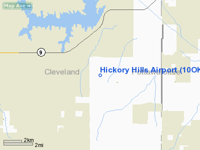
Location & QuickFacts
| FAA Information Effective: | 2008-09-25 |
| Airport Identifier: | 10OK |
| Airport Status: | Operational |
| Longitude/Latitude: | 097-13-01.0970W/35-10-00.2550N
-97.216971/35.166738 (Estimated) |
| Elevation: | 1175 ft / 358.14 m (Estimated) |
| Land: | 0 acres |
| From nearest city: | 12 nautical miles SE of Norman, OK |
| Location: | Cleveland County, OK |
| Magnetic Variation: | 07E (1985) |
Owner & Manager
| Ownership: | Privately owned |
| Owner: | Eugene L. Collett |
| Address: | 170 Hickory Hills Circle
Noble, OK 73068 |
| Phone number: | 405-872-5077 |
| Manager: | Eugene L. Collett |
| Address: | 170 Hickory Hills Circle
Noble, OK 73068 |
| Phone number: | 405-872-5077 |
Airport Operations and Facilities
| Airport Use: | Private |
| Wind indicator: | Yes |
| Segmented Circle: | No |
| Control Tower: | No |
| Landing fee charge: | No |
| Sectional chart: | Dallas-ft Worth |
| Region: | ASW - Southwest |
| Boundary ARTCC: | ZFW - Fort Worth |
| Tie-in FSS: | MLC - Mc Alester |
| FSS on Airport: | No |
| FSS Toll Free: | 1-800-WX-BRIEF |
Airport Communications
Runway Information
Runway 17/35
| Dimension: | 2600 x 150 ft / 792.5 x 45.7 m |
| Surface: | TURF, |
| |
Runway 17 |
Runway 35 |
| Traffic Pattern: | Left | Left |
|
Radio Navigation Aids
| ID |
Type |
Name |
Ch |
Freq |
Var |
Dist |
| OUN | NDB | Norman | | 260.00 | 07E | 13.4 nm |
| OK | NDB | Tuloo | | 406.00 | 07E | 26.4 nm |
| PVJ | NDB | Pauls Valley | | 384.00 | 06E | 27.1 nm |
| SRE | NDB | Seminole | | 278.00 | 06E | 27.4 nm |
| GGU | NDB | Prague | | 314.00 | 06E | 32.2 nm |
| OLR | NDB | Chickasha | | 290.00 | 07E | 37.3 nm |
| CQB | NDB | Tilghman | | 396.00 | 06E | 38.7 nm |
| HDL | NDB | Holdenville | | 411.00 | 06E | 39.8 nm |
| LCY | NDB | Logan County | | 326.00 | 07E | 41.9 nm |
| RQO | NDB | El Reno | | 335.00 | 07E | 43.1 nm |
| CUH | NDB | Cushing | | 242.00 | 05E | 48.5 nm |
| TIK | TACAN | Tinker | 105X | | 07E | 18.1 nm |
| PWA | VOR/DME | Wiley Post | 081X | 113.40 | 08E | 30.5 nm |
| ADH | VOR/DME | Ada | 125X | 117.80 | 06E | 34.7 nm |
| IRW | VORTAC | Will Rogers | 088X | 114.10 | 07E | 22.4 nm |
| OKC | VOT | Oklahoma Will Rgs W | | 108.80 | | 23.2 nm |
Remarks
- CONDL--PROVIDED BOTH THRESHOLDS ARE LOCATED TO PROVIDE A MINIMUM 20:1 CLEARANCE OVER ALL OBSTRUCTIONS IN FINAL APPROACH AREAS.
Images and information placed above are from
http://www.airport-data.com/airport/10OK/
We thank them for the data!
| General Info
|
| Country |
United States
|
| State |
OKLAHOMA
|
| FAA ID |
10OK
|
| Latitude |
35-10-00.255N
|
| Longitude |
097-13-01.097W
|
| Elevation |
1175 feet
|
| Near City |
NORMAN
|
We don't guarantee the information is fresh and accurate. The data may
be wrong or outdated.
For more up-to-date information please refer to other sources.
|
|


