 |
|
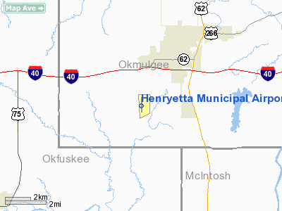
Location & QuickFacts
| FAA Information Effective: | 2008-09-25 |
| Airport Identifier: | F10 |
| Airport Status: | Operational |
| Longitude/Latitude: | 096-00-56.9980W/35-24-24.7670N
-96.015833/35.406880 (Estimated) |
| Elevation: | 849 ft / 258.78 m (Surveyed) |
| Land: | 160 acres |
| From nearest city: | 3 nautical miles SW of Henryetta, OK |
| Location: | Okmulgee County, OK |
| Magnetic Variation: | 04E (2005) |
Owner & Manager
| Ownership: | Publicly owned |
| Owner: | City Of Henryetta |
| Address: | City Hall, 115 S. 4th St
Henryetta, OK 74437 |
| Phone number: | 918-652-3348 |
| Manager: | Sonny Williams |
| Address: | Po Box 608, 10249 Loblolly Rd.
Henryetta, OK 74437 |
| Phone number: | 918-652-8634 |
Airport Operations and Facilities
| Airport Use: | Open to public |
| Wind indicator: | Yes |
| Segmented Circle: | Yes |
| Control Tower: | No |
| Lighting Schedule: | DUSK-DAWN
ACTVT MIRL RY 18/36 - CTAF. |
| Beacon Color: | Clear-Green (lighted land airport) |
| Landing fee charge: | No |
| Sectional chart: | Dallas-ft Worth |
| Region: | ASW - Southwest |
| Boundary ARTCC: | ZFW - Fort Worth |
| Tie-in FSS: | MLC - Mc Alester |
| FSS on Airport: | No |
| FSS Toll Free: | 1-800-WX-BRIEF |
| NOTAMs Facility: | MLC (NOTAM-d service avaliable) |
| Federal Agreements: | NGY |
Airport Communications
| CTAF: | 122.800 |
| Unicom: | 122.800 |
Airport Services
| Fuel available: | 100LL |
| Airframe Repair: | NONE |
| Power Plant Repair: | NONE |
| Bottled Oxygen: | NONE |
| Bulk Oxygen: | NONE |
Runway Information
Runway 18/36
| Dimension: | 3501 x 50 ft / 1067.1 x 15.2 m |
| Surface: | ASPH, Good Condition |
| Weight Limit: | Single wheel: 12000 lbs. |
| Edge Lights: | Medium |
| |
Runway 18 |
Runway 36 |
| Longitude: | 096-00-56.9460W | 096-00-57.0200W |
| Latitude: | 35-24-42.0630N | 35-24-07.4330N |
| Elevation: | 830.00 ft | 849.00 ft |
| Alignment: | 127 | 127 |
| Traffic Pattern: | Left | Left |
| Markings: | Basic, Good Condition | Non-precision instrument, Good Condition |
| Crossing Height: | 32.00 ft | 0.00 ft |
| VASI: | pulsating/steady burning on left side | |
| Visual Glide Angle: | 3.10° | 0.00° |
| Obstruction: | 15 ft trees, 300.0 ft from runway, 150 ft left of centerline, 6:1 slope to clear | 30 ft trees, 540.0 ft from runway, 11:1 slope to clear |
|
Radio Navigation Aids
| ID |
Type |
Name |
Ch |
Freq |
Var |
Dist |
| HET | NDB | Henryetta | | 267.00 | 04E | 0.2 nm |
| HDL | NDB | Holdenville | | 411.00 | 06E | 27.5 nm |
| TZO | NDB | Bristow | | 251.00 | 05E | 29.6 nm |
| SRE | NDB | Seminole | | 278.00 | 06E | 33.3 nm |
| GGU | NDB | Prague | | 314.00 | 06E | 35.0 nm |
| MKO | NDB | Muskogee | | 306.00 | 06E | 37.4 nm |
| CQB | NDB | Tilghman | | 396.00 | 06E | 43.6 nm |
| OWP | NDB | William Pogue | | 362.00 | 06E | 46.5 nm |
| CUH | NDB | Cushing | | 242.00 | 05E | 47.1 nm |
| MEE | VOR | Davis | | 108.60 | 06E | 35.2 nm |
| OKM | VOR/DME | Okmulgee | 096X | 114.90 | 08E | 18.7 nm |
| GNP | VOR/DME | Glenpool | 043X | 110.60 | 06E | 31.0 nm |
| ADH | VOR/DME | Ada | 125X | 117.80 | 06E | 48.5 nm |
| MLC | VORTAC | Mc Alester | 057X | 112.00 | 08E | 35.4 nm |
| TUL | VORTAC | Tulsa | 091X | 114.40 | 08E | 48.7 nm |
| TUL | VOT | Tulsa Intl | | 109.00 | | 48.7 nm |
Images and information placed above are from
http://www.airport-data.com/airport/F10/
We thank them for the data!
| General Info
|
| Country |
United States
|
| State |
OKLAHOMA
|
| FAA ID |
F10
|
| Latitude |
35-24-24.767N
|
| Longitude |
096-00-56.998W
|
| Elevation |
849 feet
|
| Near City |
HENRYETTA
|
We don't guarantee the information is fresh and accurate. The data may
be wrong or outdated.
For more up-to-date information please refer to other sources.
|
|


