 |
|
 |
(Click on the photo to enlarge) |
Location & QuickFacts
| FAA Information Effective: | 2008-09-25 |
| Airport Identifier: | F32 |
| Airport Status: | Operational |
| Longitude/Latitude: | 097-28-26.0870W/34-14-57.3290N
-97.473913/34.249258 (Estimated) |
| Elevation: | 956 ft / 291.39 m (Estimated) |
| Land: | 40 acres |
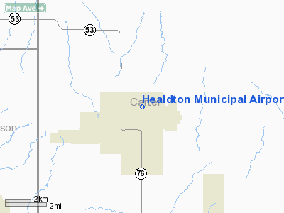
| From nearest city: | 2 nautical miles NE of Healdton, OK |
| Location: | Carter County, OK |
| Magnetic Variation: | 07E (1985) |
Owner & Manager
| Ownership: | Publicly owned |
| Owner: | City Of Healdton |
| Address: | City Hall 310 Franklin St
Healdton, OK 73438 |
| Phone number: | 580-229-1283 |
| Manager: | John King, City Mgr |
| Address: | Po Box 926
Healdton, OK 73438 |
| Phone number: | 580-229-1283 |
Airport Operations and Facilities
| Airport Use: | Open to public |
| Wind indicator: | Yes |
| Segmented Circle: | Yes |
| Control Tower: | No |
| Landing fee charge: | No |
| Sectional chart: | Dallas-ft Worth |
| Region: | ASW - Southwest |
| Boundary ARTCC: | ZFW - Fort Worth |
| Tie-in FSS: | MLC - Mc Alester |
| FSS on Airport: | No |
| FSS Toll Free: | 1-800-WX-BRIEF |
| NOTAMs Facility: | MLC (NOTAM-d service avaliable) |
| Federal Agreements: | NGY |
Airport Communications
Airport Services
| Airframe Repair: | NONE |
| Power Plant Repair: | NONE |
| Bottled Oxygen: | NONE |
| Bulk Oxygen: | NONE |
Runway Information
Runway 17/35
| Dimension: | 3000 x 50 ft / 914.4 x 15.2 m |
| Surface: | ASPH, Fair Condition |
| Weight Limit: | Single wheel: 12500 lbs. |
| |
Runway 17 |
Runway 35 |
| Traffic Pattern: | Left | Left |
| Markings: | Basic, Fair Condition | Basic, Fair Condition |
| Obstruction: | 35 ft trees, 329.0 ft from runway, 3:1 slope to clear
20 FT TREES AT 130 FT FM END OF RY; +10 FT ROAD AT 110 FT FM END OF RY; +4 FT FENCE AT 99 FT FM END OF RY. | , 50:1 slope to clear |
|
Radio Navigation Aids
| ID |
Type |
Name |
Ch |
Freq |
Var |
Dist |
| AUV | NDB | Arbuckle | | 284.00 | 07E | 18.3 nm |
| PVJ | NDB | Pauls Valley | | 384.00 | 06E | 30.5 nm |
| GLE | NDB | Gainesville | | 330.00 | 06E | 34.7 nm |
| GMZ | NDB | Grindstone Mountain | | 356.00 | 07E | 41.5 nm |
| DNI | NDB | Denison | | 341.00 | 06E | 47.5 nm |
| DUC | VOR/DME | Duncan | 047X | 111.00 | 09E | 23.4 nm |
| LAW | VOR/DME | Lawton | 031X | 109.40 | 09E | 48.9 nm |
| ADM | VORTAC | Ardmore | 114X | 116.70 | 06E | 15.4 nm |
| UKW | VORTAC | Bowie | 071X | 112.40 | 06E | 46.2 nm |
Remarks
Images and information placed above are from
http://www.airport-data.com/airport/F32/
We thank them for the data!
| General Info
|
| Country |
United States
|
| State |
OKLAHOMA
|
| FAA ID |
F32
|
| Latitude |
34-14-57.329N
|
| Longitude |
097-28-26.087W
|
| Elevation |
956 feet
|
| Near City |
HEALDTON
|
We don't guarantee the information is fresh and accurate. The data may
be wrong or outdated.
For more up-to-date information please refer to other sources.
|
|


