 |
|
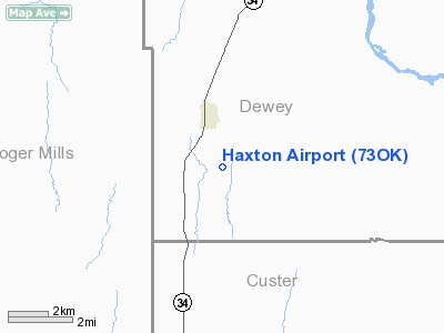
Location & QuickFacts
| FAA Information Effective: | 2008-09-25 |
| Airport Identifier: | 73OK |
| Airport Status: | Operational |
| Longitude/Latitude: | 099-20-14.3710W/35-50-44.1670N
-99.337325/35.845602 (Estimated) |
| Elevation: | 2050 ft / 624.84 m (Estimated) |
| Land: | 0 acres |
| From nearest city: | 2 nautical miles SE of Leedey, OK |
| Location: | Dewey County, OK |
| Magnetic Variation: | 08E (1985) |
Owner & Manager
| Ownership: | Privately owned |
| Owner: | Dan Haxton |
| Address: | Route 2, Box 11
Leedey, OK 73654 |
| Phone number: | 405-489-2905 |
| Address: |
|
Airport Operations and Facilities
| Airport Use: | Private |
| Wind indicator: | Yes |
| Segmented Circle: | No |
| Control Tower: | No |
| Sectional chart: | Dallas-ft Worth |
| Region: | ASW - Southwest |
| Boundary ARTCC: | ZKC - Kansas City |
| Tie-in FSS: | MLC - Mc Alester |
| FSS Toll Free: | 1-800-WX-BRIEF |
Runway Information
Runway 17/35
| Dimension: | 3000 x 60 ft / 914.4 x 18.3 m |
| Surface: | TURF, |
| |
Runway 17 |
Runway 35 |
| Traffic Pattern: | Left | Left |
| Obstruction: | 5 ft fence | 20 ft pline, 1000.0 ft from runway |
|
Radio Navigation Aids
| ID |
Type |
Name |
Ch |
Freq |
Var |
Dist |
| BZ | NDB | Fossi | | 393.00 | 08E | 24.6 nm |
| EZY | NDB | Elk City | | 241.00 | 08E | 25.4 nm |
| CLK | NDB | Clinton | | 320.00 | 07E | 26.9 nm |
| OWU | NDB | West Woodward | | 329.00 | 08E | 36.5 nm |
| OJA | NDB | Weatherford | | 272.00 | 07E | 37.7 nm |
| MDF | NDB | Mooreland/dcmsnd | | 284.00 | 08E | 39.2 nm |
| JWG | NDB | Watonga | | 359.00 | 07E | 44.4 nm |
| FAU | NDB | Fairview | | 246.00 | 07E | 49.4 nm |
| SYO | VORTAC | Sayre | 099X | 115.20 | 10E | 33.4 nm |
| BFV | VORTAC | Burns Flat | 037X | 110.00 | 08E | 37.1 nm |
| GAG | VORTAC | Gage | 103X | 115.60 | 10E | 39.9 nm |
Images and information placed above are from
http://www.airport-data.com/airport/73OK/
We thank them for the data!
| General Info
|
| Country |
United States
|
| State |
OKLAHOMA
|
| FAA ID |
73OK
|
| Latitude |
35-50-44.167N
|
| Longitude |
099-20-14.371W
|
| Elevation |
2050 feet
|
| Near City |
LEEDEY
|
We don't guarantee the information is fresh and accurate. The data may
be wrong or outdated.
For more up-to-date information please refer to other sources.
|
|


