|
|
 |
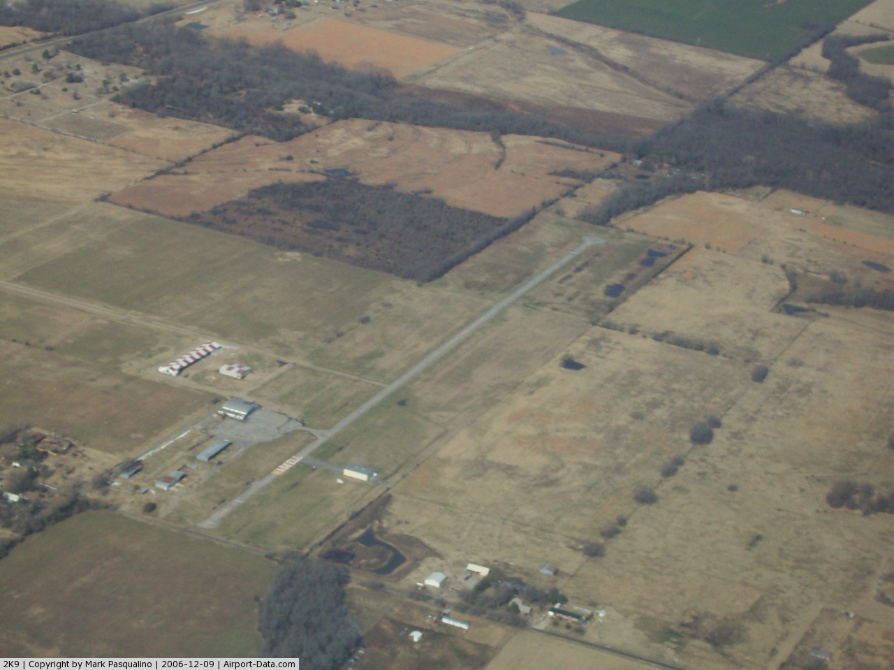
(Click on the photo to enlarge) |
Location & QuickFacts
| FAA Information Effective: | 2008-09-25 |
| Airport Identifier: | 2K9 |
| Airport Status: | Operational |
| Longitude/Latitude: | 095-40-02.6000W/35-49-58.3000N
-95.667389/35.832861 (Estimated) |
| Elevation: | 588 ft / 179.22 m (Surveyed) |
| Land: | 110 acres |
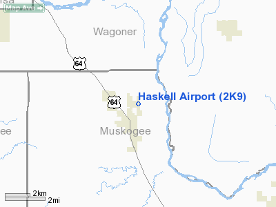
| From nearest city: | 1 nautical miles NE of Haskell, OK |
| Location: | Muskogee County, OK |
| Magnetic Variation: | 06E (1985) |
Owner & Manager
| Ownership: | Privately owned |
| Owner: | Kaz Pienkos |
| Address: | Po Box 968
Haskell, OK 74436 |
| Phone number: | 918-810-2135 |
| Manager: | Kaz Pienkos |
| Address: | Po Box 968
Haskell, OK 74436 |
| Phone number: | 918-810-2135 |
Airport Operations and Facilities
| Airport Use: | Open to public |
| Wind indicator: | Yes |
| Segmented Circle: | No |
| Control Tower: | No |
| Landing fee charge: | No |
| Sectional chart: | Dallas-ft Worth |
| Region: | ASW - Southwest |
| Boundary ARTCC: | ZFW - Fort Worth |
| Responsible ARTCC: | ZKC - Kansas City |
| Tie-in FSS: | MLC - Mc Alester |
| FSS on Airport: | No |
| FSS Toll Free: | 1-800-WX-BRIEF |
| NOTAMs Facility: | MLC (NOTAM-d service avaliable) |
Airport Communications
Airport Services
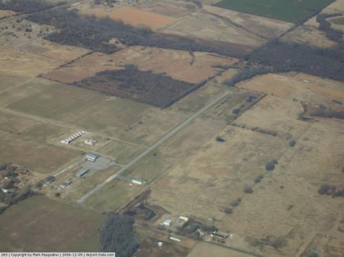
Runway Information
Runway 17/35
| Dimension: | 3710 x 30 ft / 1130.8 x 9.1 m |
| Surface: | ASPH, Fair Condition |
| |
Runway 17 |
Runway 35 |
| Traffic Pattern: | Left | Left |
| Markings: | Nonstandard, Fair Condition
SMALL NUMBERS. | Nonstandard, Fair Condition
SMALL NUMBERS WITH NTSD MARKINGS FIRST 240 FT. |
| Obstruction: | 65 ft trees, 200.0 ft from runway
65 FT TREES 100 FT FM THLD. | , 50:1 slope to clear
15 FT ROAD AT 40 FT 0B. |
|
Radio Navigation Aids
| ID |
Type |
Name |
Ch |
Freq |
Var |
Dist |
| MKO | NDB | Muskogee | | 306.00 | 06E | 23.4 nm |
| DW | NDB | Owaso | | 375.00 | 06E | 30.3 nm |
| HET | NDB | Henryetta | | 267.00 | 04E | 30.8 nm |
| OWP | NDB | William Pogue | | 362.00 | 06E | 31.3 nm |
| TQH | NDB | Tahlequah | | 215.00 | 05E | 32.7 nm |
| TZO | NDB | Bristow | | 251.00 | 05E | 37.1 nm |
| MEE | VOR | Davis | | 108.60 | 06E | 17.8 nm |
| OKM | VOR/DME | Okmulgee | 096X | 114.90 | 08E | 12.8 nm |
| GNP | VOR/DME | Glenpool | 043X | 110.60 | 06E | 15.6 nm |
| TUL | VORTAC | Tulsa | 091X | 114.40 | 08E | 22.6 nm |
| TUL | VOT | Tulsa Intl | | 109.00 | | 22.6 nm |
Remarks
- ULTRALIGHT ACTIVITY ON & INVOF ARPT.
- DALGT OPNS ONLY.
Images and information placed above are from
http://www.airport-data.com/airport/2K9/
We thank them for the data!
| General Info
|
| Country |
United States
|
| State |
OKLAHOMA
|
| FAA ID |
2K9
|
| Latitude |
35-49-50.362N
|
| Longitude |
095-40-00.935W
|
| Elevation |
588 feet
|
| Near City |
HASKELL
|
We don't guarantee the information is fresh and accurate. The data may
be wrong or outdated.
For more up-to-date information please refer to other sources.
|
|