 |
|
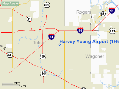
Location & QuickFacts
| FAA Information Effective: | 2008-09-25 |
| Airport Identifier: | 1H6 |
| Airport Status: | Operational |
| Longitude/Latitude: | 095-49-29.9500W/36-08-20.3400N
-95.824986/36.138983 (Estimated) |
| Elevation: | 750 ft / 228.60 m (Surveyed) |
| Land: | 92 acres |
| From nearest city: | 7 nautical miles E of Tulsa, OK |
| Location: | Tulsa County, OK |
| Magnetic Variation: | 06E (1985) |
Owner & Manager
| Ownership: | Privately owned |
| Owner: | Estate Of Terrance Mc Donald |
| Address: | 1419 South 135 East Ave
Tulsa, OK 74108 |
| Phone number: | 918-437-2877 |
| Manager: | Mike Smith |
| Address: | 1419 South 135 East Ave
Tulsa, OK 74108 |
| Phone number: | 918-437-2877 |
Airport Operations and Facilities
| Airport Use: | Open to public |
| Wind indicator: | Yes |
| Segmented Circle: | Yes |
| Control Tower: | No |
| Lighting Schedule: | DUSK-DAWN |
| Beacon Color: | Clear-Green (lighted land airport) |
| Landing fee charge: | No |
| Sectional chart: | Kansas City |
| Region: | ASW - Southwest |
| Boundary ARTCC: | ZKC - Kansas City |
| Tie-in FSS: | MLC - Mc Alester |
| FSS on Airport: | No |
| FSS Toll Free: | 1-800-WX-BRIEF |
| NOTAMs Facility: | MLC (NOTAM-d service avaliable) |
Airport Communications
| CTAF: | 122.800 |
| Unicom: | 122.800 |
Airport Services
| Fuel available: | 100LL |
| Airframe Repair: | MAJOR |
| Power Plant Repair: | MAJOR |
Runway Information
Runway 17/35
| Dimension: | 2580 x 40 ft / 786.4 x 12.2 m |
| Surface: | ASPH, Fair Condition |
| |
Runway 17 |
Runway 35 |
| Traffic Pattern: | Left | Left |
| Markings: | Basic, Fair Condition | Basic, Fair Condition |
| Obstruction: | 50 ft trees, 750.0 ft from runway, 11:1 slope to clear | 68 ft trees, 750.0 ft from runway, 55 ft left of centerline, 7:1 slope to clear |
|
Runway N/S
| Dimension: | 2580 x 80 ft / 786.4 x 24.4 m |
| Surface: | TURF, Good Condition |
| |
Runway N |
Runway S |
| Traffic Pattern: | Left | Left |
| Obstruction: | 70 ft trees, 200.0 ft from runway, 75 ft right of centerline, 2:1 slope to clear | 40 ft trees, 200.0 ft from runway, 75 ft left of centerline, 5:1 slope to clear |
|
Radio Navigation Aids
| ID |
Type |
Name |
Ch |
Freq |
Var |
Dist |
| DW | NDB | Owaso | | 375.00 | 06E | 10.4 nm |
| OWP | NDB | William Pogue | | 362.00 | 06E | 16.1 nm |
| TZO | NDB | Bristow | | 251.00 | 05E | 36.7 nm |
| TQH | NDB | Tahlequah | | 215.00 | 05E | 41.8 nm |
| MKO | NDB | Muskogee | | 306.00 | 06E | 41.9 nm |
| HET | NDB | Henryetta | | 267.00 | 04E | 45.1 nm |
| CUH | NDB | Cushing | | 242.00 | 05E | 48.6 nm |
| MEE | VOR | Davis | | 108.60 | 06E | 36.2 nm |
| GNP | VOR/DME | Glenpool | 043X | 110.60 | 06E | 14.9 nm |
| OKM | VOR/DME | Okmulgee | 096X | 114.90 | 08E | 26.9 nm |
| BVO | VOR/DME | Bartlesville | 126X | 117.90 | 08E | 42.8 nm |
| TUL | VORTAC | Tulsa | 091X | 114.40 | 08E | 3.9 nm |
| TUL | VOT | Tulsa Intl | | 109.00 | | 3.9 nm |
Remarks
- TWYS THIN & SOFT IN HOT WEATHER.
- ULTRALIGHTS ON AND IN VICINITY OF AIRPORT.
- ESTAB PRIOR TO 1959.
Images and information placed above are from
http://www.airport-data.com/airport/1H6/
We thank them for the data!
| General Info
|
| Country |
United States
|
| State |
OKLAHOMA
|
| FAA ID |
1H6
|
| Latitude |
36-08-20.340N
|
| Longitude |
095-49-29.950W
|
| Elevation |
750 feet
|
| Near City |
TULSA
|
We don't guarantee the information is fresh and accurate. The data may
be wrong or outdated.
For more up-to-date information please refer to other sources.
|
|


