 |
|
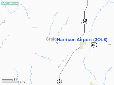
Location & QuickFacts
| FAA Information Effective: | 2008-09-25 |
| Airport Identifier: | 3OL8 |
| Airport Status: | Operational |
| Longitude/Latitude: | 095-08-56.8740W/36-52-40.2710N
-95.149132/36.877853 (Estimated) |
| Elevation: | 805 ft / 245.36 m (Estimated) |
| Land: | 0 acres |
| From nearest city: | 3 nautical miles W of Welch, OK |
| Location: | Craig County, OK |
| Magnetic Variation: | 05E (1985) |
Owner & Manager
| Ownership: | Privately owned |
| Owner: | Dr & Mrs Wm Harrison, Jr |
| Address: | 1919 S. Wheeling, Nr 400
Tulsa, OK 74104 |
| Phone number: | 918-743-2108
AIRPORT TELEPHONE: 918-788-3406. |
| Manager: | Dr & Mrs Wm Harrison, Jr |
| Address: | 1919 S. Wheeling, Nr 400
Tulsa, OK 74104 |
| Phone number: | 918-749-1418 |
Airport Operations and Facilities
| Airport Use: | Private |
| Wind indicator: | Yes |
| Segmented Circle: | No |
| Control Tower: | No |
| Lighting Schedule: | RDO-CTL
FOR ROTG BCN AND RWY LGTS, KEY 119.0 5 TIMES IN 5 SECS. |
| Beacon Color: | Clear-Green (lighted land airport) |
| Landing fee charge: | No |
| Sectional chart: | Kansas City |
| Region: | ASW - Southwest |
| Boundary ARTCC: | ZKC - Kansas City |
| Tie-in FSS: | MLC - Mc Alester |
| FSS on Airport: | No |
| FSS Toll Free: | 1-800-WX-BRIEF |
Airport Services
Runway Information
Runway 03/21
| Dimension: | 4600 x 40 ft / 1402.1 x 12.2 m |
| Surface: | ASPH, |
| Edge Lights: | Medium |
| |
Runway 03 |
Runway 21 |
| Traffic Pattern: | Left | Left |
| Displaced threshold: | 500.00 ft | 0.00 ft |
|
Radio Navigation Aids
| ID |
Type |
Name |
Ch |
Freq |
Var |
Dist |
| CFV | NDB | Coffeyville | | 212.00 | 05E | 24.1 nm |
| PPF | NDB | Parsons | | 258.00 | 06E | 32.6 nm |
| PTS | NDB | Pittsburg | | 365.00 | 05E | 39.5 nm |
| DW | NDB | Owaso | | 375.00 | 06E | 49.0 nm |
| EOS | VOR/DME | Neosho | 120X | 117.30 | 07E | 34.4 nm |
| BVO | VOR/DME | Bartlesville | 126X | 117.90 | 08E | 41.9 nm |
| CNU | VOR/DME | Chanute | 029X | 109.20 | 05E | 49.7 nm |
| OSW | VORTAC | Oswego | 123X | 117.60 | 08E | 17.0 nm |
Images and information placed above are from
http://www.airport-data.com/airport/3OL8/
We thank them for the data!
| General Info
|
| Country |
United States
|
| State |
OKLAHOMA
|
| FAA ID |
3OL8
|
| Latitude |
36-52-40.271N
|
| Longitude |
095-08-56.874W
|
| Elevation |
805 feet
|
| Near City |
WELCH
|
We don't guarantee the information is fresh and accurate. The data may
be wrong or outdated.
For more up-to-date information please refer to other sources.
|
|


