 |
|
Location & QuickFacts
| FAA Information Effective: | 2008-09-25 |
| Airport Identifier: | OL14 |
| Airport Status: | Operational |
| Longitude/Latitude: | 094-58-00.8570W/36-33-30.2880N
-94.966905/36.558413 (Estimated) |
| Elevation: | 760 ft / 231.65 m (Estimated) |
| Land: | 0 acres |
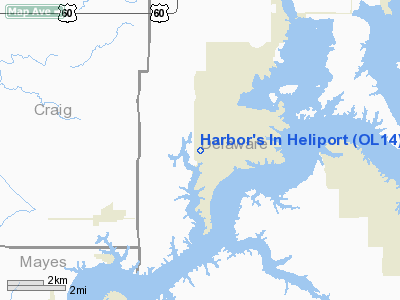
| From nearest city: | 3 nautical miles SW of Ketchum, OK |
| Location: | Delaware County, OK |
| Magnetic Variation: | 06E (1985) |
Owner & Manager
| Ownership: | Privately owned |
| Owner: | Harbors Area Associnc R M Lee
HARBORS AREA ASSOCIATION. |
| Address: | 321 South Boston Ave
Tulsa, OK 74101-2239 |
| Phone number: | 918-585-5000 |
| Manager: | Delton Mc Kellips |
| Address: | Route 1, Box 748
Eucha, OK 74342 |
| Phone number: | 918-782-2128 |
Airport Operations and Facilities
| Airport Use: | Private |
| Wind indicator: | Yes |
| Segmented Circle: | No |
| Control Tower: | No |
| Lighting Schedule: | PHONE REQ
FOR HELIPAD LGTS CALL 918-782-2128. |
| Sectional chart: | Memphis |
| Region: | ASW - Southwest |
| Boundary ARTCC: | ZKC - Kansas City |
| Tie-in FSS: | MLC - Mc Alester |
| FSS Toll Free: | 1-800-WX-BRIEF |
Runway Information
Helipad H1
| Dimension: | 60 x 60 ft / 18.3 x 18.3 m |
| Surface: | CONC, |
| |
Runway H1 |
Runway |
| Traffic Pattern: | Left | Left |
|
Radio Navigation Aids
| ID |
Type |
Name |
Ch |
Freq |
Var |
Dist |
| SLG | NDB | Siloam Springs | | 284.00 | 04E | 32.1 nm |
| TQH | NDB | Tahlequah | | 215.00 | 05E | 38.0 nm |
| CFV | NDB | Coffeyville | | 212.00 | 05E | 43.4 nm |
| DW | NDB | Owaso | | 375.00 | 06E | 46.4 nm |
| EOS | VOR/DME | Neosho | 120X | 117.30 | 07E | 30.8 nm |
| DAK | VOR/DME | Drake | 025X | 108.80 | 07E | 48.5 nm |
| OSW | VORTAC | Oswego | 123X | 117.60 | 08E | 37.8 nm |
| RZC | VORTAC | Razorback | 111X | 116.40 | 04E | 45.0 nm |
| TUL | VORTAC | Tulsa | 091X | 114.40 | 08E | 45.3 nm |
| TUL | VOT | Tulsa Intl | | 109.00 | | 45.3 nm |
Remarks
- PRVDD INGRESS/EGRESS ROUTES ARE TO/FM THE NORTH AND/OR SOUTH; AND WINDSOCK AND SUPPORTING POLE ARE RELOCATED TO EAST SIDE OF HELIPORT APPROXIMATELY 50 FT.
Images and information placed above are from
http://www.airport-data.com/airport/OL14/
We thank them for the data!
| General Info
|
| Country |
United States
|
| State |
OKLAHOMA
|
| FAA ID |
OL14
|
| Latitude |
36-33-30.288N
|
| Longitude |
094-58-00.857W
|
| Elevation |
760 feet
|
| Near City |
KETCHUM
|
We don't guarantee the information is fresh and accurate. The data may
be wrong or outdated.
For more up-to-date information please refer to other sources.
|
|


