 |
|
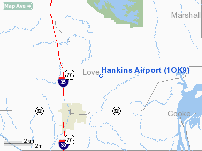
Location & QuickFacts
| FAA Information Effective: | 2008-09-25 |
| Airport Identifier: | 1OK9 |
| Airport Status: | Operational |
| Longitude/Latitude: | 097-05-21.0410W/33-58-30.3580N
-97.089178/33.975099 (Estimated) |
| Elevation: | 843 ft / 256.95 m (Estimated) |
| Land: | 100 acres |
| From nearest city: | 3 nautical miles NN of Marietta, OK |
| Location: | Love County, OK |
| Magnetic Variation: | 07E (1985) |
Owner & Manager
| Ownership: | Privately owned |
| Owner: | Jim G. Hankins |
| Address: | 67 Squirrel Ln
Pottsboro, TX 75076 |
| Phone number: | 903-786-4384 |
| Manager: | Jim G. Hankins |
| Address: | 67 Squirrel Ln
Pottsboro, TX 75076 |
| Phone number: | 903-786-4384 |
Airport Operations and Facilities
| Airport Use: | Private |
| Wind indicator: | Yes |
| Segmented Circle: | No |
| Control Tower: | No |
| Landing fee charge: | No |
| Sectional chart: | Dallas-ft Worth |
| Region: | ASW - Southwest |
| Boundary ARTCC: | ZFW - Fort Worth |
| Tie-in FSS: | MLC - Mc Alester |
| FSS on Airport: | No |
| FSS Toll Free: | 1-800-WX-BRIEF |
Runway Information
Runway 01/19
| Dimension: | 1100 x 50 ft / 335.3 x 15.2 m |
| Surface: | TURF, Poor Condition |
| |
Runway 01 |
Runway 19 |
| Traffic Pattern: | Left | Left |
|
Runway 07/25
| Dimension: | 2200 x 150 ft / 670.6 x 45.7 m |
| Surface: | TURF, Poor Condition |
| |
Runway 07 |
Runway 25 |
| Traffic Pattern: | Left | Left |
|
Radio Navigation Aids
| ID |
Type |
Name |
Ch |
Freq |
Var |
Dist |
| AUV | NDB | Arbuckle | | 284.00 | 07E | 10.7 nm |
| GLE | NDB | Gainesville | | 330.00 | 06E | 16.4 nm |
| DNI | NDB | Denison | | 341.00 | 06E | 22.8 nm |
| DUA | NDB | Durant | | 359.00 | 05E | 34.4 nm |
| GMZ | NDB | Grindstone Mountain | | 356.00 | 07E | 40.8 nm |
| PVJ | NDB | Pauls Valley | | 384.00 | 06E | 45.0 nm |
| URH | VOR/DME | Texoma | 090X | 114.30 | 05E | 34.8 nm |
| DUC | VOR/DME | Duncan | 047X | 111.00 | 09E | 47.9 nm |
| ADM | VORTAC | Ardmore | 114X | 116.70 | 06E | 14.7 nm |
| UKW | VORTAC | Bowie | 071X | 112.40 | 06E | 45.1 nm |
Remarks
Images and information placed above are from
http://www.airport-data.com/airport/1OK9/
We thank them for the data!
| General Info
|
| Country |
United States
|
| State |
OKLAHOMA
|
| FAA ID |
1OK9
|
| Latitude |
33-58-30.358N
|
| Longitude |
097-05-21.041W
|
| Elevation |
843 feet
|
| Near City |
MARIETTA
|
We don't guarantee the information is fresh and accurate. The data may
be wrong or outdated.
For more up-to-date information please refer to other sources.
|
|


