|
|
Halliburton Field Airport |
Halliburton Field
Duncan Municipal Airport |
| IATA: DUC – ICAO: KDUC – FAA LID: DUC |
| Summary |
| Airport type |
Public |
| Owner |
City of Duncan |
| Serves |
Duncan, Oklahoma |
| Elevation AMSL |
1,113 ft / 339 m |
| Coordinates |
34°28′15″N 097°57′36″W / 34.47083°N 97.96°W / 34.47083; -97.96Coordinates: 34°28′15″N 097°57′36″W / 34.47083°N 97.96°W / 34.47083; -97.96 |
| Runways |
| Direction |
Length |
Surface |
| ft |
m |
| 17/35 |
6,650 |
2,027 |
Concrete |
| Statistics (2007) |
| Aircraft operations |
8,750 |
| Based aircraft |
58 |
| Source: Federal Aviation Administration |
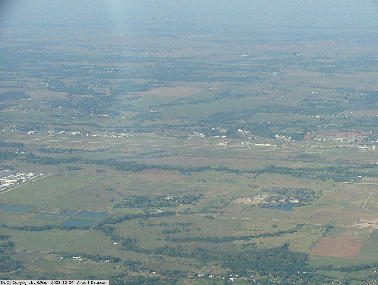
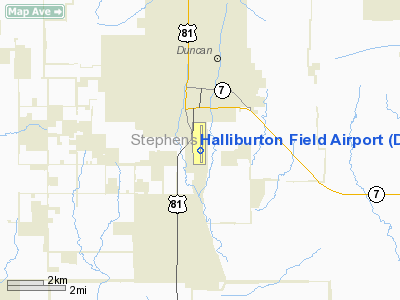
Halliburton Field (IATA: DUC, ICAO: KDUC, FAA LID: DUC) is a city-owned public-use airport located two nautical miles (4 km) south of the central business district of Duncan, a city in Stephens County, Oklahoma, United States. It is also known as the Duncan Municipal Airport.
Facilities and aircraft
Halliburton Field covers an area of 560 acres (227 ha) at an elevation of 1,113 feet (339 m) above mean sea level. It has one runway designated 17/35 with a 6,650 x 100 ft (2,027 x 30 m) concrete surface.
For the 12-month period ending November 29, 2007, the airport had 8,750 aircraft operations, an average of 23 per day: 97% general aviation and 3% air taxi. At that time there were 58 aircraft based at this airport: 81% single-engine, 14% multi-engine, 3% jet and 2% helicopter.
The above content comes from Wikipedia and is published under free licenses – click here to read more.
 |
(Click on the photo to enlarge) |
Location & QuickFacts
| FAA Information Effective: | 2008-09-25 |
| Airport Identifier: | DUC |
| Airport Status: | Operational |
| Longitude/Latitude: | 097-57-35.5000W/34-28-15.1500N
-97.959861/34.470875 (Estimated) |
| Elevation: | 1113 ft / 339.24 m (Surveyed) |
| Land: | 560 acres |
| From nearest city: | 2 nautical miles S of Duncan, OK |
| Location: | Stephens County, OK |
| Magnetic Variation: | 07E (1990) |
Owner & Manager
| Ownership: | Publicly owned |
| Owner: | City Of Duncan |
| Address: | City Hall, 720 W. Willow
Duncan, OK 73533 |
| Phone number: | 580-252-0250 |
| Manager: | Scott Vaughn
PUBLIC WORKS DIRECTOR. |
| Address: | Box 969, 720 W. Willow
Duncan, OK 73533 |
| Phone number: | 580-252-0250
PHONE NR IS FOR CITY HALL. AIRPORT TERMINAL BLDG CTC JIM BREWER 580-252-9896. |
Airport Operations and Facilities
| Airport Use: | Open to public |
| Wind indicator: | Yes |
| Segmented Circle: | Yes |
| Control Tower: | No |
| Lighting Schedule: | DUSK-DAWN
ACTVT MIRL RY 17/35, REIL & VASI RYS 17 & 35 - CTAF. |
| Beacon Color: | Clear-Green (lighted land airport) |
| Landing fee charge: | No |
| Sectional chart: | Dallas-ft Worth |
| Region: | ASW - Southwest |
| Boundary ARTCC: | ZFW - Fort Worth |
| Tie-in FSS: | MLC - Mc Alester |
| FSS on Airport: | No |
| FSS Toll Free: | 1-800-WX-BRIEF |
| NOTAMs Facility: | DUC (NOTAM-d service avaliable) |
| Federal Agreements: | NGY |
Airport Communications
| CTAF: | 122.800 |
| Unicom: | 122.800 |
Airport Services
| Fuel available: | 100LLA |
| Airframe Repair: | MAJOR |
| Power Plant Repair: | MAJOR |
| Bottled Oxygen: | NONE |
| Bulk Oxygen: | NONE |
Runway Information
Runway 17/35
| Dimension: | 6650 x 100 ft / 2026.9 x 30.5 m |
| Surface: | CONC, Fair Condition |
| Weight Limit: | Single wheel: 44000 lbs.
Dual wheel: 56000 lbs.
Dual dual tandem wheel: 101000 lbs. |
| Edge Lights: | Medium |
| |
Runway 17 |
Runway 35 |
| Longitude: | 097-57-35.9720W | 097-57-34.9990W |
| Latitude: | 34-28-48.0360N | 34-27-42.2620N |
| Elevation: | 1112.00 ft | 1086.00 ft |
| Alignment: | 127 | 127 |
| ILS Type: | | LOCALIZER
|
| Traffic Pattern: | Left | Left |
| Markings: | Non-precision instrument, Good Condition | Non-precision instrument, Good Condition |
| Crossing Height: | 43.00 ft | 44.00 ft |
| VASI: | 4-box on left side | 4-box on left side
VASI OTS INDEFLY. |
| Visual Glide Angle: | 3.00° | 3.00° |
| Runway End Identifier: | Yes
REIL OTS INDEFLY. | Yes |
| Obstruction: | 45 ft trees, 2000.0 ft from runway, 40:1 slope to clear | , 50:1 slope to clear |
|
Radio Navigation Aids
| ID |
Type |
Name |
Ch |
Freq |
Var |
Dist |
| FSI | FAN MARKER | Trail | | | 09E | 28.8 nm |
| PFL | NDB | Post | | 308.00 | 08E | 23.5 nm |
| OFZ | NDB | Trail | | 388.00 | 09E | 28.8 nm |
| OLR | NDB | Chickasha | | 290.00 | 07E | 38.1 nm |
| PVJ | NDB | Pauls Valley | | 384.00 | 06E | 39.0 nm |
| AUV | NDB | Arbuckle | | 284.00 | 07E | 45.7 nm |
| SKB | NDB | Scotland | | 344.00 | 08E | 48.6 nm |
| SHP | TACAN | Sheppard | 045X | | 10E | 39.4 nm |
| DUC | VOR/DME | Duncan | 047X | 111.00 | 09E | 5.6 nm |
| LAW | VOR/DME | Lawton | 031X | 109.40 | 09E | 22.5 nm |
| ADM | VORTAC | Ardmore | 114X | 116.70 | 06E | 42.3 nm |
| SPS | VORTAC | Wichita Falls | 074X | 112.70 | 10E | 42.9 nm |
Images and information placed above are from
http://www.airport-data.com/airport/DUC/
We thank them for the data!
| General Info
|
| Country |
United States
|
| State |
OKLAHOMA
|
| FAA ID |
DUC
|
| Latitude |
34-28-15.150N
|
| Longitude |
097-57-35.500W
|
| Elevation |
1113 feet
|
| Near City |
DUNCAN
|
We don't guarantee the information is fresh and accurate. The data may
be wrong or outdated.
For more up-to-date information please refer to other sources.
|
|