 |
|
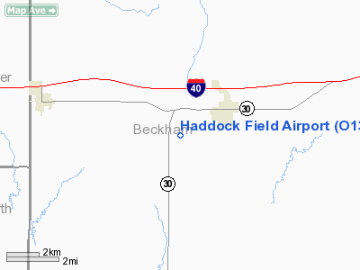
Location & QuickFacts
| FAA Information Effective: | 2008-09-25 |
| Airport Identifier: | O13 |
| Airport Status: | Operational |
| Longitude/Latitude: | 099-53-51.8000W/35-12-01.7000N
-99.897722/35.200472 (Estimated) |
| Elevation: | 2097 ft / 639.17 m (Estimated) |
| Land: | 160 acres |
| From nearest city: | 1 nautical miles SW of Erick, OK |
| Location: | Beckham County, OK |
| Magnetic Variation: | 08E (1985) |
Owner & Manager
| Ownership: | Publicly owned |
| Owner: | City Of Erick |
| Address: | City Hall, P. O. Box 25
Erick, OK 73645 |
| Phone number: | 580-526-3924 |
| Manager: | Cecil Crawford
AIRPORT BOARD CHAIRMAN. |
| Address: | P. O. Box 330, P. O. Box 25
Erick, OK 73645 |
| Phone number: | 580-210-3987 |
Airport Operations and Facilities
| Airport Use: | Open to public |
| Wind indicator: | Yes |
| Segmented Circle: | No |
| Control Tower: | No |
| Landing fee charge: | No |
| Sectional chart: | Dallas-ft Worth |
| Region: | ASW - Southwest |
| Boundary ARTCC: | ZFW - Fort Worth |
| Tie-in FSS: | MLC - Mc Alester |
| FSS on Airport: | No |
| FSS Toll Free: | 1-800-WX-BRIEF |
| NOTAMs Facility: | MLC (NOTAM-d service avaliable) |
Airport Communications
Airport Services
| Airframe Repair: | NONE |
| Power Plant Repair: | NONE |
| Bottled Oxygen: | NONE |
| Bulk Oxygen: | NONE |
Runway Information
Runway 17/35
| Dimension: | 2650 x 35 ft / 807.7 x 10.7 m |
| Surface: | ASPH, Poor Condition
RY SFC ERODING & ROUGH. |
| Weight Limit: | Single wheel: 4000 lbs. |
| |
Runway 17 |
Runway 35 |
| Longitude: | 099-52-52.8800W | 099-52-50.6700W |
| Latitude: | 35-12-14.7800N | 35-11-48.6300N |
| Elevation: | 2092.00 ft | 2097.00 ft |
| Alignment: | 127 | 127 |
| Traffic Pattern: | Left | Left |
|
Radio Navigation Aids
| ID |
Type |
Name |
Ch |
Freq |
Var |
Dist |
| EZY | NDB | Elk City | | 241.00 | 08E | 28.0 nm |
| BZ | NDB | Fossi | | 393.00 | 08E | 37.3 nm |
| HHF | NDB | Hemphill County | | 400.00 | 08E | 48.4 nm |
| SYO | VORTAC | Sayre | 099X | 115.20 | 10E | 15.5 nm |
| BFV | VORTAC | Burns Flat | 037X | 110.00 | 08E | 34.0 nm |
| LTS | VORTAC | Altus | 035X | 109.80 | 08E | 44.7 nm |
| HBR | VORTAC | Hobart | 055X | 111.80 | 10E | 45.7 nm |
Remarks
Images and information placed above are from
http://www.airport-data.com/airport/O13/
We thank them for the data!
| General Info
|
| Country |
United States
|
| State |
OKLAHOMA
|
| FAA ID |
O13
|
| Latitude |
35-12-00.188N
|
| Longitude |
099-53-01.374W
|
| Elevation |
2097 feet
|
| Near City |
ERICK
|
We don't guarantee the information is fresh and accurate. The data may
be wrong or outdated.
For more up-to-date information please refer to other sources.
|
|


