 |
|
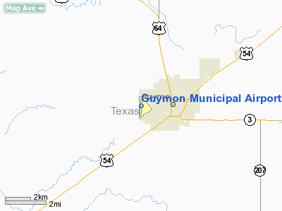
Location & QuickFacts
| FAA Information Effective: | 2008-09-25 |
| Airport Identifier: | GUY |
| Airport Status: | Operational |
| Longitude/Latitude: | 101-30-28.0140W/36-41-06.2590N
-101.507782/36.685072 (Estimated) |
| Elevation: | 3123 ft / 951.89 m (Surveyed) |
| Land: | 480 acres |
| From nearest city: | 2 nautical miles W of Guymon, OK |
| Location: | Texas County, OK |
| Magnetic Variation: | 09E (1985) |
Owner & Manager
| Ownership: | Publicly owned |
| Owner: | City Of Guymon |
| Address: | 219 W Fourth
Guymon, OK 73942 |
| Phone number: | 580-338-3396 |
| Manager: | Gregg R Downing |
| Address: | Po Box 1510
Guymon, OK 73942 |
| Phone number: | 580-338-0481 |
Airport Operations and Facilities
| Airport Use: | Open to public |
| Wind indicator: | Yes |
| Segmented Circle: | Yes |
| Control Tower: | No |
| Lighting Schedule: | DUSK-DAWN
MIRL RY 18/36 PRESET LOW INTST; TO INCR INTST ACTVT - CTAF. |
| Beacon Color: | Clear-Green (lighted land airport) |
| Landing fee charge: | No |
| Sectional chart: | Wichita |
| Region: | ASW - Southwest |
| Boundary ARTCC: | ZKC - Kansas City |
| Tie-in FSS: | MLC - Mc Alester |
| FSS on Airport: | No |
| FSS Toll Free: | 1-800-WX-BRIEF |
| NOTAMs Facility: | GUY (NOTAM-d service avaliable) |
| Federal Agreements: | NGY |
Airport Communications
| CTAF: | 122.700 |
| Unicom: | 122.700 |
Airport Services
| Fuel available: | 100LLA |
| Airframe Repair: | MAJOR |
| Power Plant Repair: | MAJOR |
| Bottled Oxygen: | NONE |
| Bulk Oxygen: | NONE |
Runway Information
Runway 06/24
| Dimension: | 1795 x 200 ft / 547.1 x 61.0 m |
| Surface: | TURF, Fair Condition |
| |
Runway 06 |
Runway 24 |
| Traffic Pattern: | Left | Left |
| Obstruction: | , 50:1 slope to clear | 10 ft road, 400.0 ft from runway, 40:1 slope to clear |
|
Runway 18/36
| Dimension: | 5900 x 100 ft / 1798.3 x 30.5 m |
| Surface: | ASPH, Good Condition |
| Weight Limit: | Single wheel: 10000 lbs. |
| Edge Lights: | Medium |
| |
Runway 18 |
Runway 36 |
| Longitude: | 101-30-24.1580W | 101-30-31.8700W |
| Latitude: | 36-41-35.2600N | 36-40-37.2590N |
| Elevation: | 3101.00 ft | 3107.00 ft |
| Alignment: | 127 | 6 |
| Traffic Pattern: | Right | Left |
| Markings: | Non-precision instrument, Good Condition | Non-precision instrument, Good Condition |
| Crossing Height: | 25.00 ft | 35.00 ft |
| VASI: | 4-box on left side | 4-light PAPI on left side |
| Visual Glide Angle: | 3.00° | 3.00° |
| Obstruction: | , 50:1 slope to clear | 20 ft trees, 500.0 ft from runway, 40 ft right of centerline, 15:1 slope to clear |
|
Radio Navigation Aids
| ID |
Type |
Name |
Ch |
Freq |
Var |
Dist |
| GUY | NDB | Guymon | | 275.00 | 09E | 1.2 nm |
| EHA | NDB | Elkhart | | 377.00 | 10E | 26.3 nm |
| HQG | NDB | Hugoton | | 365.00 | 09E | 29.5 nm |
| PYX | NDB | Perryton | | 266.00 | 09E | 40.2 nm |
| BCY | NDB | Thorp | | 212.00 | 10E | 49.7 nm |
| LBL | VORTAC | Liberal | 070X | 112.30 | 11E | 33.7 nm |
Remarks
- ARPT COURTESY CAR AVBL.
- NUMEROUS WATERFOWL INVOF ARPT SR & SS.
Images and information placed above are from
http://www.airport-data.com/airport/GUY/
We thank them for the data!
| General Info
|
| Country |
United States
|
| State |
OKLAHOMA
|
| FAA ID |
GUY
|
| Latitude |
36-41-06.259N
|
| Longitude |
101-30-28.014W
|
| Elevation |
3123 feet
|
| Near City |
GUYMON
|
We don't guarantee the information is fresh and accurate. The data may
be wrong or outdated.
For more up-to-date information please refer to other sources.
|
|


