 |
|
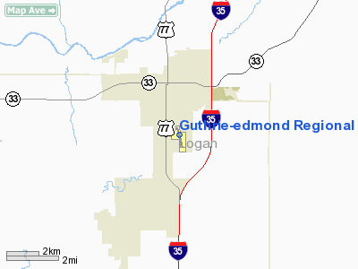
Guthrie-edmond Rgnl Airport |
Location & QuickFacts
| FAA Information Effective: | 2008-09-25 |
| Airport Identifier: | GOK |
| Airport Status: | Operational |
| Longitude/Latitude: | 097-24-57.9000W/35-51-04.5000N
-97.416083/35.851250 (Estimated) |
| Elevation: | 1069 ft / 325.83 m (Surveyed) |
| Land: | 401 acres |
| From nearest city: | 2 nautical miles S of Guthrie, OK |
| Location: | Logan County, OK |
| Magnetic Variation: | 07E (1985) |
Owner & Manager
| Ownership: | Publicly owned |
| Owner: | City Of Guthrie |
| Address: | Po Box 908, 101 N. Second St.
Guthrie, OK 73044 |
| Phone number: | 405-282-0488 |
| Manager: | Terry Jessup |
| Address: | 520 Airport Rd
Guthrie, OK 73044 |
| Phone number: | 405-282-2312 |
Airport Operations and Facilities
| Airport Use: | Open to public |
| Wind indicator: | Yes |
| Segmented Circle: | Yes |
| Control Tower: | No |
| Lighting Schedule: | DUSK-DAWN
MIRL RY 16/34 PRESET LOW INTST; TO INCR INTST ACTVT - CTAF. |
| Beacon Color: | Clear-Green (lighted land airport) |
| Landing fee charge: | No |
| Sectional chart: | Dallas-ft Worth |
| Region: | ASW - Southwest |
| Traffic Pattern Alt: | 826 ft |
| Boundary ARTCC: | ZKC - Kansas City |
| Responsible ARTCC: | ZFW - Fort Worth |
| Tie-in FSS: | MLC - Mc Alester |
| FSS on Airport: | No |
| FSS Toll Free: | 1-800-WX-BRIEF |
| NOTAMs Facility: | GOK (NOTAM-d service avaliable) |
| Federal Agreements: | NGY |
Airport Communications
| CTAF: | 122.800 |
| Unicom: | 122.800 |
Airport Services
| Fuel available: | 100LLA |
| Airframe Repair: | MAJOR |
| Power Plant Repair: | MAJOR |
| Bottled Oxygen: | NONE |
| Bulk Oxygen: | NONE |
Runway Information
Runway 16/34
| Dimension: | 5001 x 75 ft / 1524.3 x 22.9 m |
| Surface: | CONC, Good Condition |
| Pavement Class: | 4 /R/B/X/T |
| Weight Limit: | Single wheel: 30000 lbs.
Dual wheel: 48000 lbs.
Dual tandem wheel: 78000 lbs. |
| Edge Lights: | Medium |
| |
Runway 16 |
Runway 34 |
| Longitude: | 097-25-06.1622W | 097-24-50.3161W |
| Latitude: | 35-51-29.3540N | 35-50-41.6096N |
| Elevation: | 1050.00 ft | 1066.00 ft |
| Alignment: | 127 | 127 |
| Traffic Pattern: | Left | Left |
| Markings: | Non-precision instrument, Good Condition | Non-precision instrument, Good Condition |
| Crossing Height: | 45.00 ft | 45.00 ft |
| Displaced threshold: | 0.00 ft | 200.00 ft |
| VASI: | 4-light PAPI on left side | 4-light PAPI on left side |
| Visual Glide Angle: | 3.00° | 3.00° |
| Runway End Identifier: | Yes | Yes |
|
Radio Navigation Aids
| ID |
Type |
Name |
Ch |
Freq |
Var |
Dist |
| LCY | NDB | Logan County | | 326.00 | 07E | 0.3 nm |
| OK | NDB | Tuloo | | 406.00 | 07E | 24.6 nm |
| CQB | NDB | Tilghman | | 396.00 | 06E | 30.1 nm |
| CUH | NDB | Cushing | | 242.00 | 05E | 31.3 nm |
| OUN | NDB | Norman | | 260.00 | 07E | 36.4 nm |
| RQO | NDB | El Reno | | 335.00 | 07E | 36.6 nm |
| GGU | NDB | Prague | | 314.00 | 06E | 39.5 nm |
| TZO | NDB | Bristow | | 251.00 | 05E | 48.6 nm |
| JWG | NDB | Watonga | | 359.00 | 07E | 49.2 nm |
| TIK | TACAN | Tinker | 105X | | 07E | 25.0 nm |
| PWA | VOR/DME | Wiley Post | 081X | 113.40 | 08E | 22.2 nm |
| SWO | VOR/DME | Stillwater | 021X | 108.40 | 07E | 27.7 nm |
| ODG | VOR/DME | Woodring | 027X | 109.00 | 08E | 36.2 nm |
| IFI | VORTAC | Kingfisher | 094X | 114.70 | 09E | 28.8 nm |
| IRW | VORTAC | Will Rogers | 088X | 114.10 | 07E | 31.1 nm |
| END | VORTAC | Vance | 101X | 115.40 | 09E | 38.5 nm |
| OKC | VOT | Oklahoma Will Rgs W | | 108.80 | | 28.9 nm |
Remarks
- ULTRALIGHT ACTIVITY ON & INVOF AIRPORT.
- ESTABLISHED PRIOR TO 1958
Images and information placed above are from
http://www.airport-data.com/airport/GOK/
We thank them for the data!
| General Info
|
| Country |
United States
|
| State |
OKLAHOMA
|
| FAA ID |
GOK
|
| Latitude |
35-50-59.300N
|
| Longitude |
097-24-56.190W
|
| Elevation |
1068 feet
|
| Near City |
GUTHRIE
|
We don't guarantee the information is fresh and accurate. The data may
be wrong or outdated.
For more up-to-date information please refer to other sources.
|
|


