 |
|
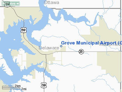
Location & QuickFacts
| FAA Information Effective: | 2008-09-25 |
| Airport Identifier: | GMJ |
| Airport Status: | Operational |
| Longitude/Latitude: | 094-44-18.8000W/36-36-24.4000N
-94.738556/36.606778 (Estimated) |
| Elevation: | 831 ft / 253.29 m (Surveyed) |
| Land: | 123 acres |
| From nearest city: | 2 nautical miles NE of Grove, OK |
| Location: | Delaware County, OK |
| Magnetic Variation: | 04E (2000) |
Owner & Manager
| Ownership: | Publicly owned |
| Owner: | City Of Grove |
| Address: | 104 W. 3rd St.
Grove, OK 74344 |
| Phone number: | 918-786-6107 |
| Manager: | Terry Abercrombie |
| Address: | 335 Airport Dr
Grove, OK 74344 |
| Phone number: | 918-786-6159 |
Airport Operations and Facilities
| Airport Use: | Open to public |
| Wind indicator: | Yes |
| Segmented Circle: | No |
| Control Tower: | No |
| Lighting Schedule: | DUSK-DAWN |
| Beacon Color: | Clear-Green (lighted land airport) |
| Landing fee charge: | No |
| Sectional chart: | Kansas City |
| Region: | ASW - Southwest |
| Boundary ARTCC: | ZKC - Kansas City |
| Tie-in FSS: | MLC - Mc Alester |
| FSS on Airport: | No |
| FSS Toll Free: | 1-800-WX-BRIEF |
| NOTAMs Facility: | GMJ (NOTAM-d service avaliable) |
| Federal Agreements: | NGY |
Airport Communications
| CTAF: | 122.800 |
| Unicom: | 122.800 |
Airport Services
| Fuel available: | 100LLA |
| Airframe Repair: | MAJOR |
| Power Plant Repair: | MAJOR |
| Bulk Oxygen: | NONE |
Runway Information
Runway 18/36
| Dimension: | 5200 x 75 ft / 1585.0 x 22.9 m |
| Surface: | ASPH, Fair Condition |
| Pavement Class: | 3 /F/C/Y/T |
| Weight Limit: | Single wheel: 30000 lbs. |
| Edge Lights: | Medium |
| |
Runway 18 |
Runway 36 |
| Longitude: | 094-44-18.8716W | 094-44-18.7856W |
| Latitude: | 36-36-50.0896N | 36-35-58.6756N |
| Elevation: | 817.00 ft | 828.00 ft |
| Alignment: | 127 | 127 |
| Traffic Pattern: | Left | Left |
| Markings: | Non-precision instrument, Fair Condition | Non-precision instrument, Fair Condition |
| Crossing Height: | 26.00 ft | 28.00 ft |
| VASI: | 4-light PAPI on left side
PAPI OTS INDEFLY. | 4-light PAPI on left side |
| Visual Glide Angle: | 2.75° | 2.75° |
| Obstruction: | 60 ft trees, 1434.0 ft from runway, 20:1 slope to clear | 35 ft trees, 705.0 ft from runway, 14:1 slope to clear |
|
Radio Navigation Aids
| ID |
Type |
Name |
Ch |
Freq |
Var |
Dist |
| SLG | NDB | Siloam Springs | | 284.00 | 04E | 27.9 nm |
| TQH | NDB | Tahlequah | | 215.00 | 05E | 42.9 nm |
| CFV | NDB | Coffeyville | | 212.00 | 05E | 49.6 nm |
| EOS | VOR/DME | Neosho | 120X | 117.30 | 07E | 20.3 nm |
| DAK | VOR/DME | Drake | 025X | 108.80 | 07E | 42.8 nm |
| RZC | VORTAC | Razorback | 111X | 116.40 | 04E | 36.9 nm |
| OSW | VORTAC | Oswego | 123X | 117.60 | 08E | 39.9 nm |
Images and information placed above are from
http://www.airport-data.com/airport/GMJ/
We thank them for the data!
| General Info
|
| Country |
United States
|
| State |
OKLAHOMA
|
| FAA ID |
GMJ
|
| Latitude |
36-36-24.410N
|
| Longitude |
094-44-18.850W
|
| Elevation |
833 feet
|
| Near City |
GROVE
|
We don't guarantee the information is fresh and accurate. The data may
be wrong or outdated.
For more up-to-date information please refer to other sources.
|
|


