 |
|
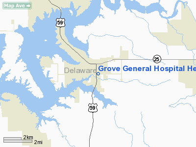
Grove General Hospital Heliport |
Location & QuickFacts
| FAA Information Effective: | 2008-09-25 |
| Airport Identifier: | 8OK5 |
| Airport Status: | Operational |
| Longitude/Latitude: | 094-46-00.8260W/36-35-00.2710N
-94.766896/36.583409 (Estimated) |
| Elevation: | 833 ft / 253.90 m (Estimated) |
| Land: | 0 acres |
| From nearest city: | 0 nautical miles N of Grove, OK |
| Location: | Delaware County, OK |
| Magnetic Variation: | 04E (2000) |
Owner & Manager
| Ownership: | Privately owned |
| Owner: | Grove General Hospital |
| Address: | 1310 South Main
Grove, OK 74344 |
| Phone number: | 918-786-2243 |
| Manager: | Randy Dubois
OTHER CONTACT: GREG MARTIN |
| Address: | 1310 South Main
Grove, OK 74344 |
| Phone number: | 918-786-2243 |
Airport Operations and Facilities
| Airport Use: | Private
MEDICAL. |
| Wind indicator: | Yes |
| Segmented Circle: | No |
| Control Tower: | No |
| Lighting Schedule: | PHONE REQ
FOR LGTS, PHONE 918-786-2243. |
| Landing fee charge: | No |
| Sectional chart: | Kansas City |
| Region: | ASW - Southwest |
| Boundary ARTCC: | ZKC - Kansas City |
| Tie-in FSS: | MLC - Mc Alester |
| FSS on Airport: | No |
| FSS Toll Free: | 1-800-WX-BRIEF |
Runway Information
Helipad H1
| Dimension: | 60 x 60 ft / 18.3 x 18.3 m |
| Surface: | CONC, |
| |
Runway H1 |
Runway |
| Traffic Pattern: | Left | Left |
|
Radio Navigation Aids
| ID |
Type |
Name |
Ch |
Freq |
Var |
Dist |
| SLG | NDB | Siloam Springs | | 284.00 | 04E | 27.3 nm |
| TQH | NDB | Tahlequah | | 215.00 | 05E | 41.1 nm |
| CFV | NDB | Coffeyville | | 212.00 | 05E | 49.4 nm |
| EOS | VOR/DME | Neosho | 120X | 117.30 | 07E | 22.3 nm |
| DAK | VOR/DME | Drake | 025X | 108.80 | 07E | 42.6 nm |
| RZC | VORTAC | Razorback | 111X | 116.40 | 04E | 37.2 nm |
| OSW | VORTAC | Oswego | 123X | 117.60 | 08E | 40.4 nm |
Remarks
- PRVDD LNDG AREA PERIMETER LGTS ARE ILLUMINATED DURG ALL NIGHT OPNS.
Images and information placed above are from
http://www.airport-data.com/airport/8OK5/
We thank them for the data!
| General Info
|
| Country |
United States
|
| State |
OKLAHOMA
|
| FAA ID |
8OK5
|
| Latitude |
36-35-00.271N
|
| Longitude |
094-46-00.826W
|
| Elevation |
833 feet
|
| Near City |
GROVE
|
We don't guarantee the information is fresh and accurate. The data may
be wrong or outdated.
For more up-to-date information please refer to other sources.
|
|


