 |
|
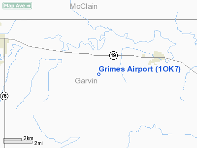
Location & QuickFacts
| FAA Information Effective: | 2008-09-25 |
| Airport Identifier: | 1OK7 |
| Airport Status: | Operational |
| Longitude/Latitude: | 097-28-56.1010W/34-48-00.2730N
-97.482250/34.800076 (Estimated) |
| Elevation: | 1035 ft / 315.47 m (Estimated) |
| Land: | 5 acres |
| From nearest city: | 4 nautical miles E of Maysville, OK |
| Location: | Garvin County, OK |
| Magnetic Variation: | 07E (1985) |
Owner & Manager
| Ownership: | Privately owned |
| Owner: | Anna Maurine Grimes |
| Address: | Rt 2 Box 145
Maysville, OK 73057 |
| Phone number: | 405-867-5898 |
| Manager: | Anna Maurine Grimes |
| Address: | Rt 2 Box 145
Maysville, OK 73057 |
| Phone number: | 405-867-5898 |
Airport Operations and Facilities
| Airport Use: | Private |
| Wind indicator: | Yes |
| Segmented Circle: | No |
| Control Tower: | No |
| Sectional chart: | Dallas-ft Worth |
| Region: | ASW - Southwest |
| Boundary ARTCC: | ZFW - Fort Worth |
| Tie-in FSS: | MLC - Mc Alester |
| FSS on Airport: | No |
| FSS Toll Free: | 1-800-WX-BRIEF |
Runway Information
Runway 18/36
| Dimension: | 2350 x 75 ft / 716.3 x 22.9 m |
| Surface: | TURF, |
| |
Runway 18 |
Runway 36 |
| Traffic Pattern: | Left | Left |
| Obstruction: | 3 ft fence | 5 ft fence |
|
Radio Navigation Aids
| ID |
Type |
Name |
Ch |
Freq |
Var |
Dist |
| FSI | FAN MARKER | Trail | | | 09E | 45.4 nm |
| PVJ | NDB | Pauls Valley | | 384.00 | 06E | 13.5 nm |
| OUN | NDB | Norman | | 260.00 | 07E | 26.9 nm |
| OLR | NDB | Chickasha | | 290.00 | 07E | 30.3 nm |
| OK | NDB | Tuloo | | 406.00 | 07E | 40.8 nm |
| AUV | NDB | Arbuckle | | 284.00 | 07E | 42.9 nm |
| OFZ | NDB | Trail | | 388.00 | 09E | 45.4 nm |
| PFL | NDB | Post | | 308.00 | 08E | 47.0 nm |
| RQO | NDB | El Reno | | 335.00 | 07E | 48.3 nm |
| SRE | NDB | Seminole | | 278.00 | 06E | 48.8 nm |
| TIK | TACAN | Tinker | 105X | | 07E | 38.6 nm |
| DUC | VOR/DME | Duncan | 047X | 111.00 | 09E | 33.0 nm |
| ADH | VOR/DME | Ada | 125X | 117.80 | 06E | 40.1 nm |
| PWA | VOR/DME | Wiley Post | 081X | 113.40 | 08E | 44.8 nm |
| LAW | VOR/DME | Lawton | 031X | 109.40 | 09E | 49.5 nm |
| IRW | VORTAC | Will Rogers | 088X | 114.10 | 07E | 34.1 nm |
| ADM | VORTAC | Ardmore | 114X | 116.70 | 06E | 38.6 nm |
| OKC | VOT | Oklahoma Will Rgs W | | 108.80 | | 36.1 nm |
Images and information placed above are from
http://www.airport-data.com/airport/1OK7/
We thank them for the data!
| General Info
|
| Country |
United States
|
| State |
OKLAHOMA
|
| FAA ID |
1OK7
|
| Latitude |
34-48-00.273N
|
| Longitude |
097-28-56.101W
|
| Elevation |
1035 feet
|
| Near City |
MAYSVILLE
|
We don't guarantee the information is fresh and accurate. The data may
be wrong or outdated.
For more up-to-date information please refer to other sources.
|
|


