 |
|
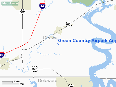
Green Country Airpark Airport |
Location & QuickFacts
| FAA Information Effective: | 2008-09-25 |
| Airport Identifier: | 69OK |
| Airport Status: | Operational |
| Longitude/Latitude: | 094-51-01.8440W/36-43-43.2620N
-94.850512/36.728684 (Estimated) |
| Elevation: | 840 ft / 256.03 m (Estimated) |
| Land: | 60 acres |
| From nearest city: | 2 nautical miles S of Fairland, OK |
| Location: | Ottawa County, OK |
| Magnetic Variation: | 05E (1985) |
Owner & Manager
| Ownership: | Privately owned |
| Owner: | Kenneth Poage |
| Address: | Rt 3 Box 1977
Afton, OK 74331 |
| Manager: | Kenneth Poage |
| Address: | Rt 3 Box 1977
Afton, OK 74331 |
| Phone number: | 918-257-4879 |
Airport Operations and Facilities
| Airport Use: | Private |
| Wind indicator: | Yes |
| Segmented Circle: | No |
| Control Tower: | No |
| Sectional chart: | Kansas City |
| Region: | ASW - Southwest |
| Boundary ARTCC: | ZKC - Kansas City |
| Tie-in FSS: | MLC - Mc Alester |
| FSS Toll Free: | 1-800-WX-BRIEF |
Runway Information
Runway 06/24
| Dimension: | 2100 x 50 ft / 640.1 x 15.2 m |
| Surface: | TURF, |
| Edge Lights: | Low
LIRL OWNERS USE ONLY. |
| |
Runway 06 |
Runway 24 |
| Traffic Pattern: | Left | Left |
| Obstruction: | 35 ft pline, 120.0 ft from runway | |
|
Radio Navigation Aids
| ID |
Type |
Name |
Ch |
Freq |
Var |
Dist |
| SLG | NDB | Siloam Springs | | 284.00 | 04E | 36.8 nm |
| CFV | NDB | Coffeyville | | 212.00 | 05E | 41.0 nm |
| PTS | NDB | Pittsburg | | 365.00 | 05E | 43.3 nm |
| PPF | NDB | Parsons | | 258.00 | 06E | 48.4 nm |
| TQH | NDB | Tahlequah | | 215.00 | 05E | 48.8 nm |
| EOS | VOR/DME | Neosho | 120X | 117.30 | 07E | 21.1 nm |
| OSW | VORTAC | Oswego | 123X | 117.60 | 08E | 30.9 nm |
| RZC | VORTAC | Razorback | 111X | 116.40 | 04E | 45.6 nm |
Images and information placed above are from
http://www.airport-data.com/airport/69OK/
We thank them for the data!
| General Info
|
| Country |
United States
|
| State |
OKLAHOMA
|
| FAA ID |
69OK
|
| Latitude |
36-43-43.262N
|
| Longitude |
094-51-01.844W
|
| Elevation |
840 feet
|
| Near City |
FAIRLAND
|
We don't guarantee the information is fresh and accurate. The data may
be wrong or outdated.
For more up-to-date information please refer to other sources.
|
|


