 |
|
Location & QuickFacts
| FAA Information Effective: | 2008-09-25 |
| Airport Identifier: | 1O1 |
| Airport Status: | Operational |
| Longitude/Latitude: | 098-44-31.2330W/34-14-15.3220N
-98.742009/34.237589 (Estimated) |
| Elevation: | 1128 ft / 343.81 m (Estimated) |
| Land: | 640 acres |
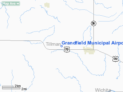
| From nearest city: | 3 nautical miles W of Grandfield, OK |
| Location: | Tillman County, OK |
| Magnetic Variation: | 07E (1985) |
Owner & Manager
| Ownership: | Publicly owned |
| Owner: | City Of Grandfield |
| Address: | Po Box Drawer L
Grandfield, OK 73546 |
| Phone number: | 580-479-5215 |
| Manager: | Randy Clark |
| Address: | Po Drawer L
Grandfield, OK 73546 |
| Phone number: | 580-479-5215 |
Airport Operations and Facilities
| Airport Use: | Open to public |
| Wind indicator: | Yes |
| Segmented Circle: | Yes |
| Control Tower: | No |
| Lighting Schedule: | DUSK-DAWN
ACTVT MIRL RY 17/35 - CTAF. |
| Beacon Color: | Clear-Green (lighted land airport)
ARPT BCN OTS INDEFLY. |
| Landing fee charge: | No |
| Sectional chart: | Dallas-ft Worth |
| Region: | ASW - Southwest |
| Boundary ARTCC: | ZFW - Fort Worth |
| Tie-in FSS: | MLC - Mc Alester |
| FSS on Airport: | No |
| FSS Toll Free: | 1-800-WX-BRIEF |
| NOTAMs Facility: | MLC (NOTAM-d service avaliable) |
| Federal Agreements: | NGRY |
Airport Communications
Airport Services
| Fuel available: | 100LL
FOR FUEL CALL 580-479-5215 0800-1630 MON-FRI; 580-479-5274 NIGHTS & WKENDS. |
| Airframe Repair: | MAJOR |
| Power Plant Repair: | MAJOR |
| Bottled Oxygen: | NONE |
| Bulk Oxygen: | NONE |
Runway Information
Runway 08/26
| Dimension: | 1540 x 75 ft / 469.4 x 22.9 m |
| Surface: | ASPH, Fair Condition |
| Pavement Class: | 3 /F/C/Y/T |
| |
Runway 08 |
Runway 26 |
| Longitude: | 098-44-40.2638W | 098-44-21.9200W |
| Latitude: | 34-14-36.7500N | 34-14-36.7500N |
| Elevation: | 1128.00 ft | 1128.00 ft |
| Alignment: | 90 | 127 |
| Traffic Pattern: | Left | Left |
| Markings: | Basic, Fair Condition | Basic, Fair Condition |
| Obstruction: | 4 ft fence, 300.0 ft from runway, 25:1 slope to clear | 4 ft fence, 300.0 ft from runway, 25:1 slope to clear |
|
Runway 17/35
| Dimension: | 3100 x 75 ft / 944.9 x 22.9 m |
| Surface: | ASPH, Fair Condition |
| Pavement Class: | 3 /F/C/Y/T |
| Weight Limit: | Single wheel: 11000 lbs. |
| Edge Lights: | Medium |
| |
Runway 17 |
Runway 35 |
| Longitude: | 098-44-18.9334W | 098-44-19.3343W |
| Latitude: | 34-14-37.1463N | 34-14-06.4827N |
| Elevation: | 1126.00 ft | 1128.00 ft |
| Alignment: | 127 | 1 |
| Traffic Pattern: | Left | Left |
| Markings: | Basic, Fair Condition | Basic, Fair Condition |
| Obstruction: | 4 ft fence, 300.0 ft from runway, 25:1 slope to clear | 4 ft fence, 300.0 ft from runway, 25:1 slope to clear |
|
Radio Navigation Aids
| ID |
Type |
Name |
Ch |
Freq |
Var |
Dist |
| FSI | FAN MARKER | Trail | | | 09E | 36.8 nm |
| VRT | NDB | Wilbarger | | 230.00 | 08E | 26.7 nm |
| PFL | NDB | Post | | 308.00 | 08E | 27.9 nm |
| SKB | NDB | Scotland | | 344.00 | 08E | 29.8 nm |
| OFZ | NDB | Trail | | 388.00 | 09E | 36.8 nm |
| SHP | TACAN | Sheppard | 045X | | 10E | 19.9 nm |
| LAW | VOR/DME | Lawton | 031X | 109.40 | 09E | 22.5 nm |
| DUC | VOR/DME | Duncan | 047X | 111.00 | 09E | 41.9 nm |
| SPS | VORTAC | Wichita Falls | 074X | 112.70 | 10E | 16.8 nm |
| LTS | VORTAC | Altus | 035X | 109.80 | 08E | 36.6 nm |
| HBR | VORTAC | Hobart | 055X | 111.80 | 10E | 41.0 nm |
Remarks
- TOWER 1073 FT AGL 12,000 FT SSE OF ARPT.
- TOWER 1059 FT AGL 8,500 FT SE OF ARPT.
Images and information placed above are from
http://www.airport-data.com/airport/1O1/
We thank them for the data!
| General Info
|
| Country |
United States
|
| State |
OKLAHOMA
|
| FAA ID |
1O1
|
| Latitude |
34-14-15.322N
|
| Longitude |
098-44-31.233W
|
| Elevation |
1128 feet
|
| Near City |
GRANDFIELD
|
We don't guarantee the information is fresh and accurate. The data may
be wrong or outdated.
For more up-to-date information please refer to other sources.
|
|


