 |
|
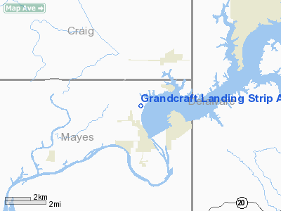
Grandcraft Landing Strip Airport |
Location & QuickFacts
| FAA Information Effective: | 2008-09-25 |
| Airport Identifier: | OK30 |
| Airport Status: | Operational |
| Longitude/Latitude: | 095-03-00.8660W/36-29-30.3020N
-95.050241/36.491751 (Estimated) |
| Elevation: | 827 ft / 252.07 m (Estimated) |
| Land: | 0 acres |
| From nearest city: | 1 nautical miles N of Langley, OK |
| Location: | Mayes County, OK |
| Magnetic Variation: | 05E (1985) |
Owner & Manager
| Ownership: | Privately owned |
| Owner: | Grand Craft, Inc |
| Address: |
Langley, OK 74361 |
| Manager: | G E Moots |
| Address: | Po Box 188
Pryor, OK 74361 |
| Phone number: | 918-825-2822 |
Airport Operations and Facilities
| Airport Use: | Private |
| Wind indicator: | Yes |
| Segmented Circle: | No |
| Control Tower: | No |
| Landing fee charge: | No |
| Sectional chart: | Kansas City |
| Region: | ASW - Southwest |
| Boundary ARTCC: | ZKC - Kansas City |
| Tie-in FSS: | MLC - Mc Alester |
| FSS on Airport: | No |
| FSS Toll Free: | 1-800-WX-BRIEF |
Airport Services
| Airframe Repair: | NONE |
| Power Plant Repair: | NONE |
Runway Information
Runway N/S
| Dimension: | 3000 x 150 ft / 914.4 x 45.7 m |
| Surface: | TURF, |
| |
Runway N |
Runway S |
| Traffic Pattern: | Right | Right |
|
Radio Navigation Aids
| ID |
Type |
Name |
Ch |
Freq |
Var |
Dist |
| SLG | NDB | Siloam Springs | | 284.00 | 04E | 32.7 nm |
| TQH | NDB | Tahlequah | | 215.00 | 05E | 34.0 nm |
| DW | NDB | Owaso | | 375.00 | 06E | 41.4 nm |
| CFV | NDB | Coffeyville | | 212.00 | 05E | 44.0 nm |
| EOS | VOR/DME | Neosho | 120X | 117.30 | 07E | 36.4 nm |
| DAK | VOR/DME | Drake | 025X | 108.80 | 07E | 49.4 nm |
| TUL | VORTAC | Tulsa | 091X | 114.40 | 08E | 39.9 nm |
| OSW | VORTAC | Oswego | 123X | 117.60 | 08E | 40.7 nm |
| RZC | VORTAC | Razorback | 111X | 116.40 | 04E | 47.3 nm |
| TUL | VOT | Tulsa Intl | | 109.00 | | 39.9 nm |
Remarks
- LIVESTOCK ON ARPT. LANDING STRIP SMOOTH.
Images and information placed above are from
http://www.airport-data.com/airport/OK30/
We thank them for the data!
| General Info
|
| Country |
United States
|
| State |
OKLAHOMA
|
| FAA ID |
OK30
|
| Latitude |
36-29-30.302N
|
| Longitude |
095-03-00.866W
|
| Elevation |
827 feet
|
| Near City |
LANGLEY
|
We don't guarantee the information is fresh and accurate. The data may
be wrong or outdated.
For more up-to-date information please refer to other sources.
|
|


