 |
|
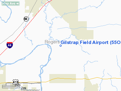
Location & QuickFacts
| FAA Information Effective: | 2008-09-25 |
| Airport Identifier: | 55OK |
| Airport Status: | Operational |
| Longitude/Latitude: | 095-34-41.9190W/36-13-26.3520N
-95.578311/36.223987 (Estimated) |
| Elevation: | 575 ft / 175.26 m (Estimated) |
| Land: | 40 acres |
| From nearest city: | 6 nautical miles NW of Inola, OK |
| Location: | Rogers County, OK |
| Magnetic Variation: | 06E (1985) |
Owner & Manager
| Ownership: | Privately owned |
| Owner: | Stanley C. Gilstrap |
| Address: | 14195 East 550 Rd
Inola, OK 74036 |
| Phone number: | 918-543-8135 |
| Manager: | Stanley C. Gilstrap |
| Address: | 14195 East 550 Rd
Inola, OK 74036 |
| Phone number: | 918-543-8135 |
Airport Operations and Facilities
| Airport Use: | Private |
| Wind indicator: | Yes |
| Segmented Circle: | No |
| Control Tower: | No |
| Sectional chart: | Kansas City |
| Region: | ASW - Southwest |
| Boundary ARTCC: | ZKC - Kansas City |
| Tie-in FSS: | MLC - Mc Alester |
| FSS Toll Free: | 1-800-WX-BRIEF |
Runway Information
Runway 18/36
| Dimension: | 1700 x 60 ft / 518.2 x 18.3 m |
| Surface: | TURF, |
| |
Runway 18 |
Runway 36 |
| Traffic Pattern: | Left | Left |
| Obstruction: | 25 ft trees, 500.0 ft from runway | 30 ft pline, 400.0 ft from runway |
|
Radio Navigation Aids
| ID |
Type |
Name |
Ch |
Freq |
Var |
Dist |
| DW | NDB | Owaso | | 375.00 | 06E | 15.2 nm |
| OWP | NDB | William Pogue | | 362.00 | 06E | 28.1 nm |
| TQH | NDB | Tahlequah | | 215.00 | 05E | 33.1 nm |
| MKO | NDB | Muskogee | | 306.00 | 06E | 40.4 nm |
| TZO | NDB | Bristow | | 251.00 | 05E | 49.4 nm |
| MEE | VOR | Davis | | 108.60 | 06E | 35.2 nm |
| GNP | VOR/DME | Glenpool | 043X | 110.60 | 06E | 26.3 nm |
| OKM | VOR/DME | Okmulgee | 096X | 114.90 | 08E | 34.8 nm |
| BVO | VOR/DME | Bartlesville | 126X | 117.90 | 08E | 42.4 nm |
| TUL | VORTAC | Tulsa | 091X | 114.40 | 08E | 10.3 nm |
| TUL | VOT | Tulsa Intl | | 109.00 | | 10.3 nm |
Images and information placed above are from
http://www.airport-data.com/airport/55OK/
We thank them for the data!
| General Info
|
| Country |
United States
|
| State |
OKLAHOMA
|
| FAA ID |
55OK
|
| Latitude |
36-13-26.352N
|
| Longitude |
095-34-41.919W
|
| Elevation |
575 feet
|
| Near City |
CLAREMORE
|
We don't guarantee the information is fresh and accurate. The data may
be wrong or outdated.
For more up-to-date information please refer to other sources.
|
|


