 |
|
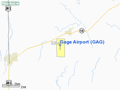
Location & QuickFacts
| FAA Information Effective: | 2008-09-25 |
| Airport Identifier: | GAG |
| Airport Status: | Operational |
| Longitude/Latitude: | 099-46-35.1250W/36-17-43.9400N
-99.776424/36.295539 (Estimated) |
| Elevation: | 2223 ft / 677.57 m (Surveyed) |
| Land: | 780 acres |
| From nearest city: | 2 nautical miles SW of Gage, OK |
| Location: | Ellis County, OK |
| Magnetic Variation: | 08E (1985) |
Owner & Manager
| Ownership: | Publicly owned |
| Owner: | Town Of Gage |
| Address: | Box 328
Gage, OK 73843 |
| Phone number: | 580-923-7727 |
| Manager: | Richard Chapman
CHAIRMAN ARPT BOARD. |
| Address: | Box 235
Gage, OK 73843 |
| Phone number: | 580-923-7778 |
Airport Operations and Facilities
| Airport Use: | Open to public |
| Wind indicator: | Yes |
| Segmented Circle: | No |
| Control Tower: | No |
| Lighting Schedule: | DUSK-DAWN
ACTVT LIRL RY 17/35 - 123.0. |
| Beacon Color: | Clear-Green (lighted land airport)
ROTG BCN OTS INDEFLY. |
| Landing fee charge: | No |
| Sectional chart: | Wichita |
| Region: | ASW - Southwest |
| Boundary ARTCC: | ZKC - Kansas City |
| Tie-in FSS: | MLC - Mc Alester |
| FSS Toll Free: | 1-800-WX-BRIEF |
| NOTAMs Facility: | GAG (NOTAM-d service avaliable) |
| Federal Agreements: | N13 |
Airport Communications
Airport Services
| Airframe Repair: | NONE |
| Power Plant Repair: | NONE |
| Bottled Oxygen: | NONE |
| Bulk Oxygen: | NONE |
Runway Information
Runway 17/35
| Dimension: | 5415 x 100 ft / 1650.5 x 30.5 m |
| Surface: | ASPH, Fair Condition
MIDDLE 100 FT IS SEAL COATED. |
| Surface Treatment: | Porous Friction Course |
| Weight Limit: | Single wheel: 4000 lbs. |
| Edge Lights: | Non-standard lighting system
NSTD LIRL; LGTS +30 FT FM EDGE OF RY. |
| |
Runway 17 |
Runway 35 |
| Longitude: | 099-46-35.1480W | 099-46-35.2740W |
| Latitude: | 36-18-10.7290N | 36-17-17.1430N |
| Elevation: | 2162.00 ft | 2222.00 ft |
| Alignment: | 127 | 127 |
| Traffic Pattern: | Left | Left |
| Markings: | Basic, Poor Condition
MARKINGS SEVERELY FADED. | Basic, Poor Condition
MARKINGS SEVERELY FADED. |
|
Radio Navigation Aids
| ID |
Type |
Name |
Ch |
Freq |
Var |
Dist |
| OWU | NDB | West Woodward | | 329.00 | 08E | 14.8 nm |
| MDF | NDB | Mooreland/dcmsnd | | 284.00 | 08E | 30.5 nm |
| BFK | NDB | Buffalo | | 215.00 | 08E | 35.0 nm |
| HHF | NDB | Hemphill County | | 400.00 | 08E | 39.0 nm |
| PYX | NDB | Perryton | | 266.00 | 09E | 47.6 nm |
| GAG | VORTAC | Gage | 103X | 115.60 | 10E | 5.8 nm |
Remarks
- ARPT CLSD TO JET ACFT OVER 12500 LBS. BY MGRS REQUEST.
- TWYS CLSD; USE MIDWAY STUB & BACK TAXI.
- ULTRALIGHT ACTIVITY ON & INVOF ARPT.
Images and information placed above are from
http://www.airport-data.com/airport/GAG/
We thank them for the data!
| General Info
|
| Country |
United States
|
| State |
OKLAHOMA
|
| FAA ID |
GAG
|
| Latitude |
36-17-43.940N
|
| Longitude |
099-46-35.125W
|
| Elevation |
2223 feet
|
| Near City |
GAGE
|
We don't guarantee the information is fresh and accurate. The data may
be wrong or outdated.
For more up-to-date information please refer to other sources.
|
|


