 |
|
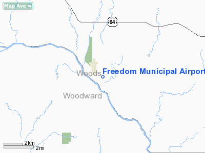
Location & QuickFacts
| FAA Information Effective: | 2008-09-25 |
| Airport Identifier: | K77 |
| Airport Status: | Operational |
| Longitude/Latitude: | 099-06-07.2400W/36-45-30.5800N
-99.102011/36.758494 (Estimated) |
| Elevation: | 1517 ft / 462.38 m (Surveyed) |
| Land: | 15 acres |
| From nearest city: | 1 nautical miles SE of Freedom, OK |
| Location: | Woods County, OK |
| Magnetic Variation: | 08E (1985) |
Owner & Manager
| Ownership: | Publicly owned |
| Owner: | Town Of Freedom |
| Address: | City Municipal Offices
Freedom, OK 73842 |
| Phone number: | 580-621-3302 |
| Manager: | Terrence E. Turner
CHAIRMAN; AIRPORT COMM. |
| Address: | Star Route One
Freedom, OK 73842 |
| Phone number: | 580-621-3585 |
Airport Operations and Facilities
| Airport Use: | Open to public |
| Wind indicator: | Yes |
| Segmented Circle: | No |
| Control Tower: | No |
| Landing fee charge: | No |
| Sectional chart: | Wichita |
| Region: | ASW - Southwest |
| Boundary ARTCC: | ZKC - Kansas City |
| Tie-in FSS: | MLC - Mc Alester |
| FSS on Airport: | No |
| FSS Toll Free: | 1-800-WX-BRIEF |
| NOTAMs Facility: | MLC (NOTAM-d service avaliable) |
Airport Communications
Runway Information
Runway 12/30
| Dimension: | 3000 x 35 ft / 914.4 x 10.7 m |
| Surface: | ASPH, Poor Condition
RY EDGES/THLDS UNSTABLE. FIRST 300 FT OF RY 30 END COVERED IN GRASS. |
| |
Runway 12 |
Runway 30 |
| Traffic Pattern: | Left | Left |
| Obstruction: | 50 ft trees, 534.0 ft from runway, 6:1 slope to clear
5 FT FENCE 200 FT FM THLD 99 FT L OF CNTRLN. | 54 ft trees, 465.0 ft from runway, 4:1 slope to clear |
|
Radio Navigation Aids
| ID |
Type |
Name |
Ch |
Freq |
Var |
Dist |
| MDF | NDB | Mooreland/dcmsnd | | 284.00 | 08E | 16.9 nm |
| AVK | NDB | Alva | | 203.00 | 08E | 20.8 nm |
| BFK | NDB | Buffalo | | 215.00 | 08E | 25.7 nm |
| OWU | NDB | West Woodward | | 329.00 | 08E | 28.2 nm |
| FAU | NDB | Fairview | | 246.00 | 07E | 41.4 nm |
| GAG | VORTAC | Gage | 103X | 115.60 | 10E | 45.1 nm |
Images and information placed above are from
http://www.airport-data.com/airport/K77/
We thank them for the data!
| General Info
|
| Country |
United States
|
| State |
OKLAHOMA
|
| FAA ID |
K77
|
| Latitude |
36-45-30.580N
|
| Longitude |
099-06-07.240W
|
| Elevation |
1517 feet
|
| Near City |
FREEDOM
|
We don't guarantee the information is fresh and accurate. The data may
be wrong or outdated.
For more up-to-date information please refer to other sources.
|
|


