 |
|
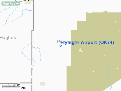
Location & QuickFacts
| FAA Information Effective: | 2008-09-25 |
| Airport Identifier: | OK74 |
| Airport Status: | Operational |
| Longitude/Latitude: | 096-02-02.9940W/34-49-46.3370N
-96.034165/34.829538 (Estimated) |
| Elevation: | 850 ft / 259.08 m (Estimated) |
| Land: | 0 acres |
| From nearest city: | 4 nautical miles NE of Ashland, OK |
| Location: | Pittsburg County, OK |
| Magnetic Variation: | 06E (1990) |
Owner & Manager
| Ownership: | Privately owned |
| Owner: | Stephen A. Hubbert |
| Address: | Rt 1 Box 238
Stuart, OK 74570 |
| Phone number: | 918-302-7457 |
| Manager: | Stephen A. Hubbert |
| Address: | Rt 1 Box 238
Stuart, OK 74570 |
| Phone number: | 918-302-7457 |
Airport Operations and Facilities
| Airport Use: | Private |
| Wind indicator: | Yes |
| Segmented Circle: | No |
| Control Tower: | No |
| Sectional chart: | Dallas-ft Worth |
| Region: | ASW - Southwest |
| Boundary ARTCC: | ZFW - Fort Worth |
| Tie-in FSS: | MLC - Mc Alester |
| FSS on Airport: | No |
| FSS Toll Free: | 1-800-WX-BRIEF |
Runway Information
Runway 18/36
| Dimension: | 2200 x 45 ft / 670.6 x 13.7 m |
| Surface: | TURF, |
| |
Runway 18 |
Runway 36 |
| Traffic Pattern: | Left | Left |
| Obstruction: | 50 ft trees, 150.0 ft from runway | 36 ft pline, 325.0 ft from runway |
|
Radio Navigation Aids
| ID |
Type |
Name |
Ch |
Freq |
Var |
Dist |
| HDL | NDB | Holdenville | | 411.00 | 06E | 24.2 nm |
| HET | NDB | Henryetta | | 267.00 | 04E | 34.6 nm |
| SRE | NDB | Seminole | | 278.00 | 06E | 41.2 nm |
| AEE | NDB | Antlers | | 391.00 | 05E | 42.8 nm |
| ADH | VOR/DME | Ada | 125X | 117.80 | 06E | 31.4 nm |
| MLC | VORTAC | Mc Alester | 057X | 112.00 | 08E | 12.5 nm |
Images and information placed above are from
http://www.airport-data.com/airport/OK74/
We thank them for the data!
| General Info
|
| Country |
United States
|
| State |
OKLAHOMA
|
| FAA ID |
OK74
|
| Latitude |
34-49-46.337N
|
| Longitude |
096-02-02.994W
|
| Elevation |
850 feet
|
| Near City |
ASHLAND
|
We don't guarantee the information is fresh and accurate. The data may
be wrong or outdated.
For more up-to-date information please refer to other sources.
|
|


