 |
|
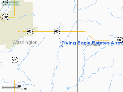
Flying Eagle Estates Airport |
Location & QuickFacts
| FAA Information Effective: | 2008-09-25 |
| Airport Identifier: | 9OK3 |
| Airport Status: | Operational |
| Longitude/Latitude: | 095-50-25.9380W/36-42-13.3220N
-95.840538/36.703701 (Estimated) |
| Elevation: | 690 ft / 210.31 m (Estimated) |
| Land: | 80 acres |
| From nearest city: | 7 nautical miles SE of Bartlesville, OK |
| Location: | Washington County, OK |
| Magnetic Variation: | 06E (1990) |
Owner & Manager
| Ownership: | Privately owned |
| Owner: | Robert W Veit |
| Address: | 402354 W. 2200 Road
Bartlesville, OK 74006 |
| Phone number: | 918-333-2533 |
| Manager: | Robert W Veit |
| Address: | 402354 W. 2200 Road
Bartlesville, OK 74006 |
| Phone number: | 918-333-2533 |
Airport Operations and Facilities
| Airport Use: | Private |
| Wind indicator: | Yes |
| Segmented Circle: | No |
| Control Tower: | No |
| Sectional chart: | Kansas City |
| Region: | ASW - Southwest |
| Boundary ARTCC: | ZKC - Kansas City |
| Tie-in FSS: | MLC - Mc Alester |
| FSS on Airport: | No |
| FSS Toll Free: | 1-800-WX-BRIEF |
Runway Information
Runway 04/22
| Dimension: | 2200 x 50 ft / 670.6 x 15.2 m |
| Surface: | TURF, |
| |
Runway 04 |
Runway 22 |
| Traffic Pattern: | Left | Left |
| Displaced threshold: | 400.00 ft | 500.00 ft |
| Obstruction: | 50 ft trees | 50 ft trees, 100.0 ft from runway |
|
Radio Navigation Aids
| ID |
Type |
Name |
Ch |
Freq |
Var |
Dist |
| DW | NDB | Owaso | | 375.00 | 06E | 23.9 nm |
| CFV | NDB | Coffeyville | | 212.00 | 05E | 26.8 nm |
| OWP | NDB | William Pogue | | 362.00 | 06E | 35.3 nm |
| PPF | NDB | Parsons | | 258.00 | 06E | 41.3 nm |
| BVO | VOR/DME | Bartlesville | 126X | 117.90 | 08E | 11.6 nm |
| GNP | VOR/DME | Glenpool | 043X | 110.60 | 06E | 47.5 nm |
| TUL | VORTAC | Tulsa | 091X | 114.40 | 08E | 30.6 nm |
| OSW | VORTAC | Oswego | 123X | 117.60 | 08E | 41.0 nm |
| TUL | VOT | Tulsa Intl | | 109.00 | | 30.6 nm |
Remarks
- DEER AND CANADIAN GEESE ON ARPT.
Images and information placed above are from
http://www.airport-data.com/airport/9OK3/
We thank them for the data!
| General Info
|
| Country |
United States
|
| State |
OKLAHOMA
|
| FAA ID |
9OK3
|
| Latitude |
36-42-13.322N
|
| Longitude |
095-50-25.938W
|
| Elevation |
690 feet
|
| Near City |
BARTLESVILLE
|
We don't guarantee the information is fresh and accurate. The data may
be wrong or outdated.
For more up-to-date information please refer to other sources.
|
|


