 |
|
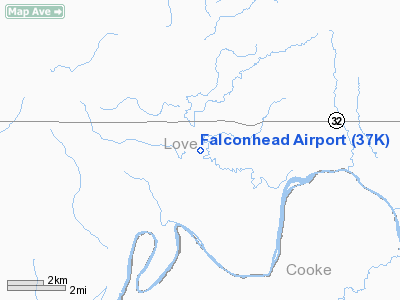
Location & QuickFacts
| FAA Information Effective: | 2008-09-25 |
| Airport Identifier: | 37K |
| Airport Status: | Operational |
| Longitude/Latitude: | 097-17-46.9000W/33-55-33.5000N
-97.296361/33.925972 (Estimated) |
| Elevation: | 690 ft / 210.31 m (Estimated) |
| Land: | 114 acres |
| From nearest city: | 2 nautical miles NW of Burneyville, OK |
| Location: | Love County, OK |
| Magnetic Variation: | 07E (1985) |
Owner & Manager
| Ownership: | Privately owned |
| Owner: | Lowell E Thompson |
| Address: | 127 Shadybrook Road
Burneyville, OK 73430 |
| Phone number: | 580-276-5275 |
| Manager: | Lowell E Thompson |
| Address: | 127 Shadybrook Road
Burneyville, OK 73430 |
| Phone number: | 580-276-5275 |
Airport Operations and Facilities
| Airport Use: | Open to public |
| Wind indicator: | Yes |
| Segmented Circle: | No |
| Control Tower: | No |
| Landing fee charge: | No |
| Sectional chart: | Dallas-ft Worth |
| Region: | ASW - Southwest |
| Boundary ARTCC: | ZFW - Fort Worth |
| Tie-in FSS: | MLC - Mc Alester |
| FSS on Airport: | No |
| FSS Toll Free: | 1-800-WX-BRIEF |
| NOTAMs Facility: | MLC (NOTAM-d service avaliable) |
Airport Communications
Airport Services
| Airframe Repair: | NONE |
| Power Plant Repair: | NONE |
Runway Information
Runway 18/36
| Dimension: | 4400 x 75 ft / 1341.1 x 22.9 m |
| Surface: | ASPH, Fair Condition
ASPH HAS WEAK SPOTS THROUGH BASE. |
| |
Runway 18 |
Runway 36 |
| Longitude: | 097-17-42.6600W | 097-17-51.0500W |
| Latitude: | 33-55-54.9500N | 33-55-11.9900N |
| Elevation: | 690.00 ft | 690.00 ft |
| Alignment: | 127 | 9 |
| Traffic Pattern: | Left | Left |
| Markings: | Basic, Poor Condition
MARKINGS SEVERELY FADED AND CHIPPED. | Basic, Poor Condition
MARKINGS SEVERELY FADED AND CHIPPED. |
| Obstruction: | 25 ft trees, 250.0 ft from runway, 2:1 slope to clear
-20 FT TERRAIN DROP INTO RIVER 120 FT FROM RY END; +15 FT TREES 100 FT FM RY END. | 50 ft trees, 250.0 ft from runway, 1:1 slope to clear
-4 FT DITCH 125 FT FM RY END; +15 FT TREES 100 FT FM RY END. |
|
Radio Navigation Aids
| ID |
Type |
Name |
Ch |
Freq |
Var |
Dist |
| GLE | NDB | Gainesville | | 330.00 | 06E | 13.4 nm |
| AUV | NDB | Arbuckle | | 284.00 | 07E | 16.0 nm |
| GMZ | NDB | Grindstone Mountain | | 356.00 | 07E | 30.7 nm |
| DNI | NDB | Denison | | 341.00 | 06E | 31.9 nm |
| DUA | NDB | Durant | | 359.00 | 05E | 44.7 nm |
| PVJ | NDB | Pauls Valley | | 384.00 | 06E | 47.6 nm |
| DUC | VOR/DME | Duncan | 047X | 111.00 | 09E | 41.4 nm |
| URH | VOR/DME | Texoma | 090X | 114.30 | 05E | 45.1 nm |
| ADM | VORTAC | Ardmore | 114X | 116.70 | 06E | 18.3 nm |
| UKW | VORTAC | Bowie | 071X | 112.40 | 06E | 35.2 nm |
Remarks
Images and information placed above are from
http://www.airport-data.com/airport/37K/
We thank them for the data!
| General Info
|
| Country |
United States
|
| State |
OKLAHOMA
|
| FAA ID |
37K
|
| Latitude |
33-55-30.362N
|
| Longitude |
097-17-51.060W
|
| Elevation |
690 feet
|
| Near City |
BURNEYVILLE
|
We don't guarantee the information is fresh and accurate. The data may
be wrong or outdated.
For more up-to-date information please refer to other sources.
|
|


