 |
|
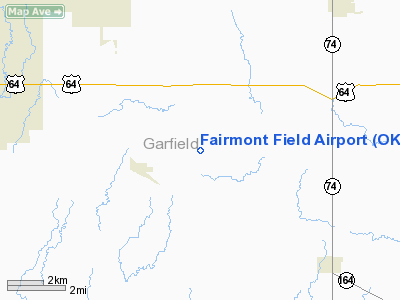
Location & QuickFacts
| FAA Information Effective: | 2008-09-25 |
| Airport Identifier: | OK16 |
| Airport Status: | Operational |
| Longitude/Latitude: | 097-40-04.0000W/36-21-53.0000N
-97.667778/36.364722 (Estimated) |
| Elevation: | 1168 ft / 356.01 m (Estimated) |
| Land: | 120 acres |
| From nearest city: | 2 nautical miles NE of Fairmont, OK |
| Location: | Garfield County, OK |
| Magnetic Variation: | () |
Owner & Manager
| Ownership: | Privately owned |
| Owner: | Destin Corporation |
| Address: | Po Box 2403, University Stn
Enid, OK 73702-2403 |
| Phone number: | 580-242-6627 |
| Manager: | Kenneth R. Hollrah |
| Address: | Po Box 2403, University Stn
Enid, OK 73702-2403 |
| Phone number: | 580-242-6627 |
Airport Operations and Facilities
| Airport Use: | Private |
| Wind indicator: | Yes |
| Segmented Circle: | No |
| Control Tower: | No |
| Sectional chart: | Wichita |
| Region: | ASW - Southwest |
| Boundary ARTCC: | ZKC - Kansas City |
| Tie-in FSS: | MLC - Mc Alester |
| FSS Toll Free: | 1-800-WX-BRIEF |
Airport Services
Runway Information
Runway 17/35
| Dimension: | 2211 x 65 ft / 673.9 x 19.8 m |
| Surface: | TURF, |
| |
Runway 17 |
Runway 35 |
| Traffic Pattern: | Left | Left |
| Obstruction: | , 40.0 ft from runway | 4 ft trees, 100.0 ft from runway |
|
Radio Navigation Aids
| ID |
Type |
Name |
Ch |
Freq |
Var |
Dist |
| LCY | NDB | Logan County | | 326.00 | 07E | 33.5 nm |
| PN | NDB | Ponca | | 515.00 | 05E | 38.9 nm |
| FAU | NDB | Fairview | | 246.00 | 07E | 39.5 nm |
| JWG | NDB | Watonga | | 359.00 | 07E | 47.6 nm |
| ODG | VOR/DME | Woodring | 027X | 109.00 | 08E | 5.8 nm |
| SWO | VOR/DME | Stillwater | 021X | 108.40 | 07E | 29.6 nm |
| END | VORTAC | Vance | 101X | 115.40 | 09E | 12.2 nm |
| PER | VORTAC | Pioneer | 079X | 113.20 | 06E | 33.6 nm |
| IFI | VORTAC | Kingfisher | 094X | 114.70 | 09E | 37.4 nm |
Images and information placed above are from
http://www.airport-data.com/airport/OK16/
We thank them for the data!
|
|


