 |
|
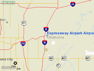
Expressway Airpark Airport |
Location & QuickFacts
| FAA Information Effective: | 2008-09-25 |
| Airport Identifier: | 12OK |
| Airport Status: | Operational |
| Longitude/Latitude: | 097-27-11.3400W/35-32-28.8100N
-97.453150/35.541336 (Estimated) |
| Elevation: | 1070 ft / 326.14 m (Estimated) |
| Land: | 60 acres |
| From nearest city: | 5 nautical miles NE of Oklahoma City, OK |
| Location: | Oklahoma County, OK |
| Magnetic Variation: | 07E (1985) |
Owner & Manager
| Ownership: | Privately owned |
| Owner: | John A Sabolich |
| Address: | 3101 Ne 63
Oklahoma City, OK 73121 |
| Phone number: | 405-478-4116 |
| Manager: | John A Sabolich |
| Address: | 3101 Ne 63
Oklahoma City, OK 73121 |
| Phone number: | 405-478-4116 |
Airport Operations and Facilities
| Airport Use: | Private |
| Wind indicator: | Yes |
| Segmented Circle: | No |
| Control Tower: | No |
| Lighting Schedule: | 1730-0400 |
| Beacon Color: | Clear-Green (lighted land airport)
ROTG BCN OTS INDEFLY. |
| Sectional chart: | Dallas-ft Worth |
| Region: | ASW - Southwest |
| Boundary ARTCC: | ZKC - Kansas City |
| Responsible ARTCC: | ZFW - Fort Worth |
| Tie-in FSS: | MLC - Mc Alester |
| FSS on Airport: | No |
| FSS Toll Free: | 1-800-WX-BRIEF |
Airport Communications
Airport Services
| Fuel available: | 100LL |
| Airframe Repair: | MINOR |
| Power Plant Repair: | MINOR |
| Bottled Oxygen: | NONE |
| Bulk Oxygen: | NONE |
Runway Information
Runway 02/20
| Dimension: | 3350 x 50 ft / 1021.1 x 15.2 m |
| Surface: | ASPH, Poor Condition
CRACKING; ASPH BREAKING UP. |
| Weight Limit: | Single wheel: 12500 lbs. |
| Edge Lights: | Low |
| |
Runway 02 |
Runway 20 |
| Traffic Pattern: | Left | Left |
| Markings: | Basic, Poor Condition
MARKINGS & CNTRLN FADED - POOR COND. | Basic, Poor Condition |
| Obstruction: | 16 ft road, 300.0 ft from runway, 6:1 slope to clear | 222 ft trees, 1600.0 ft from runway, 6:1 slope to clear
4' POST 20' FM RY END 75' R OF CNTRLN. |
|
Radio Navigation Aids
| ID |
Type |
Name |
Ch |
Freq |
Var |
Dist |
| OK | NDB | Tuloo | | 406.00 | 07E | 8.6 nm |
| OUN | NDB | Norman | | 260.00 | 07E | 17.6 nm |
| LCY | NDB | Logan County | | 326.00 | 07E | 18.4 nm |
| RQO | NDB | El Reno | | 335.00 | 07E | 27.5 nm |
| CQB | NDB | Tilghman | | 396.00 | 06E | 32.9 nm |
| GGU | NDB | Prague | | 314.00 | 06E | 36.0 nm |
| OLR | NDB | Chickasha | | 290.00 | 07E | 36.6 nm |
| CUH | NDB | Cushing | | 242.00 | 05E | 39.2 nm |
| SRE | NDB | Seminole | | 278.00 | 06E | 41.4 nm |
| TIK | TACAN | Tinker | 105X | | 07E | 7.3 nm |
| PWA | VOR/DME | Wiley Post | 081X | 113.40 | 08E | 9.5 nm |
| SWO | VOR/DME | Stillwater | 021X | 108.40 | 07E | 44.9 nm |
| IRW | VORTAC | Will Rogers | 088X | 114.10 | 07E | 13.4 nm |
| IFI | VORTAC | Kingfisher | 094X | 114.70 | 09E | 31.2 nm |
| OKC | VOT | Oklahoma Will Rgs W | | 108.80 | | 11.4 nm |
Remarks
- PARALLEL TWY CLSD INDEFLY.
- RY 20 OBSTACLE FREE ZONE CONTAINS MUCH DEBRIS (BROKEN CONC/ROCKS).
- OWNER DESIRES ARPT NOT BE CHARTED.
Images and information placed above are from
http://www.airport-data.com/airport/12OK/
We thank them for the data!
| General Info
|
| Country |
United States
|
| State |
OKLAHOMA
|
| FAA ID |
12OK
|
| Latitude |
35-32-28.810N
|
| Longitude |
097-27-11.340W
|
| Elevation |
1070 feet
|
| Near City |
OKLAHOMA CITY
|
We don't guarantee the information is fresh and accurate. The data may
be wrong or outdated.
For more up-to-date information please refer to other sources.
|
|


