 |
|
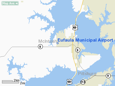
Location & QuickFacts
| FAA Information Effective: | 2008-09-25 |
| Airport Identifier: | F08 |
| Airport Status: | Operational |
| Longitude/Latitude: | 095-37-30.9510W/35-17-45.3550N
-95.625264/35.295932 (Estimated) |
| Elevation: | 635 ft / 193.55 m (Estimated) |
| Land: | 80 acres |
| From nearest city: | 2 nautical miles W of Eufaula, OK |
| Location: | Mc Intosh County, OK |
| Magnetic Variation: | 06E (1985) |
Owner & Manager
| Ownership: | Publicly owned |
| Owner: | City Of Eufaula |
| Address: | City Hall, P. O. Box 684
Eufaula, OK 74432 |
| Phone number: | 918-689-2533 |
| Manager: | Dean Smith
MAYOR. |
| Address: | City Hall, P. O. Box 684
Eufaula, OK 74432 |
| Phone number: | 918-689-2534 |
Airport Operations and Facilities
| Airport Use: | Open to public |
| Wind indicator: | Yes |
| Segmented Circle: | Yes |
| Control Tower: | No |
| Lighting Schedule: | DUSK-DAWN
MIRL RY 17/35 PRESET LOW INTST; TO INCR INTST ACTVT- CTAF. |
| Beacon Color: | Clear-Green (lighted land airport)
ROTG BCN OTS INDEFLY. |
| Landing fee charge: | No |
| Sectional chart: | Dallas-ft Worth |
| Region: | ASW - Southwest |
| Boundary ARTCC: | ZFW - Fort Worth |
| Tie-in FSS: | MLC - Mc Alester |
| FSS on Airport: | No |
| FSS Toll Free: | 1-800-WX-BRIEF |
| NOTAMs Facility: | MLC (NOTAM-d service avaliable) |
| Federal Agreements: | NGY |
Airport Communications
Airport Services
| Bottled Oxygen: | NONE |
| Bulk Oxygen: | NONE |
Runway Information
Runway 17/35
| Dimension: | 3000 x 60 ft / 914.4 x 18.3 m |
| Surface: | ASPH, Good Condition
RY HAS LOOSE AGGREGATE, HEAVY GRASS ENCROACHMENT & SEVERE SPALLING. |
| Weight Limit: | Single wheel: 4000 lbs. |
| Edge Lights: | Medium |
| |
Runway 17 |
Runway 35 |
| Traffic Pattern: | Left | Left |
| Markings: | Basic, Good Condition | Basic, Good Condition |
| Obstruction: | 40 ft trees, 705.0 ft from runway, 12:1 slope to clear | 30 ft trees, 260.0 ft from runway, 52 ft right of centerline, 2:1 slope to clear |
|
Radio Navigation Aids
| ID |
Type |
Name |
Ch |
Freq |
Var |
Dist |
| HET | NDB | Henryetta | | 267.00 | 04E | 20.1 nm |
| MKO | NDB | Muskogee | | 306.00 | 06E | 24.4 nm |
| HDL | NDB | Holdenville | | 411.00 | 06E | 40.7 nm |
| IQS | NDB | Sallisaw | | 520.00 | 05E | 41.2 nm |
| TZO | NDB | Bristow | | 251.00 | 05E | 48.4 nm |
| TQH | NDB | Tahlequah | | 215.00 | 05E | 48.5 nm |
| MEE | VOR | Davis | | 108.60 | 06E | 25.4 nm |
| OKM | VOR/DME | Okmulgee | 096X | 114.90 | 08E | 26.6 nm |
| GNP | VOR/DME | Glenpool | 043X | 110.60 | 06E | 41.1 nm |
| MLC | VORTAC | Mc Alester | 057X | 112.00 | 08E | 27.9 nm |
Remarks
- ULTRALIGHTS ON & IN VICINITY OF AIRPORT.
Images and information placed above are from
http://www.airport-data.com/airport/F08/
We thank them for the data!
| General Info
|
| Country |
United States
|
| State |
OKLAHOMA
|
| FAA ID |
F08
|
| Latitude |
35-17-45.355N
|
| Longitude |
095-37-30.951W
|
| Elevation |
635 feet
|
| Near City |
EUFAULA
|
We don't guarantee the information is fresh and accurate. The data may
be wrong or outdated.
For more up-to-date information please refer to other sources.
|
|


