|
|
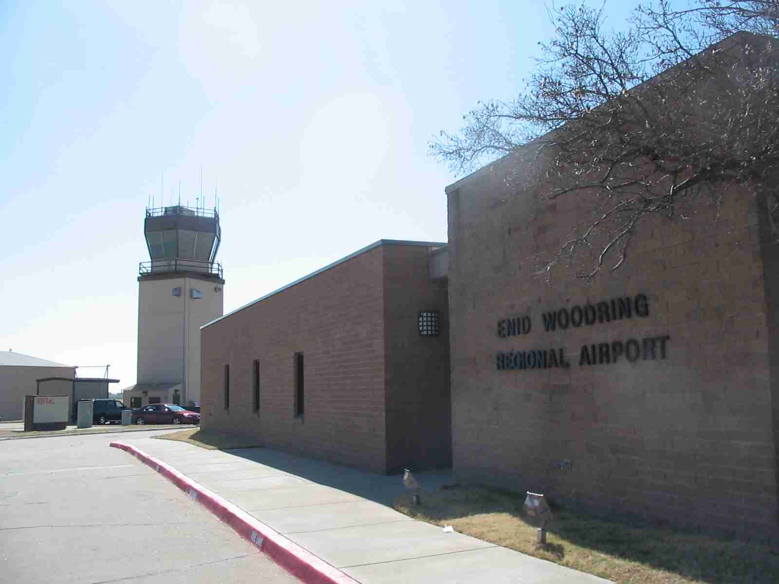
Enid Woodring Rgnl Airport |
| Enid Woodring Regional Airport |
 |
| IATA: WDG – ICAO: KWDG – FAA LID: WDG |
| Summary |
| Airport type |
Public |
| Owner |
City of Enid |
| Serves |
Enid, Oklahoma |
| Elevation AMSL |
1,167 ft / 356 m |
| Coordinates |
36°22′42″N 097°47′20″W / 36.37833°N 97.78889°W / 36.37833; -97.78889 |
| Website |
www.enid.org/... |
| Runways |
| Direction |
Length |
Surface |
| ft |
m |
| 17/35 |
6,249 |
1,905 |
Concrete |
| 13/31 |
3,149 |
960 |
Asphalt |
| Statistics (2008) |
| Aircraft operations |
34,118 |
| Based aircraft |
73 |
| Source: FAA record & diagram |
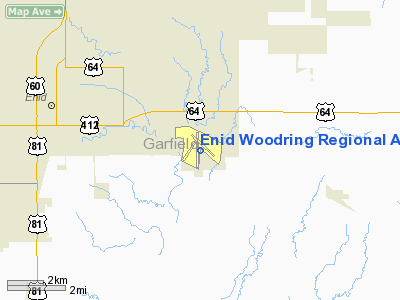
Enid Woodring Regional Airport (IATA: WDG, ICAO: KWDG, FAA LID: WDG) is a city-owned, public-use airport located four nautical miles (7 km) southeast of the central business district of Enid, a city in Garfield County, Oklahoma, United States. It is also referred to as Woodring Airport and was formerly known as Enid Woodring Municipal Airport. It is mostly used for military training flights based at Vance Air Force Base. Enid was the first city of Oklahoma to have a municipally owned airport.
Scheduled passenger flights on Great Lakes Airlines to Denver and Liberal were discontinued in August 2006. The service was subsidized by the Essential Air Service program. The airport now houses a restaurant and several rooms of aerospace and military memorabilia. Outdoors is the Woodring Wall of Honor and Veterans Park, which honors Oklahoma veterans. Ceremonies are held annually on Memorial Day to honor fallen soldiers. I. A. Woodring
Enid's Airport was renamed Enid Woodring Municipal Airport on May 30, 1933 after Lieutenant Irving A. Woodring, born February 1, 1902 in Enid, Oklahoma. Irvin A. Woodring was one of the U.S. Army Air Corps' "Three Musketeers of Aviation" along with fellow pilots John J. Williams and William Lewers Cornelius. The group performed aerobatics at the National Air Races. J.J. Williams died in practice at Mines Field, Los Angeles on September 11, 1928. Charles Lindbergh, for whom the three had served as escorts, filled in following Williams death. Two weeks later, W. L. Cornelius died when his plane collided with another plane. Woodring died in an airplane accident on January 20, 1930, falling 2,000 feet to his death at Wright Field in Dayton, Ohio after his plane exploded in mid-air.
Facilities and aircraft
Enid Woodring Regional Airport covers an area of 1,206 acres (488 ha) at an elevation of 1,167 feet (356 m) above mean sea level. It has two runways: 17/35 is 6,249 by 100 feet (1,905 x 30 m) with a concrete surface and 13/31 is 3,149 by 108 feet (960 x 33 m) with an asphalt surface.
For the 12-month period ending May 9, 2008, the airport had 34,118 aircraft operations, an average of 93 per day: 55% military, 43% general aviation and 2% air taxi. At that time there were 73 aircraft based at this airport: 85% single-engine, 8% multi-engine and 7% jet.
Gallery
The above content comes from Wikipedia and is published under free licenses – click here to read more.
Location & QuickFacts
| FAA Information Effective: | 2008-09-25 |
| Airport Identifier: | WDG |
| Airport Status: | Operational |
| Longitude/Latitude: | 097-47-20.4000W/36-22-42.1000N
-97.789000/36.378361 (Estimated) |
| Elevation: | 1167 ft / 355.70 m (Surveyed) |
| Land: | 1206 acres |
| From nearest city: | 4 nautical miles SE of Enid, OK |
| Location: | Garfield County, OK |
| Magnetic Variation: | 08E (1965) |
Owner & Manager
| Ownership: | Publicly owned |
| Owner: | City Of Enid |
| Address: | Po Box 1768
Enid, OK 73702 |
| Phone number: | 580-234-0400 |
| Manager: | Don Cornell |
| Address: | 1026 South 66th Street
Enid, OK 73701 |
| Phone number: | 580-234-5476 |
Airport Operations and Facilities
| Airport Use: | Open to public |
| Wind indicator: | Yes |
| Segmented Circle: | Yes |
| Control Tower: | Yes |
| Lighting Schedule: | DUSK-DAWN
ACTVT MALSR RY 35 - CTAF. WHEN ATCT CLSD ACTVT MIRL RY 17/35 - CTAF. |
| Beacon Color: | Clear-Green (lighted land airport) |
| Landing fee charge: | No |
| Sectional chart: | Wichita |
| Region: | ASW - Southwest |
| Boundary ARTCC: | ZKC - Kansas City |
| Tie-in FSS: | MLC - Mc Alester |
| FSS on Airport: | No |
| FSS Toll Free: | 1-800-WX-BRIEF |
| NOTAMs Facility: | WDG (NOTAM-d service avaliable) |
| Federal Agreements: | NGY3 |
Airport Communications
| CTAF: | 118.900 |
| Unicom: | 122.950 |
Airport Services
| Fuel available: | 100LLA
FUEL AVBL 24 HRS WITH AUTOMATED CREDIT CARD SYSTEM. |
| Airframe Repair: | MAJOR |
| Power Plant Repair: | MAJOR |
Runway Information
Runway 12/30
| Dimension: | 3151 x 108 ft / 960.4 x 32.9 m |
| Surface: | ASPH, Poor Condition
RY HAS SEVERE CRACKING, RAVELING, AND DETERIORATION. |
| Pavement Class: | 2 /F/D/Z/T |
| Weight Limit: | Single wheel: 42000 lbs.
Dual wheel: 55000 lbs.
Dual tandem wheel: 80000 lbs. |
| Edge Lights: | Medium |
| |
Runway 12 |
Runway 30 |
| Longitude: | 097-47-19.2199W | 097-46-51.9779W |
| Latitude: | 36-22-53.9341N | 36-22-31.8899N |
| Elevation: | 1158.00 ft | 1158.00 ft |
| Alignment: | 127 | 127 |
| Traffic Pattern: | Left | Right |
| Markings: | Basic, Fair Condition | Basic, Fair Condition |
| Displaced threshold: | 112.00 ft | 0.00 ft |
| Obstruction: | , 50:1 slope to clear | 4 ft fence, 314.0 ft from runway, 28:1 slope to clear |
|
Runway 17/35
| Dimension: | 6249 x 100 ft / 1904.7 x 30.5 m |
| Surface: | CONC,
RY HAS SEVERE CRACKING, RAVELING, AND DETERIORATION. |
| Surface Treatment: | Saw-cut or plastic Grooved |
| Pavement Class: | 5 /R/A/X/T |
| Weight Limit: | Single wheel: 50000 lbs.
Dual wheel: 88000 lbs.
Dual tandem wheel: 140000 lbs. |
| Edge Lights: | Medium |
| |
Runway 17 |
Runway 35 |
| Longitude: | 097-47-27.8785W | 097-47-27.9019W |
| Latitude: | 36-23-12.5577N | 36-22-10.7625N |
| Elevation: | 1167.00 ft | 1146.00 ft |
| Alignment: | 127 | 0 |
| ILS Type: | | ILS
|
| Traffic Pattern: | Left | Right |
| Markings: | Non-precision instrument, Good Condition | Precision instrument, Good Condition |
| Crossing Height: | 0.00 ft | 54.00 ft |
| Displaced threshold: | 611.00 ft | 0.00 ft |
| VASI: | | 4-box on left side |
| Visual Glide Angle: | 0.00° | 3.00° |
| Approach lights: | | MALSR
MALSR OTS INDEFLY. |
| Runway End Identifier: | Yes
REIL OTS INDEFLY. | |
| Obstruction: | 20 ft road, 231.0 ft from runway, 505 ft left of centerline, 1:1 slope to clear
APCH SLOPE 42:1 TO DSPLCD THLD.
5 FT ROAD 195 FT FM RY END 387 FT L & 8 FT FENCE 77 FT FM RY END 490 FT L. | , 50:1 slope to clear |
|
Radio Navigation Aids
| ID |
Type |
Name |
Ch |
Freq |
Var |
Dist |
| FAU | NDB | Fairview | | 246.00 | 07E | 33.8 nm |
| LCY | NDB | Logan County | | 326.00 | 07E | 36.8 nm |
| PN | NDB | Ponca | | 515.00 | 05E | 42.7 nm |
| JWG | NDB | Watonga | | 359.00 | 07E | 43.8 nm |
| AVK | NDB | Alva | | 203.00 | 08E | 48.9 nm |
| ODG | VOR/DME | Woodring | 027X | 109.00 | 08E | 0.3 nm |
| SWO | VOR/DME | Stillwater | 021X | 108.40 | 07E | 35.5 nm |
| END | VORTAC | Vance | 101X | 115.40 | 09E | 6.6 nm |
| IFI | VORTAC | Kingfisher | 094X | 114.70 | 09E | 36.0 nm |
| PER | VORTAC | Pioneer | 079X | 113.20 | 06E | 37.6 nm |
Remarks
- MILITARY JET TRAINING DALGT 3 NMR.
Images and information placed above are from
http://www.airport-data.com/airport/WDG/
We thank them for the data!
| General Info
|
| Country |
United States
|
| State |
OKLAHOMA
|
| FAA ID |
WDG
|
| Latitude |
36-22-45.132N
|
| Longitude |
097-47-28.004W
|
| Elevation |
1167 feet
|
| Near City |
ENID
|
We don't guarantee the information is fresh and accurate. The data may
be wrong or outdated.
For more up-to-date information please refer to other sources.
|
|