 |
|
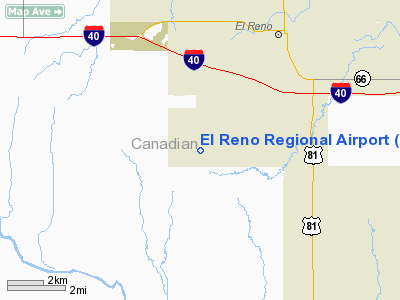
Location & QuickFacts
| FAA Information Effective: | 2008-09-25 |
| Airport Identifier: | RQO |
| Airport Status: | Operational |
| Longitude/Latitude: | 098-00-20.8350W/35-28-21.6190N
-98.005788/35.472672 (Estimated) |
| Elevation: | 1417 ft / 431.90 m (Surveyed) |
| Land: | 698 acres |
| From nearest city: | 4 nautical miles SW of El Reno, OK |
| Location: | Canadian County, OK |
| Magnetic Variation: | 07E (1995) |
Owner & Manager
| Ownership: | Publicly owned |
| Owner: | City Of El Reno |
| Address: | Po Box 217
El Reno, OK 73036 |
| Phone number: | 405-262-4070 |
| Manager: | Rick Mullaney |
| Address: | Box 217
El Reno, OK 73036 |
| Phone number: | 405-262-4272 |
Airport Operations and Facilities
| Airport Use: | Open to public |
| Wind indicator: | Yes |
| Segmented Circle: | Yes |
| Control Tower: | No |
| Lighting Schedule: | DUSK-DAWN
ACTVT MIRL RY 17/35, REIL RYS 17 & 35 - CTAF. |
| Beacon Color: | Clear-Green (lighted land airport) |
| Landing fee charge: | No |
| Sectional chart: | Dallas-ft Worth |
| Region: | ASW - Southwest |
| Traffic Pattern Alt: | 800 ft |
| Boundary ARTCC: | ZFW - Fort Worth |
| Tie-in FSS: | MLC - Mc Alester |
| FSS on Airport: | No |
| FSS Toll Free: | 1-800-WX-BRIEF |
| NOTAMs Facility: | RQO (NOTAM-d service avaliable) |
| Federal Agreements: | NGRY |
Airport Communications
| CTAF: | 122.800 |
| Unicom: | 122.800 |
Airport Services
| Fuel available: | 100LLA
24 HR. AUTOMATED CREDIT CARD SYSTEM. |
| Airframe Repair: | MAJOR |
| Power Plant Repair: | MAJOR |
| Bottled Oxygen: | NONE |
| Bulk Oxygen: | NONE |
Runway Information
Runway 17/35
| Dimension: | 5600 x 75 ft / 1706.9 x 22.9 m |
| Surface: | CONC-TRTD, Good Condition |
| Surface Treatment: | Saw-cut or plastic Grooved |
| Pavement Class: | 4 /R/B/X/T |
| Weight Limit: | Single wheel: 12000 lbs. |
| Edge Lights: | Medium |
| |
Runway 17 |
Runway 35 |
| Longitude: | 098-00-15.5950W | 098-00-15.5800W |
| Latitude: | 35-28-52.3410N | 35-27-56.9810N |
| Elevation: | 1412.00 ft | 1414.00 ft |
| Alignment: | 127 | 127 |
| Traffic Pattern: | Left | Right |
| Markings: | Non-precision instrument, Good Condition | Non-precision instrument, Good Condition |
| Crossing Height: | 34.00 ft | 34.00 ft |
| VASI: | 4-light PAPI on left side | 4-light PAPI on left side |
| Visual Glide Angle: | 2.00° | 2.00° |
| Runway End Identifier: | Yes | Yes |
| Obstruction: | 80 ft pline, 1800.0 ft from runway, 20:1 slope to clear | 15 ft road, 460.0 ft from runway, 17:1 slope to clear |
|
Runway 18/36
| Dimension: | 4630 x 190 ft / 1411.2 x 57.9 m |
| Surface: | TURF, Fair Condition |
| |
Runway 18 |
Runway 36 |
| Longitude: | 098-00-27.1800W | 098-00-27.1800W |
| Latitude: | 35-28-40.8380N | 35-27-55.0460N |
| Alignment: | 127 | 0 |
| Traffic Pattern: | Right | Left |
| Obstruction: | 15 ft road, 280.0 ft from runway, 90 ft right of centerline, 18:1 slope to clear | 30 ft pline, 350.0 ft from runway, 95 ft left of centerline, 11:1 slope to clear |
|
Radio Navigation Aids
| ID |
Type |
Name |
Ch |
Freq |
Var |
Dist |
| FSI | FAN MARKER | Trail | | | 09E | 45.9 nm |
| RQO | NDB | El Reno | | 335.00 | 07E | 0.4 nm |
| OK | NDB | Tuloo | | 406.00 | 07E | 19.6 nm |
| OLR | NDB | Chickasha | | 290.00 | 07E | 22.2 nm |
| OUN | NDB | Norman | | 260.00 | 07E | 29.5 nm |
| JWG | NDB | Watonga | | 359.00 | 07E | 31.1 nm |
| OJA | NDB | Weatherford | | 272.00 | 07E | 32.7 nm |
| LCY | NDB | Logan County | | 326.00 | 07E | 36.5 nm |
| CLK | NDB | Clinton | | 320.00 | 07E | 45.6 nm |
| OFZ | NDB | Trail | | 388.00 | 09E | 45.9 nm |
| TIK | TACAN | Tinker | 105X | | 07E | 30.7 nm |
| PWA | VOR/DME | Wiley Post | 081X | 113.40 | 08E | 17.9 nm |
| IFI | VORTAC | Kingfisher | 094X | 114.70 | 09E | 20.0 nm |
| IRW | VORTAC | Will Rogers | 088X | 114.10 | 07E | 20.6 nm |
| OKC | VOT | Oklahoma Will Rgs W | | 108.80 | | 20.4 nm |
Images and information placed above are from
http://www.airport-data.com/airport/RQO/
We thank them for the data!
|
|


