 |
|
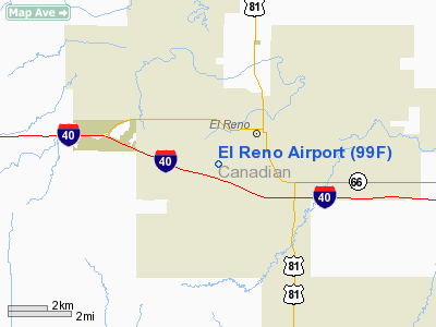
Location & QuickFacts
| FAA Information Effective: | 2008-09-25 |
| Airport Identifier: | 99F |
| Airport Status: | Operational |
| Longitude/Latitude: | 097-58-46.1790W/35-31-00.1870N
-97.979494/35.516719 (Estimated) |
| Elevation: | 1395 ft / 425.20 m (Estimated) |
| Land: | 10 acres |
| From nearest city: | 2 nautical miles SW of El Reno, OK |
| Location: | Canadian County, OK |
| Magnetic Variation: | 07E (1985) |
Owner & Manager
| Ownership: | Privately owned |
| Owner: | Marshall Gibson/glen Ramsey
AND MARK GIBSON. |
| Address: | 1821 W Elm
El Reno, OK 73036 |
| Phone number: | 405-262-4880 |
| Manager: | Marshall Gibson/glen Ramsey
AND MARK GIBSON. EL RENO AVIA PRES, J. MARSHALL GIBSON AVIATION PRES. |
| Address: | Po Box 880
El Reno, OK 73036 |
| Phone number: | 405-262-4880
GIBSON AVIATION PHONE 405-262-4880; EL RENO AVIATION PHONE 405-262-2387. |
Airport Operations and Facilities
| Airport Use: | Open to public |
| Wind indicator: | Yes |
| Segmented Circle: | No |
| Control Tower: | No |
| Landing fee charge: | No |
| Sectional chart: | Dallas-ft Worth |
| Region: | ASW - Southwest |
| Boundary ARTCC: | ZFW - Fort Worth |
| Tie-in FSS: | MLC - Mc Alester |
| FSS on Airport: | No |
| FSS Toll Free: | 1-800-WX-BRIEF |
| NOTAMs Facility: | MLC (NOTAM-d service avaliable) |
Airport Communications
Airport Services
| Airframe Repair: | NONE |
| Power Plant Repair: | NONE |
Runway Information
Runway 17/35
| Dimension: | 2600 x 100 ft / 792.5 x 30.5 m |
| Surface: | TURF, Fair Condition |
| |
Runway 17 |
Runway 35 |
| Traffic Pattern: | Right | Left |
| Obstruction: | 35 ft tree, 276.0 ft from runway, 7:1 slope to clear | 35 ft pole, 750.0 ft from runway, 75 ft right of centerline, 21:1 slope to clear |
|
Radio Navigation Aids
| ID |
Type |
Name |
Ch |
Freq |
Var |
Dist |
| FSI | FAN MARKER | Trail | | | 09E | 48.8 nm |
| RQO | NDB | El Reno | | 335.00 | 07E | 2.7 nm |
| OK | NDB | Tuloo | | 406.00 | 07E | 18.5 nm |
| OLR | NDB | Chickasha | | 290.00 | 07E | 24.8 nm |
| OUN | NDB | Norman | | 260.00 | 07E | 29.7 nm |
| JWG | NDB | Watonga | | 359.00 | 07E | 30.1 nm |
| OJA | NDB | Weatherford | | 272.00 | 07E | 33.8 nm |
| LCY | NDB | Logan County | | 326.00 | 07E | 33.9 nm |
| CLK | NDB | Clinton | | 320.00 | 07E | 46.8 nm |
| OFZ | NDB | Trail | | 388.00 | 09E | 48.8 nm |
| TIK | TACAN | Tinker | 105X | | 07E | 29.8 nm |
| PWA | VOR/DME | Wiley Post | 081X | 113.40 | 08E | 16.3 nm |
| IFI | VORTAC | Kingfisher | 094X | 114.70 | 09E | 17.4 nm |
| IRW | VORTAC | Will Rogers | 088X | 114.10 | 07E | 20.5 nm |
| END | VORTAC | Vance | 101X | 115.40 | 09E | 49.9 nm |
| OKC | VOT | Oklahoma Will Rgs W | | 108.80 | | 20.0 nm |
Remarks
- E/W TWY MKD WITH ORANGE 'L' SHAPED MARKERS; DO NOT LAND ON TWY.
- PRE-DATES THE ACT.
Images and information placed above are from
http://www.airport-data.com/airport/99F/
We thank them for the data!
| General Info
|
| Country |
United States
|
| State |
OKLAHOMA
|
| FAA ID |
99F
|
| Latitude |
35-31-00.187N
|
| Longitude |
097-58-46.179W
|
| Elevation |
1395 feet
|
| Near City |
EL RENO
|
We don't guarantee the information is fresh and accurate. The data may
be wrong or outdated.
For more up-to-date information please refer to other sources.
|
|


