 |
|
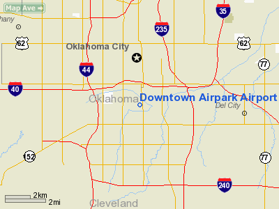
Location & QuickFacts
| FAA Information Effective: | 2008-09-25 |
| Airport Identifier: | OK03 |
| Airport Status: | Operational |
| Longitude/Latitude: | 097-31-59.1390W/35-26-57.2170N
-97.533094/35.449227 (Estimated) |
| Elevation: | 1180 ft / 359.66 m (Estimated) |
| Land: | 86 acres |
| From nearest city: | 2 nautical miles SW of Oklahoma City, OK |
| Location: | Oklahoma County, OK |
| Magnetic Variation: | 07E (1985) |
Owner & Manager
| Ownership: | Privately owned |
| Owner: | Downtown Airpark Inc. |
| Address: | Po Box 2368
Oklahoma City, OK 73101-2368 |
| Phone number: | 405-634-1456 |
| Manager: | W. D. Amis, Iii |
| Address: | Po Box 2368
Oklahoma City, OK 73101-2368 |
| Phone number: | 405-634-1456 |
Airport Operations and Facilities
| Airport Use: | Private |
| Wind indicator: | Yes |
| Segmented Circle: | No |
| Control Tower: | No |
| Lighting Schedule: | DUSK-DAWN |
| Beacon Color: | Clear-Green (lighted land airport) |
| Sectional chart: | Dallas-ft Worth |
| Region: | ASW - Southwest |
| Boundary ARTCC: | ZFW - Fort Worth |
| Tie-in FSS: | MLC - Mc Alester |
| FSS on Airport: | No |
| FSS Toll Free: | 1-800-WX-BRIEF |
Airport Communications
Airport Services
| Fuel available: | 100LLA |
| Airframe Repair: | MAJOR |
| Power Plant Repair: | MAJOR |
| Bottled Oxygen: | HIGH/LOW |
| Bulk Oxygen: | HIGH/LOW |
Runway Information
Runway 16/34
| Dimension: | 3240 x 85 ft / 987.6 x 25.9 m |
| Surface: | ASPH, Fair Condition |
| Weight Limit: | Single wheel: 12500 lbs. |
| Edge Lights: | Non-standard lighting system
NSTD LIRL. RY 16 LGTS BEGIN 350 FT S OF THLD; 2940 FT LGTD. |
| |
Runway 16 |
Runway 34 |
| Traffic Pattern: | Left | Left |
| Markings: | Basic, Fair Condition | Basic, Fair Condition |
| Obstruction: | 35 ft pline, 800.0 ft from runway, 17:1 slope to clear
FENCE RUNNING DIAGONALLY FROM EAST CORNER THR CROSSING EXTDD CNTRLN 91' FROM THR. | 25 ft rr, 250.0 ft from runway, 2:1 slope to clear
50 FT DITCH 115 FT FM THLD. |
|
Radio Navigation Aids
| ID |
Type |
Name |
Ch |
Freq |
Var |
Dist |
| OK | NDB | Tuloo | | 406.00 | 07E | 3.8 nm |
| OUN | NDB | Norman | | 260.00 | 07E | 12.5 nm |
| RQO | NDB | El Reno | | 335.00 | 07E | 23.4 nm |
| LCY | NDB | Logan County | | 326.00 | 07E | 24.5 nm |
| OLR | NDB | Chickasha | | 290.00 | 07E | 29.9 nm |
| CQB | NDB | Tilghman | | 396.00 | 06E | 38.6 nm |
| GGU | NDB | Prague | | 314.00 | 06E | 40.1 nm |
| SRE | NDB | Seminole | | 278.00 | 06E | 43.4 nm |
| CUH | NDB | Cushing | | 242.00 | 05E | 45.5 nm |
| PVJ | NDB | Pauls Valley | | 384.00 | 06E | 46.6 nm |
| TIK | TACAN | Tinker | 105X | | 07E | 7.6 nm |
| PWA | VOR/DME | Wiley Post | 081X | 113.40 | 08E | 7.5 nm |
| IRW | VORTAC | Will Rogers | 088X | 114.10 | 07E | 6.6 nm |
| IFI | VORTAC | Kingfisher | 094X | 114.70 | 09E | 31.4 nm |
| OKC | VOT | Oklahoma Will Rgs W | | 108.80 | | 4.7 nm |
Images and information placed above are from
http://www.airport-data.com/airport/OK03/
We thank them for the data!
| General Info
|
| Country |
United States
|
| State |
OKLAHOMA
|
| FAA ID |
OK03
|
| Time |
UTC-6(-5DT)
|
| Latitude |
35.449228
35° 26' 57.22" N
|
| Longitude |
-97.533094
097° 31' 59.14" W
|
| Elevation |
1180 feet
360 meters
|
| Magnetic Variation |
005° E (01/06)
|
| Beacon |
Yes
|
| Operating Agency |
PRIVATE
|
| Near City |
Oklahoma City
|
| Operating Hours |
SEE REMARKS FOR OPERATING HOURS OR COMMUNICATIONS FOR POSSIBLE HOURS
|
| Daylight Saving Time |
Second Sunday in March at 0200 to first Sunday in November at 0200 local time (Exception Arizona and that portion of Indiana in the Eastern Time Zone)
|
We don't guarantee the information is fresh and accurate. The data may
be wrong or outdated.
For more up-to-date information please refer to other sources.
|
|


