 |
|
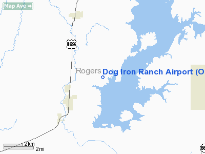
Location & QuickFacts
| FAA Information Effective: | 2008-09-25 |
| Airport Identifier: | OK37 |
| Airport Status: | Operational |
| Longitude/Latitude: | 095-40-03.9200W/36-28-10.3300N
-95.667756/36.469536 (Estimated) |
| Elevation: | 760 ft / 231.65 m (Estimated) |
| Land: | 0 acres |
| From nearest city: | 3 nautical miles NE of Oologah, OK |
| Location: | Rogers County, OK |
| Magnetic Variation: | 05E (1995) |
Owner & Manager
| Ownership: | Privately owned |
| Owner: | Will Rogers Memorial & Birthplace |
| Address: | Po Box 157
Claremore, OK 74018 |
| Phone number: | 918-341-0719 |
| Manager: | Steve Gragert |
| Address: | Po Box 157
Claremore, OK 74018 |
| Phone number: | 918-341-0719 |
Airport Operations and Facilities
| Airport Use: | Private |
| Wind indicator: | Yes |
| Segmented Circle: | No |
| Control Tower: | No |
| Sectional chart: | Kansas City |
| Region: | ASW - Southwest |
| Boundary ARTCC: | ZKC - Kansas City |
| Tie-in FSS: | MLC - Mc Alester |
| FSS Toll Free: | 1-800-WX-BRIEF |
Runway Information
Runway 17/35
| Dimension: | 2000 x 25 ft / 609.6 x 7.6 m |
| Surface: | TURF, |
| |
Runway 17 |
Runway 35 |
| Traffic Pattern: | Left | Left |
|
Radio Navigation Aids
| ID |
Type |
Name |
Ch |
Freq |
Var |
Dist |
| DW | NDB | Owaso | | 375.00 | 06E | 14.0 nm |
| OWP | NDB | William Pogue | | 362.00 | 06E | 29.5 nm |
| CFV | NDB | Coffeyville | | 212.00 | 05E | 37.8 nm |
| TQH | NDB | Tahlequah | | 215.00 | 05E | 45.8 nm |
| BVO | VOR/DME | Bartlesville | 126X | 117.90 | 08E | 27.7 nm |
| GNP | VOR/DME | Glenpool | 043X | 110.60 | 06E | 36.1 nm |
| OKM | VOR/DME | Okmulgee | 096X | 114.90 | 08E | 47.7 nm |
| TUL | VORTAC | Tulsa | 091X | 114.40 | 08E | 17.4 nm |
| OSW | VORTAC | Oswego | 123X | 117.60 | 08E | 47.0 nm |
| TUL | VOT | Tulsa Intl | | 109.00 | | 17.4 nm |
Images and information placed above are from
http://www.airport-data.com/airport/OK37/
We thank them for the data!
| General Info
|
| Country |
United States
|
| State |
OKLAHOMA
|
| FAA ID |
OK37
|
| Latitude |
36-28-10.330N
|
| Longitude |
095-40-03.920W
|
| Elevation |
760 feet
|
| Near City |
OOLAGAH
|
We don't guarantee the information is fresh and accurate. The data may
be wrong or outdated.
For more up-to-date information please refer to other sources.
|
|


