 |
|
Location & QuickFacts
| FAA Information Effective: | 2008-09-25 |
| Airport Identifier: | OK07 |
| Airport Status: | Operational |
| Longitude/Latitude: | 098-19-32.3000W/34-31-05.4000N
-98.325639/34.518167 (Estimated) |
| Elevation: | 1115 ft / 339.85 m (Estimated) |
| Land: | 10 acres |
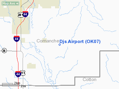
| From nearest city: | 7 nautical miles SE of Lawton, OK |
| Location: | Comanche County, OK |
| Magnetic Variation: | () |
Owner & Manager
| Ownership: | Privately owned |
| Owner: | Daniel Steinbroner |
| Address: | 13402 Se Goodin Rd
Lawton, OK 73501 |
| Phone number: | 580-248-1435
CELL 580-695-5524 |
| Manager: | Daniel Steinbroner |
| Address: | 13402 Se Goodin Rd
Lawton, OK 73501 |
| Phone number: | 580-248-1435 |
Airport Operations and Facilities
| Airport Use: | Private |
| Wind indicator: | Yes |
| Control Tower: | No |
| Sectional chart: | Dallas-ft Worth |
| Region: | ASW - Southwest |
| Boundary ARTCC: | ZFW - Fort Worth |
| Tie-in FSS: | MLC - Mc Alester |
| FSS Toll Free: | 1-800-WX-BRIEF |
Runway Information
Runway 17/35
| Dimension: | 2600 x 165 ft / 792.5 x 50.3 m |
| Surface: | TURF, |
| |
Runway 17 |
Runway 35 |
| Traffic Pattern: | Left | Right |
| Obstruction: | 20 ft pline, 10.0 ft from runway | |
|
Radio Navigation Aids
| ID |
Type |
Name |
Ch |
Freq |
Var |
Dist |
| FSI | FAN MARKER | Trail | | | 09E | 16.3 nm |
| PFL | NDB | Post | | 308.00 | 08E | 6.7 nm |
| OFZ | NDB | Trail | | 388.00 | 09E | 16.3 nm |
| OLR | NDB | Chickasha | | 290.00 | 07E | 39.3 nm |
| SKB | NDB | Scotland | | 344.00 | 08E | 44.5 nm |
| SHP | TACAN | Sheppard | 045X | | 10E | 33.2 nm |
| LAW | VOR/DME | Lawton | 031X | 109.40 | 09E | 4.5 nm |
| DUC | VOR/DME | Duncan | 047X | 111.00 | 09E | 21.8 nm |
| SPS | VORTAC | Wichita Falls | 074X | 112.70 | 10E | 34.6 nm |
| HBR | VORTAC | Hobart | 055X | 111.80 | 10E | 42.0 nm |
| LTS | VORTAC | Altus | 035X | 109.80 | 08E | 47.6 nm |
Images and information placed above are from
http://www.airport-data.com/airport/OK07/
We thank them for the data!
|
|


