 |
|
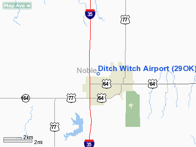
Location & QuickFacts
| FAA Information Effective: | 2008-09-25 |
| Airport Identifier: | 29OK |
| Airport Status: | Operational |
| Longitude/Latitude: | 097-19-01.1560W/36-18-00.1450N
-97.316988/36.300040 (Estimated) |
| Elevation: | 1120 ft / 341.38 m (Estimated) |
| Land: | 15 acres |
| From nearest city: | 0 nautical miles W of Perry, OK |
| Location: | Noble County, OK |
| Magnetic Variation: | 07E (1985) |
Owner & Manager
| Ownership: | Privately owned |
| Owner: | Charles Machine Works, Inc. |
| Address: | Box 66
Perry, OK 73077 |
| Phone number: | 580-336-4402 |
| Manager: | Tom Nilssen |
| Address: | Box 66
Perry, OK 73077 |
| Phone number: | 580-336-4402
CELL 580-370-1291 |
Airport Operations and Facilities
| Airport Use: | Private |
| Wind indicator: | Yes |
| Segmented Circle: | No |
| Control Tower: | No |
| Sectional chart: | Wichita |
| Region: | ASW - Southwest |
| Boundary ARTCC: | ZKC - Kansas City |
| Tie-in FSS: | MLC - Mc Alester |
| FSS Toll Free: | 1-800-WX-BRIEF |
Runway Information
Runway 17/35
| Dimension: | 4000 x 40 ft / 1219.2 x 12.2 m |
| Surface: | ASPH, |
| |
Runway 17 |
Runway 35 |
| Traffic Pattern: | Right | Left |
|
Radio Navigation Aids
| ID |
Type |
Name |
Ch |
Freq |
Var |
Dist |
| LCY | NDB | Logan County | | 326.00 | 07E | 27.7 nm |
| PN | NDB | Ponca | | 515.00 | 05E | 33.2 nm |
| CUH | NDB | Cushing | | 242.00 | 05E | 36.0 nm |
| CQB | NDB | Tilghman | | 396.00 | 06E | 42.3 nm |
| SWO | VOR/DME | Stillwater | 021X | 108.40 | 07E | 12.3 nm |
| ODG | VOR/DME | Woodring | 027X | 109.00 | 08E | 23.2 nm |
| PWA | VOR/DME | Wiley Post | 081X | 113.40 | 08E | 48.8 nm |
| PER | VORTAC | Pioneer | 079X | 113.20 | 06E | 27.9 nm |
| END | VORTAC | Vance | 101X | 115.40 | 09E | 29.3 nm |
| IFI | VORTAC | Kingfisher | 094X | 114.70 | 09E | 44.7 nm |
Remarks
- THRS ARE LCTD TO PRVD 20:1 CLEARANCE OVER ALL OBSTRUCTIONS.
Images and information placed above are from
http://www.airport-data.com/airport/29OK/
We thank them for the data!
| General Info
|
| Country |
United States
|
| State |
OKLAHOMA
|
| FAA ID |
29OK
|
| Latitude |
36-18-00.145N
|
| Longitude |
097-19-01.156W
|
| Elevation |
1120 feet
|
| Near City |
PERRY
|
We don't guarantee the information is fresh and accurate. The data may
be wrong or outdated.
For more up-to-date information please refer to other sources.
|
|


