 |
|
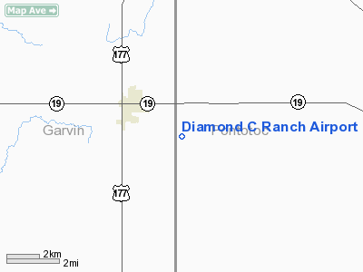
Location & QuickFacts
| FAA Information Effective: | 2008-09-25 |
| Airport Identifier: | 9OK5 |
| Airport Status: | Operational |
| Longitude/Latitude: | 096-55-39.0000W/34-46-42.0000N
-96.927500/34.778333 (Estimated) |
| Elevation: | 1140 ft / 347.47 m (Estimated) |
| Land: | 620 acres |
| From nearest city: | 3 nautical miles SE of Stratford, OK |
| Location: | Pontotoc County, OK |
| Magnetic Variation: | 06E (1990) |
Owner & Manager
| Ownership: | Privately owned |
| Owner: | Jack D. Connally |
| Address: | 11627 Forest Creek Place
Dallas, TX 75230 |
| Phone number: | 214-691-8929 |
| Manager: | Jack D. Connally |
| Address: | 11627 Forest Creek Place
Dallas, TX 75230 |
| Phone number: | 214-691-8929 |
Airport Operations and Facilities
| Airport Use: | Private |
| Wind indicator: | Yes |
| Segmented Circle: | No |
| Control Tower: | No |
| Sectional chart: | Dallas-ft Worth |
| Region: | ASW - Southwest |
| Boundary ARTCC: | ZFW - Fort Worth |
| Tie-in FSS: | MLC - Mc Alester |
| FSS on Airport: | No |
| FSS Toll Free: | 1-800-WX-BRIEF |
Runway Information
Runway 16/34
| Dimension: | 2500 x 100 ft / 762.0 x 30.5 m |
| Surface: | TURF, |
| |
Runway 16 |
Runway 34 |
| Traffic Pattern: | Left | Right |
| Displaced threshold: | 1000.00 ft | 0.00 ft |
| Obstruction: | 50 ft plines | |
|
Radio Navigation Aids
| ID |
Type |
Name |
Ch |
Freq |
Var |
Dist |
| PVJ | NDB | Pauls Valley | | 384.00 | 06E | 15.4 nm |
| HDL | NDB | Holdenville | | 411.00 | 06E | 31.3 nm |
| SRE | NDB | Seminole | | 278.00 | 06E | 32.2 nm |
| OUN | NDB | Norman | | 260.00 | 07E | 38.9 nm |
| AUV | NDB | Arbuckle | | 284.00 | 07E | 39.0 nm |
| GGU | NDB | Prague | | 314.00 | 06E | 45.6 nm |
| TIK | TACAN | Tinker | 105X | | 07E | 45.4 nm |
| ADH | VOR/DME | Ada | 125X | 117.80 | 06E | 12.8 nm |
| ADM | VORTAC | Ardmore | 114X | 116.70 | 06E | 36.1 nm |
| IRW | VORTAC | Will Rogers | 088X | 114.10 | 07E | 48.4 nm |
| OKC | VOT | Oklahoma Will Rgs W | | 108.80 | | 49.6 nm |
Images and information placed above are from
http://www.airport-data.com/airport/9OK5/
We thank them for the data!
| General Info
|
| Country |
United States
|
| State |
OKLAHOMA
|
| FAA ID |
9OK5
|
| Latitude |
34-46-42.000N
|
| Longitude |
096-55-39.000W
|
| Elevation |
1140 feet
|
| Near City |
STRATFORD
|
We don't guarantee the information is fresh and accurate. The data may
be wrong or outdated.
For more up-to-date information please refer to other sources.
|
|


